
DOKINHA
Pleasure Craft
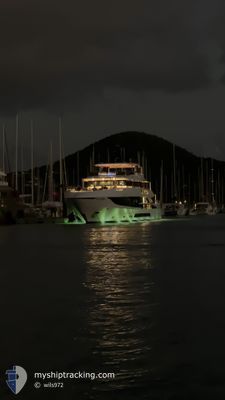
Current Trip
ANTIGUA
| Time Travelled | 1 day |
|---|---|
| Remaining Time | --- |
| Distance Travelled | 15.67 nm |
| Remaining Distance | --- |
| AVG Speed | 8.7 Knots |
| MAX Speed | 12.7 Knots |
| AVG Wind | 17.5 knots |
| MAX Wind | 21 knots |
| MIN Temp | 25.2°C / 77.36°F |
| MAX Temp | 26.6°C / 79.88°F |
| Draught | 0 m |
| Position Received | 6 m ago |
Current Position
| Longitude | --- |
|---|---|
| Latitude | --- |
| Status | At anchor |
| Speed | 0.2 Knots |
| Course | 50° |
| Area | Caribbean Sea |
| Station | T-AIS |
| Position Received | 6 m ago |
Info
Information
The current position of DOKINHA is in Caribbean Sea with coordinates 17.09860° / -61.89326° as reported on 2025-02-18 06:48 by AIS to our vessel tracker app. The vessel's current speed is 0.2 Knots
The vessel DOKINHA (IMO: 1078248, MMSI: 319297900) is a Pleasure Craft It's sailing under the flag of [KY] Cayman Is.
In this page you can find informations about the vessels current position, last detected port calls, and current voyage information. If the vessels is not in coverage by AIS you will find the latest position.
The current position of DOKINHA is detected by our AIS receivers and we are not responsible for the reliability of the data. The last position was recorded while the vessel was in Coverage by the Ais receivers of our vessel tracking app.
Weather
| Temperature | 25.3°C / 77.54°F |
|---|---|
| Wind Speed | 16 knots |
| Direction | 77° ENE |
| Pressure | 1015.8 hPa |
| Humidity | 75.9 % |
| Cloud Coverage | 54 % |
Featured Company
Last Port Calls
| Port | Arrival | Departure | Time In Port |
|---|---|---|---|
| 2025-02-12 17:24 | 2025-02-16 15:50 | 3 d | |
| 2025-02-01 15:48 | 2025-02-10 12:47 | 8 d | |
| 2025-01-10 22:17 | 2025-01-30 12:38 | 19 d | |
| 2025-01-05 22:59 | 2025-01-07 14:36 | 1 d | |
| 2025-01-04 17:42 | 2025-01-05 00:58 | 7 h | |
| 2024-12-14 16:09 | 2025-01-03 14:39 | 19 d | |
| 2024-12-06 21:10 | 2024-12-07 12:31 | 15 h | |
| 2024-12-03 20:44 | 2024-12-06 12:32 | 2 d |
Last Trips
| Origin | Departure | Destination | Arrival | Distance | |
|---|---|---|---|---|---|
| 2025-02-10 08:47 | 2025-02-12 13:24 | 108.68 nm | |||
| 2025-01-30 08:38 | 2025-02-01 11:48 | 34.26 nm | |||
| 2025-01-07 10:36 | 2025-01-10 18:17 | 80.05 nm | |||
| 2025-01-04 20:58 | 2025-01-05 18:59 | 20.68 nm | |||
| 2025-01-03 10:39 | 2025-01-04 13:42 | 23.77 nm | |||
| 2024-12-07 08:31 | 2024-12-14 12:09 | 478.51 nm | |||
| 2024-12-06 08:32 | 2024-12-06 17:10 | 37.48 nm |
Events
| Time | Event | Details | Position / Dest | Info |
|---|---|---|---|---|
| 2025-02-16 17:24 | Status Changed | At anchor Under way using engine |
17.09860 / -61.89305
ANTIGUA
|
Speed: 0.3 kn Course: 91° |
| 2025-02-16 17:17 | STOP Moving | 2.44 nm, South West of ST JOHNS |
17.09874 / -61.89287
ANTIGUA
|
Speed: 0.3 kn Course: 69° |
| 2025-02-16 15:50 | PORT DEPARTURE |
|
17.01232 / -61.77672
ANTIGUA
|
Speed: 4 kn Course: 258° |
| 2025-02-16 15:48 | START Moving |
17.01281 / -61.77417
[AG] ANTIGUA
|
Speed: 3.9 kn Course: 255° |
|
| 2025-02-16 15:20 | Status Changed | Under way using engine Moored |
17.01450 / -61.77069
[AG] ANTIGUA
|
Speed: Course: 83° |
| 2025-02-12 17:43 | Status Changed | Moored Under way using engine |
17.01450 / -61.77069
[AG] ANTIGUA
|
Speed: Course: 85° |
| 2025-02-12 17:31 | STOP Moving |
17.01379 / -61.77205
[AG] ANTIGUA
|
Speed: Course: 71° |
|
| 2025-02-12 17:24 | PORT ARRIVAL |
|
17.01260 / -61.77448
[AG] ANTIGUA
|
Speed: 2.9 kn Course: 65° |
| 2025-02-12 15:40 | START Moving | 4.3 nm, South West of ST JOHNS |
17.06799 / -61.90640
ANTIGUA
|
Speed: 5 kn Course: 212.3° |
| 2025-02-12 15:19 | Status Changed | Under way using engine At anchor |
17.07009 / -61.90476
ANTIGUA
|
Speed: 0.2 kn Course: 78° |