
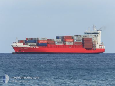
DINA TRADER
Container Ship
Current Trip
| Time Travelled | 17 h, 1 mins |
|---|---|
| Remaining Time | 12 h, 39 mins |
| Distance Travelled | 227.13 nm |
| Remaining Distance | 184.23 nm |
| AVG Speed | 13.5 Knots |
| MAX Speed | 18.6 Knots |
| AVG Wind | 6.1 knots |
| MAX Wind | 12 knots |
| MIN Temp | 6.1°C / 42.98°F |
| MAX Temp | 9.4°C / 48.92°F |
| Draught | 7.7 m |
| Position Received | 2 m ago |
Current Position
| Longitude | --- |
|---|---|
| Latitude | --- |
| Status | Under way using engine |
| Speed | 13.9 Knots |
| Course | 33.5° |
| Area | North Sea |
| Station | T-AIS |
| Position Received | 2 m ago |
Info
Information
The current position of DINA TRADER is in North Sea with coordinates 56.38864° / 7.46407° as reported on 2025-12-17 14:30 by AIS to our vessel tracker app. The vessel's current speed is 13.9 Knots and is heading at the port of GOTEBORG. The estimated time of arrival as calculated by MyShipTracking vessel tracking app is 2025-12-18 04:12 LT
The vessel DINA TRADER (IMO: 9354442, MMSI: 255801780) is a Container Ship that was built in 2007 ( 18 years old ). It's sailing under the flag of [PT] Portugal.
In this page you can find informations about the vessels current position, last detected port calls, and current voyage information. If the vessels is not in coverage by AIS you will find the latest position.
The current position of DINA TRADER is detected by our AIS receivers and we are not responsible for the reliability of the data. The last position was recorded while the vessel was in Coverage by the Ais receivers of our vessel tracking app.
The current draught of DINA TRADER as reported by AIS is 7.7 meters
Weather
| Temperature | 8.1°C / 46.58°F |
|---|---|
| Wind Speed | 11 knots |
| Direction | 211° SSW |
| Pressure | 1012.5 hPa |
| Humidity | 87.1 % |
| Cloud Coverage | 100 % |
Featured Company
Last Port Calls
| Port | Arrival | Departure | Time In Port |
|---|---|---|---|
| 2025-12-14 18:11 | 2025-12-16 22:32 | 2 d | |
| 2025-12-13 20:14 | 2025-12-14 08:28 | 12 h | |
| 2025-12-11 01:41 | 2025-12-11 19:28 | 17 h | |
| 2025-12-07 11:04 | 2025-12-08 14:28 | 1 d | |
| 2025-12-06 10:37 | 2025-12-06 16:04 | 5 h | |
| 2025-12-04 01:35 | 2025-12-04 21:18 | 19 h | |
| 2025-11-30 12:18 | 2025-12-01 20:41 | 1 d | |
| 2025-11-29 17:05 | 2025-11-29 21:55 | 4 h | |
| 2025-11-26 07:24 | 2025-11-28 01:12 | 1 d | |
| 2025-11-23 06:06 | 2025-11-24 18:36 | 1 d |
Most Visited Ports (Last year)
| Port | Arrivals | |
|---|---|---|
| 19 | ||
| 14 | ||
| 6 | ||
| 5 | ||
| 5 | ||
| 5 |
Last Trips
| Origin | Departure | Destination | Arrival | Distance | |
|---|---|---|---|---|---|
| 2025-12-14 08:28 | 2025-12-14 18:11 | 114.05 nm | |||
| 2025-12-11 19:28 | 2025-12-13 20:14 | 374.15 nm | |||
| 2025-12-08 14:28 | 2025-12-11 01:41 | 416.05 nm | |||
| 2025-12-06 16:04 | 2025-12-07 11:04 | 116.84 nm | |||
| 2025-12-04 21:18 | 2025-12-06 10:37 | 372.70 nm | |||
| 2025-12-01 20:41 | 2025-12-04 01:35 | 414.51 nm | |||
| 2025-11-29 21:55 | 2025-11-30 12:18 | 117.12 nm | |||
| 2025-11-28 01:12 | 2025-11-29 17:05 | 372.18 nm | |||
| 2025-11-24 18:36 | 2025-11-26 07:24 | 410.95 nm | |||
| 2025-11-22 21:16 | 2025-11-23 06:06 | 113.30 nm |
Events
| Time | Event | Details | Position / Dest | Info |
|---|---|---|---|---|
| 2025-12-17 09:26 | Change Sea Area | Danish part of the North Sea German part of the North Sea |
55.19110 / 7.44267
North Sea
SEGOT
|
Speed: 14 kn Course: 356.2° |
| 2025-12-17 08:08 | Status Changed | Under way using engine Default |
54.89332 / 7.48834
SEGOT
|
Speed: 13.3 kn Course: 355° |
| 2025-12-17 07:50 | Status Changed | Default Under way using engine |
54.82568 / 7.49812
SEGOT
|
Speed: 12.7 kn Course: 357.6° |
| 2025-12-17 07:39 | Status Changed | Under way using engine Default |
54.78675 / 7.50244
SEGOT
|
Speed: 12.7 kn Course: 358° |
| 2025-12-17 07:26 | IN Coverage |
54.78675 / 7.50244
North Sea
SEGOT
|
Speed: 12.7 kn Course: 357.6° |
|
| 2025-12-17 03:02 | Status Changed | Default Under way using engine |
54.01082 / 8.20152
SEGOT
|
Speed: 10.8 kn Course: 281.6° |
| 2025-12-17 02:54 | OUT of Coverage |
54.00526 / 8.24890
North Sea
SEGOT
|
Speed: 10.8 kn Course: 281.6° |
|
| 2025-12-17 02:43 | Status Changed | Under way using engine Default |
53.99752 / 8.31350
SEGOT
|
Speed: 16.2 kn Course: 284° |
| 2025-12-17 02:18 | Status Changed | Default Under way using engine |
53.97360 / 8.51761
SEGOT
|
Speed: 17.7 kn Course: 282.2° |
| 2025-12-16 21:32 | PORT DEPARTURE |
|
53.54579 / 9.85609
SEGOT
|
Speed: 9 kn Course: 287° |