

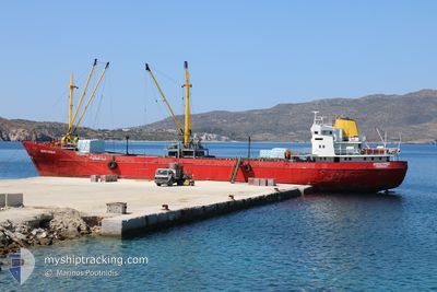
DIMITRIOS
General Cargo

Current Trip
| Time Travelled | 2 days |
|---|---|
| Remaining Time | --- |
| Distance Travelled | 237.68 nm |
| Remaining Distance | --- |
| AVG Speed | 8.3 Knots |
| MAX Speed | 9.2 Knots |
| AVG Wind | 16.4 knots |
| MAX Wind | 19 knots |
| MIN Temp | 6.4°C / 43.52°F |
| MAX Temp | 12.9°C / 55.22°F |
| Draught | 4.6 m |
| Position Received | Now |
Current Position
| Longitude | --- |
|---|---|
| Latitude | --- |
| Status | Under way using engine |
| Speed | 0.1 Knots |
| Course | --- |
| Area | Aegean Sea |
| Station | T-AIS |
| Position Received | Now |
Information
The current position of DIMITRIOS is in Aegean Sea with coordinates 37.52031° / 25.17339° as reported on 2025-03-22 03:46 by AIS to our vessel tracker app. The vessel's current speed is 0.1 Knots
The vessel DIMITRIOS (IMO: 6500909, MMSI: 237006500) is a General Cargo that was built in 1964 ( 61 years old ). It's sailing under the flag of [GR] Greece.
In this page you can find informations about the vessels current position, last detected port calls, and current voyage information. If the vessels is not in coverage by AIS you will find the latest position.
The current position of DIMITRIOS is detected by our AIS receivers and we are not responsible for the reliability of the data. The last position was recorded while the vessel was in Coverage by the Ais receivers of our vessel tracking app.
The current draught of DIMITRIOS as reported by AIS is 4.6 meters
Weather
| Temperature | 11.7°C / 53.06°F |
|---|---|
| Wind Speed | 14 knots |
| Direction | 349° N |
| Pressure | 1023 hPa |
| Humidity | 58.9 % |
| Cloud Coverage | --- |


Featured Company
Last Port Calls
| Port | Arrival | Departure | Time In Port |
|---|---|---|---|
| 2025-03-15 05:02 | 2025-03-19 10:16 | 4 d | |
| 2025-03-12 05:42 | 2025-03-13 12:37 | 1 d | |
| 2025-03-08 16:31 | 2025-03-11 14:37 | 2 d | |
| 2025-03-06 05:26 | 2025-03-06 11:22 | 5 h | |
| 2025-03-03 22:29 | 2025-03-05 02:18 | 1 d | |
| 2025-03-03 05:42 | 2025-03-03 12:03 | 6 h | |
| 2025-02-28 05:37 | 2025-03-01 17:43 | 1 d | |
| 2025-02-27 06:20 | 2025-02-27 08:21 | 2 h | |
| 2025-02-26 06:11 | 2025-02-26 16:06 | 9 h | |
| 2025-02-25 08:16 | 2025-02-25 10:30 | 2 h |
Most Visited Ports (Last year)
| Port | Arrivals | |
|---|---|---|
| 20 | ||
| 16 | ||
| 9 | ||
| 8 | ||
| 8 | ||
| 7 |
Last Trips
| Origin | Departure | Destination | Arrival | Distance | |
|---|---|---|---|---|---|
| 2025-03-13 14:37 | 2025-03-15 07:02 | 226.10 nm | |||
| 2025-03-11 16:37 | 2025-03-12 07:42 | 107.41 nm | |||
| 2025-03-06 13:22 | 2025-03-08 18:31 | 330.91 nm | |||
| 2025-03-05 04:18 | 2025-03-06 07:26 | 64.45 nm | |||
| 2025-03-03 14:03 | 2025-03-04 00:29 | 69.91 nm | |||
| 2025-03-01 19:43 | 2025-03-03 07:42 | 253.81 nm | |||
| 2025-02-27 10:21 | 2025-02-28 07:37 | 178.98 nm | |||
| 2025-02-26 18:06 | 2025-02-27 08:20 | 82.92 nm | |||
| 2025-02-25 12:30 | 2025-02-26 08:11 | 48.76 nm | |||
| 2025-02-24 16:43 | 2025-02-25 10:16 | 28.62 nm |
Events
| Time | Event | Details | Position / Dest | Info |
|---|---|---|---|---|
| 2025-03-21 23:13 | STOP Moving | 1.22 nm, South East of TINOS |
37.51989 / 25.17323
GRTIN
|
Speed: 0.2 kn Course: 511° |
| 2025-03-21 22:31 | Status Changed | Under way using engine Default |
37.53702 / 25.26138
GRTIN
|
Speed: 8.7 kn Course: 207° |
| 2025-03-21 22:13 | Status Changed | Default Under way using engine |
37.57013 / 25.29531
GRTIN
|
Speed: 8.6 kn Course: 206.2° |
| 2025-03-21 21:58 | Status Changed | Under way using engine Default |
37.60125 / 25.31476
GRTIN
|
Speed: 8.3 kn Course: 188° |
| 2025-03-21 21:58 | IN Coverage |
37.60125 / 25.31476
Aegean Sea
GRTIN
|
Speed: 8.4 kn Course: 205.8° |
|
| 2025-03-21 21:02 | Status Changed | Default Under way using engine |
37.73132 / 25.34359
GRTIN
|
Speed: 8.2 kn Course: 192.6° |
| 2025-03-21 20:56 | OUT of Coverage |
37.74574 / 25.34482
Aegean Sea
GRTIN
|
Speed: 8.2 kn Course: 192.6° |
|
| 2025-03-21 15:37 | Destination Changed | GRTIN GRSHA |
38.50811 / 25.36732
GRTIN
|
Speed: 8.7 kn Course: 179.6° |
| 2025-03-21 15:37 | ETA Changed | 2025/03/22 01:00 2025/03/15 03:00 |
38.50811 / 25.36732
GRTIN
|
Speed: 8.7 kn Course: 179.6° |
| 2025-03-21 15:12 | Status Changed | Under way using engine Default |
38.56745 / 25.36649
GRSHA
|
Speed: 8.2 kn Course: 174° |