
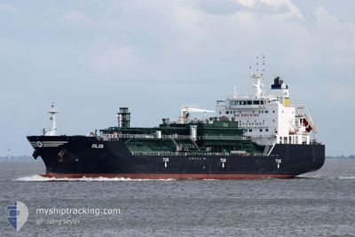
DILOS
Tanker
Current Trip
| Time Travelled | 1 day |
|---|---|
| Remaining Time | --- |
| Distance Travelled | 372.64 nm |
| Remaining Distance | --- |
| AVG Speed | 12.4 Knots |
| MAX Speed | 13.5 Knots |
| AVG Wind | 9.5 knots |
| MAX Wind | 16.8 knots |
| MIN Temp | 16.6°C / 61.88°F |
| MAX Temp | 24.1°C / 75.38°F |
| Draught | 8.2 m |
| Position Received | 48 m ago |
Current Position
| Longitude | --- |
|---|---|
| Latitude | --- |
| Status | Under way using engine |
| Speed | 12.2 Knots |
| Course | 52.2° |
| Area | Persian Gulf |
| Station | T-AIS |
| Position Received | 48 m ago |
Info
Information
The current position of DILOS is in Persian Gulf with coordinates 26.19632° / 55.95801° as reported on 2025-02-17 12:37 by AIS to our vessel tracker app. The vessel's current speed is 12.2 Knots and is heading at the port of TERNEUZEN. The estimated time of arrival as calculated by MyShipTracking vessel tracking app is 2025-03-09 15:00 LT
The vessel DILOS (IMO: 9711535, MMSI: 241409000) is a Tanker It's sailing under the flag of [GR] Greece.
In this page you can find informations about the vessels current position, last detected port calls, and current voyage information. If the vessels is not in coverage by AIS you will find the latest position.
The current position of DILOS is detected by our AIS receivers and we are not responsible for the reliability of the data. The last position was recorded while the vessel was in Coverage by the Ais receivers of our vessel tracking app.
The current draught of DILOS as reported by AIS is 8.2 meters
Weather
| Temperature | 24.1°C / 75.38°F |
|---|---|
| Wind Speed | 7 knots |
| Direction | 43° NE |
| Pressure | 1012.3 hPa |
| Humidity | 65.5 % |
| Cloud Coverage | 86 % |
Featured Company
Last Port Calls
| Port | Arrival | Departure | Time In Port |
|---|---|---|---|
| 2025-02-14 06:49 | 2025-02-16 07:09 | 2 d | |
| 2025-02-08 16:00 | 2025-02-10 19:52 | 2 d | |
| 2025-01-12 15:40 | 2025-01-13 12:01 | 20 h | |
| 2025-01-07 15:05 | 2025-01-09 10:01 | 1 d | |
| 2025-01-05 06:09 | 2025-01-06 08:57 | 1 d | |
| 2024-12-24 03:24 | 2024-12-25 14:44 | 1 d | |
| 2024-12-19 20:52 | 2024-12-20 22:53 | 1 d | |
| 2024-12-16 18:15 | 2024-12-17 04:38 | 10 h |
Last Trips
| Origin | Departure | Destination | Arrival | Distance | |
|---|---|---|---|---|---|
| 2025-02-10 22:52 | 2025-02-14 09:49 | 21.23 nm | |||
| 2025-01-13 19:01 | 2025-02-08 19:00 | 4738.46 nm | |||
| 2025-01-09 18:01 | 2025-01-12 22:40 | 828.63 nm | |||
| 2025-01-06 16:57 | 2025-01-07 23:05 | 263.82 nm | |||
| 2024-12-25 21:44 | 2025-01-05 14:09 | 1560.45 nm | |||
| 2024-12-21 06:53 | 2024-12-24 10:24 | 774.45 nm | |||
| 2024-12-17 12:38 | 2024-12-20 04:52 | 5.07 nm | |||
| 2024-11-29 23:27 | 2024-12-17 02:15 | 843.12 nm |
Events
| Time | Event | Details | Position / Dest | Info |
|---|---|---|---|---|
| 2025-02-17 12:41 | Status Changed | Default Under way using engine |
26.20645 / 55.97217
FOR ORDERS
|
Speed: 12.2 kn Course: 52.2° |
| 2025-02-17 12:24 | Detected in Sea | Omani part of the Persian Gulf |
26.16957 / 55.92105
Persian Gulf
FOR ORDERS
|
Speed: 12 kn Course: 51.1° |
| 2025-02-17 12:07 | Status Changed | Under way using engine Default |
26.13321 / 55.87249
FOR ORDERS
|
Speed: 11.9 kn Course: 49° |
| 2025-02-17 12:05 | Status Changed | Default Under way using engine |
26.12956 / 55.86768
FOR ORDERS
|
Speed: 12.2 kn Course: 49.8° |
| 2025-02-17 11:58 | Status Changed | Under way using engine Default |
26.11278 / 55.84541
FOR ORDERS
|
Speed: 12.2 kn Course: 49° |
| 2025-02-17 11:53 | Status Changed | Default Under way using engine |
26.10324 / 55.83312
FOR ORDERS
|
Speed: 12 kn Course: 47.7° |
| 2025-02-17 11:28 | ETA Changed | 2025/03/09 15:00 2025/03/06 15:00 |
26.04604 / 55.76176
FOR ORDERS
|
Speed: 12.1 kn Course: 47.4° |
| 2025-02-17 11:09 | Destination Changed | FOR ORDERS CAPE TOWN |
26.00332 / 55.70936
FOR ORDERS
|
Speed: 11.3 kn Course: 56.8° |
| 2025-02-17 10:10 | Draught Changed | 8.2 6.7 |
26.00788 / 55.49091
CAPE TOWN
|
Speed: 12.1 kn Course: 93.8° |
| 2025-02-17 10:10 | Destination Changed | CAPE TOWN SAJUB |
26.00788 / 55.49091
CAPE TOWN
|
Speed: 12.1 kn Course: 93.8° |