
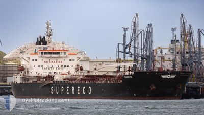
DIADEMA
Tanker
Current Trip
| Trip Time | 1 day |
|---|---|
| Trip Distance | 442.47 nm |
| AVG Speed | 10.7 Knots |
| MAX Speed | 13.4 Knots |
| Draught | 8.4 m |
| AVG Wind | 8.4 knots |
| MAX Wind | 16.5 knots |
| MIN Temp | 16.1°C / 60.98°F |
| MAX Temp | 18.8°C / 65.84°F |
| Position Received | 3 m ago |
Current Position
| Longitude | 10.29659° |
|---|---|
| Latitude | 43.56161° |
| Status | Moored |
| Speed | |
| Course | 226° |
| Area | Tyrrhenian Sea |
| Station | T-AIS |
| Position Received | 3 m ago |
Info
Information
The current position of DIADEMA is in Tyrrhenian Sea with coordinates 43.56161° / 10.29659° as reported on 2024-05-17 02:33 by AIS to our vessel tracker app. The vessel's current speed is 0 Knots and is currently inside the port of LIVORNO.
The vessel DIADEMA (IMO: 9808326, MMSI: 311000576) is a Tanker It's sailing under the flag of [BS] Bahamas.
In this page you can find informations about the vessels current position, last detected port calls, and current voyage information. If the vessels is not in coverage by AIS you will find the latest position.
The current position of DIADEMA is detected by our AIS receivers and we are not responsible for the reliability of the data. The last position was recorded while the vessel was in Coverage by the Ais receivers of our vessel tracking app.
The current draught of DIADEMA as reported by AIS is 8.4 meters
Weather
| Temperature | 17.5°C / 63.5°F |
|---|---|
| Wind Speed | 20 knots |
| Direction | 249° WSW |
| Pressure | 1009.2 hPa |
| Humidity | 75.1 % |
| Cloud Coverage | --- |
Featured Company
Last Port Calls
| Port | Arrival | Departure | Time In Port |
|---|---|---|---|
| 2024-05-16 17:42 | |||
| 2024-05-13 14:43 | 2024-05-15 05:30 | 1 d | |
| 2024-04-20 00:40 | 2024-04-22 22:20 | 2 d | |
| 2024-04-16 14:35 | 2024-04-17 19:07 | 1 d | |
| 2024-04-12 16:13 | 2024-04-14 00:44 | 1 d | |
| 2024-04-09 07:59 | 2024-04-10 12:41 | 1 d | |
| 2024-04-03 21:34 | 2024-04-05 05:26 | 1 d | |
| 2024-03-30 16:49 | 2024-04-02 02:57 | 2 d | |
| 2024-03-20 16:16 | 2024-03-23 08:14 | 2 d |
Most Visited Ports (Last year)
| Port | Arrivals | |
|---|---|---|
| 8 | ||
| 4 | ||
| 4 | ||
| 3 | ||
| 3 | ||
| 2 |
Last Trips
| Origin | Departure | Destination | Arrival | Distance | |
|---|---|---|---|---|---|
| 2024-05-15 05:30 | 2024-05-16 17:42 | 442.47 nm | |||
| 2024-04-22 22:20 | 2024-05-13 14:43 | 3907.53 nm | |||
| 2024-04-17 19:07 | 2024-04-20 00:40 | 647.32 nm | |||
| 2024-04-14 00:44 | 2024-04-16 14:35 | 645.80 nm | |||
| 2024-04-10 12:41 | 2024-04-12 16:13 | 12.46 nm | |||
| 2024-04-05 05:26 | 2024-04-09 07:59 | 959.24 nm | |||
| 2024-04-02 02:57 | 2024-04-03 21:34 | 373.24 nm | |||
| 2024-03-23 08:14 | 2024-03-30 16:49 | 1458.53 nm | |||
| 2024-02-27 03:11 | 2024-03-20 16:16 | 3525.78 nm |
Events
| Time | Event | Details | Position / Dest | Info |
|---|---|---|---|---|
| 2024-05-16 16:39 | Status Changed | Moored Under way using engine |
43.56160 / 10.29658
[IT] LIVORNO
|
Speed: 0.2 kn Course: 226° |
| 2024-05-16 16:05 | STOP Moving |
43.55647 / 10.29208
[IT] LIVORNO
|
Speed: 0.3 kn Course: 219° |
|
| 2024-05-16 15:42 | PORT ARRIVAL |
|
43.53902 / 10.28596
[IT] LIVORNO
|
Speed: 7.4 kn Course: 57.3° |
| 2024-05-16 11:58 | Change Sea Area | Italian part of the Tyrrhenian Sea Italian part of the Ligurian Sea |
43.27120 / 9.54797
Tyrrhenian Sea
IT LIV
|
Speed: 12.9 kn Course: 86.8° |
| 2024-05-16 11:55 | Change Sea Area | Italian part of the Ligurian Sea French part of the Ligurian Sea |
43.27049 / 9.53166
Ligurian Sea
IT LIV
|
Speed: 12.9 kn Course: 85.8° |
| 2024-05-16 10:04 | Change Sea Area | French part of the Ligurian Sea French part of the Mediterranean Sea - Western Basin |
43.17912 / 9.01481
Ligurian Sea
IT LIV
|
Speed: 12.8 kn Course: 66.8° |
| 2024-05-16 06:50 | IN Coverage |
42.91784 / 8.16845
Mediterranean Sea - Western Basin
IT LIV
|
Speed: 13.1 kn Course: 66.9° |
|
| 2024-05-16 05:32 | OUT of Coverage |
42.80707 / 7.80798
Mediterranean Sea - Western Basin
IT LIV
|
Speed: 12.9 kn Course: 66.6° |
|
| 2024-05-16 04:40 | Detected in Sea | French part of the Mediterranean Sea - Western Basin |
42.73514 / 7.57712
Mediterranean Sea - Western Basin
IT LIV
|
Speed: 12.8 kn Course: 67.1° |
| 2024-05-16 04:38 | IN Coverage |
42.73514 / 7.57712
Mediterranean Sea - Western Basin
IT LIV
|
Speed: 12.8 kn Course: 67.1° |