
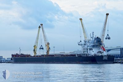
DESPINA V
Cargo
Current Trip
| Time Travelled | 9 days |
|---|---|
| Remaining Time | --- |
| Distance Travelled | 2916.57 nm |
| Remaining Distance | --- |
| AVG Speed | 12.4 Knots |
| MAX Speed | 15.4 Knots |
| AVG Wind | 12.4 knots |
| MAX Wind | 22 knots |
| MIN Temp | 12.5°C / 54.5°F |
| MAX Temp | 27°C / 80.6°F |
| Draught | 12.9 m |
| Position Received | 1 m ago |
Current Position
| Longitude | 1.98083° |
|---|---|
| Latitude | 51.33161° |
| Status | Under way using engine |
| Speed | 13.3 Knots |
| Course | 41.6° |
| Area | North Sea |
| Station | T-AIS |
| Position Received | 1 m ago |
Info
Information
The current position of DESPINA V is in North Sea with coordinates 51.33161° / 1.98083° as reported on 2024-05-12 06:37 by AIS to our vessel tracker app. The vessel's current speed is 13.3 Knots and is heading at the port of STADE. The estimated time of arrival as calculated by MyShipTracking vessel tracking app is 2024-05-13 10:00 LT
The vessel DESPINA V (IMO: 9727986, MMSI: 371313000) is a Cargo It's sailing under the flag of [PA] Panama.
In this page you can find informations about the vessels current position, last detected port calls, and current voyage information. If the vessels is not in coverage by AIS you will find the latest position.
The current position of DESPINA V is detected by our AIS receivers and we are not responsible for the reliability of the data. The last position was recorded while the vessel was in Coverage by the Ais receivers of our vessel tracking app.
The current draught of DESPINA V as reported by AIS is 12.9 meters
Weather
| Temperature | 13.5°C / 56.3°F |
|---|---|
| Wind Speed | 12 knots |
| Direction | 108° ESE |
| Pressure | 1014.8 hPa |
| Humidity | 89.8 % |
| Cloud Coverage | 98 % |
Featured Company
Last Port Calls
| Port | Arrival | Departure | Time In Port |
|---|---|---|---|
| 2024-05-01 00:17 | 2024-05-02 14:38 | 1 d | |
| 2024-04-30 19:23 | 2024-04-30 20:53 | 1 h | |
| 2024-04-30 12:17 | 2024-04-30 15:33 | 3 h | |
| 2024-04-30 07:44 | 2024-04-30 08:05 | 21 m | |
| 2024-04-18 11:49 | 2024-04-23 04:07 | 4 d | |
| 2024-04-04 00:10 | 2024-04-05 05:25 | 1 d | |
| 2024-03-24 02:41 | 2024-03-24 02:56 | 15 m | |
| 2024-03-20 12:19 | 2024-03-20 14:23 | 2 h | |
| 2024-03-18 20:34 | 2024-03-20 09:27 | 1 d | |
| 2024-03-04 05:51 |
Most Visited Ports (Last year)
| Port | Arrivals | |
|---|---|---|
| 6 | ||
| 3 | ||
| 2 | ||
| 2 | ||
| 2 | ||
| 2 |
Last Trips
| Origin | Departure | Destination | Arrival | Distance | |
|---|---|---|---|---|---|
| 2024-04-30 20:53 | 2024-05-01 00:17 | 0.59 nm | |||
| 2024-04-30 15:33 | 2024-04-30 19:23 | 0.54 nm | |||
| 2024-04-30 08:05 | 2024-04-30 12:17 | 0.54 nm | |||
| 2024-04-23 06:07 | 2024-04-30 07:44 | 2322.71 nm | |||
| 2024-04-05 05:25 | 2024-04-18 13:49 | 2360.62 nm | |||
| 2024-03-24 03:56 | 2024-04-04 00:10 | 3049.09 nm | |||
| 2024-03-20 15:23 | 2024-03-24 03:41 | 7.16 nm | |||
| 2024-03-20 10:27 | 2024-03-20 13:19 | 10.17 nm | |||
| 2024-02-13 15:41 | 2024-03-04 00:51 | 3369.99 nm |
Events
| Time | Event | Details | Position / Dest | Info |
|---|---|---|---|---|
| 2024-05-12 05:11 | Detected in Sea | United Kingdom part of the North Sea |
51.07854 / 1.65129
North Sea
STADE GERMANY
|
Speed: 14.2 kn Course: 34.6° |
| 2024-05-12 04:53 | Change Sea Area | French part of the North Sea French part of the English Channel |
51.01939 / 1.58687
North Sea
STADE GERMANY
|
Speed: 14.4 kn Course: 34.4° |
| 2024-05-12 02:01 | Detected in Sea | French part of the English Channel |
50.50434 / .93511
English Channel
STADE GERMANY
|
Speed: 13.5 kn Course: 71.5° |
| 2024-05-11 20:31 | Change Sea Area | United Kingdom part of the English Channel French part of the English Channel |
50.13851 / -1.07499
English Channel
STADE GERMANY
|
Speed: 14.3 kn Course: 75.8° |
| 2024-05-11 17:25 | Change Sea Area | French part of the English Channel Guernsey part of the English Channel |
49.97095 / -2.02965
English Channel
STADE GERMANY
|
Speed: 10.3 kn Course: 71.7° |
| 2024-05-11 12:16 | Change Sea Area | Guernsey part of the English Channel United Kingdom part of the English Channel |
49.71300 / -3.40190
English Channel
STADE GERMANY
|
Speed: 12.2 kn Course: 71.8° |
| 2024-05-11 06:59 | Change Sea Area | United Kingdom part of the English Channel United Kingdom part of the Celtic Sea |
49.31418 / -5.09756
English Channel
STADE GERMANY
|
Speed: 14.3 kn Course: 60.2° |
| 2024-05-11 06:10 | Change Sea Area | United Kingdom part of the Celtic Sea French part of the Celtic Sea |
49.21644 / -5.35381
Celtic Sea
STADE GERMANY
|
Speed: 14.3 kn Course: 59.2° |
| 2024-05-11 05:39 | Status Changed | Under way using engine Default |
49.15631 / -5.51531
STADE GERMANY
|
Speed: 14.3 kn Course: 59° |
| 2024-05-11 05:39 | Status Changed | Default Under way using engine |
49.15474 / -5.51948
STADE GERMANY
|
Speed: 14.3 kn Course: 59.1° |