
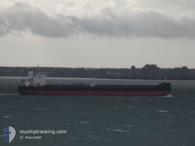
DENSA FLAMINGO
Cargo
Current Trip
| Time Travelled | 3 days |
|---|---|
| Remaining Time | --- |
| Distance Travelled | 803.24 nm |
| Remaining Distance | --- |
| AVG Speed | 8.9 Knots |
| MAX Speed | 10.3 Knots |
| AVG Wind | 10.2 knots |
| MAX Wind | 16.9 knots |
| MIN Temp | 23.3°C / 73.94°F |
| MAX Temp | 28.2°C / 82.76°F |
| Draught | 14 m |
| Position Received | 3 d ago |
Current Position
| Longitude | --- |
|---|---|
| Latitude | --- |
| Status | Under way using engine |
| Speed | 8.6 Knots |
| Course | 132.9° |
| Area | North Atlantic Ocean |
| Station | T-AIS |
| Position Received | 3 d ago |
Info
Information
The current position of DENSA FLAMINGO is in North Atlantic Ocean with coordinates 36.81640° / -75.76666° as reported on 2024-09-29 11:57 by AIS to our vessel tracker app. The vessel's current speed is 8.6 Knots and is heading at the port of GANGAVARAM.
The vessel DENSA FLAMINGO (MMSI: 215284000) is a Cargo It's sailing under the flag of [MT] Malta.
In this page you can find informations about the vessels current position, last detected port calls, and current voyage information. If the vessels is not in coverage by AIS you will find the latest position.
The current position of DENSA FLAMINGO is detected by our AIS receivers and we are not responsible for the reliability of the data. The last position was recorded while the vessel was in Coverage by the Ais receivers of our vessel tracking app.
The current draught of DENSA FLAMINGO as reported by AIS is 14 meters
Weather
| Temperature | 28.1°C / 82.58°F |
|---|---|
| Wind Speed | 14 knots |
| Direction | 273° W |
| Pressure | 1010.4 hPa |
| Humidity | 70.9 % |
| Cloud Coverage | --- |
Featured Company
Last Trips
| Origin | Departure | Destination | Arrival | Distance | |
|---|---|---|---|---|---|
| 2024-08-15 12:55 | 2024-09-26 23:48 | 5366.30 nm | |||
| 2024-06-22 07:17 | 2024-08-02 17:12 | 6889.44 nm |
Events
| Time | Event | Details | Position / Dest | Info |
|---|---|---|---|---|
| 2024-09-29 12:03 | Status Changed | Default Under way using engine |
36.80862 / -75.75177
INGGV
|
Speed: 8.6 kn Course: 132.9° |
| 2024-09-29 11:57 | OUT of Coverage |
36.81640 / -75.76666
North Atlantic Ocean
|
Speed: 8.6 kn Course: 132.9° |
|
| 2024-09-29 11:39 | Status Changed | Under way using engine Default |
36.84069 / -75.80892
INGGV
|
Speed: 8.3 kn Course: 122° |
| 2024-09-29 11:26 | Status Changed | Default Under way using engine |
36.85599 / -75.83988
INGGV
|
Speed: 8.4 kn Course: 122.2° |
| 2024-09-29 11:13 | Status Changed | Under way using engine Default |
36.87375 / -75.87272
INGGV
|
Speed: 8.3 kn Course: 141° |
| 2024-09-29 11:03 | Status Changed | Default Under way using engine |
36.89031 / -75.89110
INGGV
|
Speed: 8.2 kn Course: 137° |
| 2024-09-29 10:49 | Status Changed | Under way using engine Default |
36.91405 / -75.91775
INGGV
|
Speed: 8.2 kn Course: 138° |
| 2024-09-29 10:43 | Status Changed | Default Under way using engine |
36.92378 / -75.93038
INGGV
|
Speed: 8.2 kn Course: 107.7° |
| 2024-09-29 10:37 | Status Changed | Under way using engine Default |
36.93143 / -75.94497
INGGV
|
Speed: 8.3 kn Course: 107° |
| 2024-09-29 10:11 | Status Changed | Default Under way using engine |
36.94957 / -76.01613
INGGV
|
Speed: 7.9 kn Course: 108.5° |