

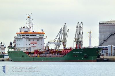
DEFNE BAYRAK
Tanker

Current Trip
| Time Travelled | 1 day |
|---|---|
| Remaining Time | 6 days |
| Distance Travelled | 459.80 nm |
| Remaining Distance | 1666.37 nm |
| AVG Speed | 10.7 Knots |
| MAX Speed | 14.7 Knots |
| AVG Wind | 14.6 knots |
| MAX Wind | 20.9 knots |
| MIN Temp | 2.2°C / 35.96°F |
| MAX Temp | 10.1°C / 50.18°F |
| Draught | 6.1 m |
| Position Received | 53 m ago |
Current Position
| Longitude | --- |
|---|---|
| Latitude | --- |
| Status | Under way using engine |
| Speed | 10.9 Knots |
| Course | 214.5° |
| Area | Celtic Sea |
| Station | T-AIS |
| Position Received | 53 m ago |
Information
The current position of DEFNE BAYRAK is in Celtic Sea with coordinates 48.82042° / -5.84676° as reported on 2025-02-15 12:13 by AIS to our vessel tracker app. The vessel's current speed is 10.9 Knots and is heading at the port of FOS. The estimated time of arrival as calculated by MyShipTracking vessel tracking app is 2025-02-21 18:23 LT
The vessel DEFNE BAYRAK (IMO: 9835032, MMSI: 215086000) is a Tanker It's sailing under the flag of [MT] Malta.
In this page you can find informations about the vessels current position, last detected port calls, and current voyage information. If the vessels is not in coverage by AIS you will find the latest position.
The current position of DEFNE BAYRAK is detected by our AIS receivers and we are not responsible for the reliability of the data. The last position was recorded while the vessel was in Coverage by the Ais receivers of our vessel tracking app.
The current draught of DEFNE BAYRAK as reported by AIS is 6.1 meters
Weather
| Temperature | 10.1°C / 50.18°F |
|---|---|
| Wind Speed | 19 knots |
| Direction | 143° SE |
| Pressure | 1013.5 hPa |
| Humidity | 72.6 % |
| Cloud Coverage | 27 % |


Featured Company
Last Port Calls
| Port | Arrival | Departure | Time In Port |
|---|---|---|---|
| 2025-02-12 03:01 | 2025-02-13 17:57 | 1 d | |
| 2025-02-10 23:45 | 2025-02-11 13:01 | 13 h | |
| 2025-02-09 06:44 | 2025-02-09 19:06 | 12 h | |
| 2025-01-29 03:15 | 2025-01-30 03:07 | 23 h | |
| 2025-01-28 02:47 | 2025-01-29 02:52 | 1 d | |
| 2025-01-26 20:41 | 2025-01-28 02:29 | 1 d | |
| 2025-01-24 13:41 | 2025-01-25 20:50 | 1 d | |
| 2025-01-22 22:18 | 2025-01-23 22:34 | 1 d | |
| 2025-01-20 07:23 | 2025-01-21 03:13 | 19 h | |
| 2025-01-16 17:03 | 2025-01-18 00:35 | 1 d |
Most Visited Ports (Last year)
| Port | Arrivals | |
|---|---|---|
| 8 | ||
| 8 | ||
| 6 | ||
| 5 | ||
| 3 | ||
| 3 |
Last Trips
| Origin | Departure | Destination | Arrival | Distance | |
|---|---|---|---|---|---|
| 2025-02-11 14:01 | 2025-02-12 04:01 | 147.37 nm | |||
| 2025-02-09 19:06 | 2025-02-11 00:45 | 107.17 nm | |||
| 2025-01-30 04:07 | 2025-02-09 06:44 | 2122.57 nm | |||
| 2025-01-29 03:52 | 2025-01-29 04:15 | 1.05 nm | |||
| 2025-01-28 03:29 | 2025-01-28 03:47 | 2.87 nm | |||
| 2025-01-25 21:50 | 2025-01-26 21:41 | 234.99 nm | |||
| 2025-01-23 23:34 | 2025-01-24 14:41 | 166.09 nm | |||
| 2025-01-21 04:13 | 2025-01-22 23:18 | 356.91 nm | |||
| 2025-01-18 01:35 | 2025-01-20 08:23 | 4.94 nm | |||
| 2025-01-15 20:27 | 2025-01-16 18:03 | 191.98 nm |
Events
| Time | Event | Details | Position / Dest | Info |
|---|---|---|---|---|
| 2025-02-15 12:19 | Status Changed | Default Under way using engine |
48.80294 / -5.86356
NLRTM>FRFOS
|
Speed: 10.9 kn Course: 214.5° |
| 2025-02-15 12:12 | Status Changed | Under way using engine Default |
48.82084 / -5.84633
NLRTM>FRFOS
|
Speed: 10.7 kn Course: 209° |
| 2025-02-15 11:47 | Status Changed | Default Under way using engine |
48.88514 / -5.78498
NLRTM>FRFOS
|
Speed: 11.2 kn Course: 233.1° |
| 2025-02-15 11:40 | Status Changed | Under way using engine Default |
48.89999 / -5.76285
NLRTM>FRFOS
|
Speed: 11.6 kn Course: 241° |
| 2025-02-15 11:03 | Status Changed | Default Under way using engine |
48.95614 / -5.60191
NLRTM>FRFOS
|
Speed: 11.2 kn Course: 242.2° |
| 2025-02-15 10:48 | Status Changed | Under way using engine Default |
48.97881 / -5.53813
NLRTM>FRFOS
|
Speed: 10.9 kn Course: 245° |
| 2025-02-15 10:12 | Status Changed | Default Under way using engine |
49.02937 / -5.37647
NLRTM>FRFOS
|
Speed: 11.4 kn Course: 240.8° |
| 2025-02-15 09:48 | Status Changed | Under way using engine Default |
49.06904 / -5.27897
NLRTM>FRFOS
|
Speed: 10.8 kn Course: 235° |
| 2025-02-15 09:39 | Status Changed | Default Under way using engine |
49.08602 / -5.25003
NLRTM>FRFOS
|
Speed: 11 kn Course: 242.7° |
| 2025-02-15 08:58 | Status Changed | Under way using engine Default |
49.14702 / -5.08806
NLRTM>FRFOS
|
Speed: 10.5 kn Course: 239° |