
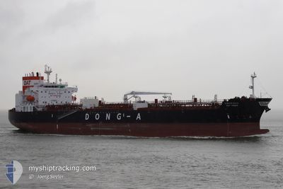
DAT VENUS
Tanker
Current Trip
COPOC
| Time Travelled | 7 days |
|---|---|
| Remaining Time | --- |
| Distance Travelled | 1698.09 nm |
| Remaining Distance | --- |
| AVG Speed | 11.6 Knots |
| MAX Speed | 14.3 Knots |
| AVG Wind | 14.6 knots |
| MAX Wind | 25 knots |
| MIN Temp | 17.3°C / 63.14°F |
| MAX Temp | 28.4°C / 83.12°F |
| Draught | 11.9 m |
| Position Received | 22 h, 17 m ago |
Current Position
| Longitude | -74.25434° |
|---|---|
| Latitude | 11.14940° |
| Status | At anchor |
| Speed | |
| Course | 216° |
| Area | Caribbean Sea |
| Station | T-AIS |
| Position Received | 22 h, 17 m ago |
Info
Information
The current position of DAT VENUS is in Caribbean Sea with coordinates 11.14940° / -74.25434° as reported on 2024-04-27 16:56 by AIS to our vessel tracker app. The vessel's current speed is 0 Knots
The vessel DAT VENUS (IMO: 9948293, MMSI: 538010420) is a Tanker It's sailing under the flag of [MH] Marshall Is.
In this page you can find informations about the vessels current position, last detected port calls, and current voyage information. If the vessels is not in coverage by AIS you will find the latest position.
The current position of DAT VENUS is detected by our AIS receivers and we are not responsible for the reliability of the data. The last position was recorded while the vessel was in Coverage by the Ais receivers of our vessel tracking app.
The current draught of DAT VENUS as reported by AIS is 11.9 meters
Weather
| Temperature | 28.6°C / 83.48°F |
|---|---|
| Wind Speed | 6 knots |
| Direction | 44° NE |
| Pressure | 1010.9 hPa |
| Humidity | 71 % |
| Cloud Coverage | 100 % |
Featured Company
Last Port Calls
| Port | Arrival | Departure | Time In Port |
|---|---|---|---|
| 2024-04-21 11:58 | 2024-04-21 12:26 | 27 m | |
| 2024-04-06 23:32 | 2024-04-09 06:54 | 2 d | |
| 2024-04-01 15:28 | 2024-04-03 23:58 | 2 d | |
| 2024-03-12 20:57 | 2024-03-14 17:33 | 1 d | |
| 2024-03-09 22:43 | 2024-03-11 03:00 | 1 d | |
| 2024-03-04 17:41 | 2024-03-06 13:12 | 1 d | |
| 2024-02-12 08:05 | 2024-02-14 13:49 | 2 d | |
| 2024-02-04 22:05 | 2024-02-05 14:27 | 16 h |
Last Trips
| Origin | Departure | Destination | Arrival | Distance | |
|---|---|---|---|---|---|
| 2024-04-09 02:54 | 2024-04-21 06:58 | 2046.37 nm | |||
| 2024-04-03 19:58 | 2024-04-06 19:32 | 102.45 nm | |||
| 2024-03-14 19:33 | 2024-04-01 11:28 | 5127.79 nm | |||
| 2024-03-11 04:00 | 2024-03-12 22:57 | 525.79 nm | |||
| 2024-03-06 14:12 | 2024-03-09 23:43 | 869.04 nm | |||
| 2024-02-14 07:49 | 2024-03-04 18:41 | 5110.32 nm | |||
| 2024-02-05 09:27 | 2024-02-12 02:05 | 1790.60 nm | |||
| 2024-01-31 14:29 | 2024-02-04 17:05 | 729.22 nm |
Events
| Time | Event | Details | Position / Dest | Info |
|---|---|---|---|---|
| 2024-04-27 17:04 | Status Changed | Default At anchor |
11.14833 / -74.25333
COPOC
|
Speed: Course: 216° |
| 2024-04-27 16:56 | Status Changed | At anchor Default |
11.14940 / -74.25434
COPOC
|
Speed: Course: -1° |
| 2024-04-27 16:56 | OUT of Coverage |
11.14940 / -74.25434
Caribbean Sea
|
Speed: Course: 323.3° |
|
| 2024-04-27 16:11 | Status Changed | Default At anchor |
11.14941 / -74.25417
COPOC
|
Speed: Course: 220° |
| 2024-04-27 16:08 | Status Changed | At anchor Default |
11.14940 / -74.25417
COPOC
|
Speed: Course: -1° |
| 2024-04-27 16:08 | Detected in Sea | Colombian part of the Caribbean Sea |
11.14940 / -74.25417
Caribbean Sea
|
Speed: Course: 323.3° |
| 2024-04-27 15:59 | Draught Changed | 11.9 9 |
11.14833 / -74.25333
COPOC
|
Speed: Course: -1° |
| 2024-04-27 15:59 | Destination Changed | COPOC US CRP |
11.14833 / -74.25333
COPOC
|
Speed: Course: -1° |
| 2024-04-27 15:59 | ETA Changed | 2024/04/27 07:30 2024/04/17 10:00 |
11.14833 / -74.25333
COPOC
|
Speed: Course: -1° |
| 2024-04-27 15:53 | IN Coverage |
11.14940 / -74.25417
Caribbean Sea
|
Speed: Course: 323.3° |