
DANUM 179
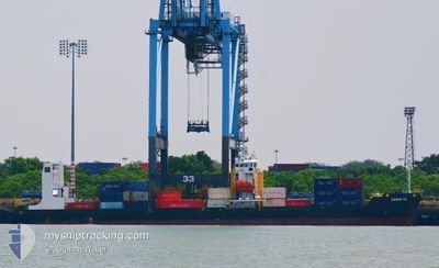
Cargo
Current Trip
| Trip Time | 1 day |
|---|---|
| Trip Distance | 237.54 nm |
| AVG Speed | 7.6 Knots |
| MAX Speed | 10.3 Knots |
| Draught | 4.6 m |
| AVG Wind | 13 knots |
| MAX Wind | 23.3 knots |
| MIN Temp | 22°C / 71.6°F |
| MAX Temp | 28.7°C / 83.66°F |
| Position Received | 1 m ago |
Current Position
| Longitude | --- |
|---|---|
| Latitude | --- |
| Status | Under way using engine |
| Speed | |
| Course | 294° |
| Area | Singapore Strait |
| Station | T-AIS |
| Position Received | 1 m ago |
Info
Information
The current position of DANUM 179 is in Singapore Strait with coordinates 1.43568° / 103.89205° as reported on 2025-01-11 03:05 by AIS to our vessel tracker app. The vessel's current speed is 0 Knots and is currently inside the port of PASIR GUDANG.
The vessel DANUM 179 (IMO: 8357215, MMSI: 533132786) is a Cargo It's sailing under the flag of [MY] Malaysia.
In this page you can find informations about the vessels current position, last detected port calls, and current voyage information. If the vessels is not in coverage by AIS you will find the latest position.
The current position of DANUM 179 is detected by our AIS receivers and we are not responsible for the reliability of the data. The last position was recorded while the vessel was in Coverage by the Ais receivers of our vessel tracking app.
The current draught of DANUM 179 as reported by AIS is 4.6 meters
Weather
| Temperature | 22.2°C / 71.96°F |
|---|---|
| Wind Speed | 8 knots |
| Direction | 286° WNW |
| Pressure | 1011.8 hPa |
| Humidity | 98.1 % |
| Cloud Coverage | 100 % |
Featured Company
Last Port Calls
| Port | Arrival | Departure | Time In Port |
|---|---|---|---|
| 2025-01-10 23:25 | |||
| 2025-01-09 00:53 | 2025-01-09 18:01 | 17 h | |
| 2025-01-03 13:27 | 2025-01-04 16:32 | 1 d | |
| 2024-12-24 05:52 | 2024-12-24 14:12 | 8 h | |
| 2024-12-20 18:08 | 2024-12-22 15:05 | 1 d | |
| 2024-12-15 22:05 | 2024-12-16 18:42 | 20 h | |
| 2024-12-09 21:32 | 2024-12-10 03:25 | 5 h | |
| 2024-12-07 23:16 | 2024-12-08 08:09 | 8 h | |
| 2024-12-07 03:49 | 2024-12-07 10:17 | 6 h | |
| 2024-12-02 06:08 | 2024-12-03 01:21 | 19 h |
Most Visited Ports (Last year)
| Port | Arrivals | |
|---|---|---|
| 26 | ||
| 22 | ||
| 19 | ||
| 1 | ||
| 1 | ||
| 1 |
Last Trips
| Origin | Departure | Destination | Arrival | Distance | |
|---|---|---|---|---|---|
| 2025-01-10 02:01 | 2025-01-11 07:25 | 237.54 nm | |||
| 2025-01-05 00:32 | 2025-01-09 08:53 | 787.40 nm | |||
| 2024-12-24 22:12 | 2025-01-03 21:27 | 1061.68 nm | |||
| 2024-12-22 23:05 | 2024-12-24 13:52 | 238.39 nm | |||
| 2024-12-17 02:42 | 2024-12-21 02:08 | 784.85 nm | |||
| 2024-12-10 11:25 | 2024-12-16 06:05 | 1056.55 nm | |||
| 2024-12-08 16:09 | 2024-12-10 05:32 | 239.31 nm | |||
| 2024-12-07 18:17 | 2024-12-08 07:16 | 19.41 nm | |||
| 2024-12-03 09:21 | 2024-12-07 11:49 | 785.56 nm | |||
| 2024-11-26 13:13 | 2024-12-02 14:08 | 1056.46 nm |
Events
| Time | Event | Details | Position / Dest | Info |
|---|---|---|---|---|
| 2025-01-10 23:35 | STOP Moving |
1.43564 / 103.89203
[MY] PASIR GUDANG
|
Speed: 0.3 kn Course: 294° |
|
| 2025-01-10 23:25 | PORT ARRIVAL |
|
1.43420 / 103.89325
[MY] PASIR GUDANG
|
Speed: 0.6 kn Course: 289° |
| 2025-01-10 22:55 | Change Sea Area | Malaysian part of the Singapore Strait Singaporean part of the Singapore Strait |
1.41669 / 103.92655
Singapore Strait
|
Speed: 8.3 kn Course: 318.2° |
| 2025-01-10 21:52 | Change Sea Area | Singaporean part of the Singapore Strait Malaysian part of the Singapore Strait |
1.36083 / 104.04922
Singapore Strait
|
Speed: 8.8 kn Course: 307.6° |
| 2025-01-10 21:01 | Change Sea Area | Malaysian part of the Singapore Strait Indonesian part of the Singapore Strait |
1.27161 / 104.08123
Singapore Strait
|
Speed: 8 kn Course: 40.8° |
| 2025-01-10 17:11 | Draught Changed | 4.6 4.2 |
1.07652 / 103.70811
PASIR GUDANG MY
|
Speed: 6.8 kn Course: 55.5° |
| 2025-01-10 17:11 | Destination Changed | PASIR GUDANG MY PORT KLANG MY |
1.07652 / 103.70811
PASIR GUDANG MY
|
Speed: 6.8 kn Course: 55.5° |
| 2025-01-10 17:11 | ETA Changed | 2025/11/01 04:00 2025/01/09 05:00 |
1.07652 / 103.70811
PASIR GUDANG MY
|
Speed: 6.8 kn Course: 55.5° |
| 2025-01-10 16:43 | Status Changed | Under way using engine Default |
1.04528 / 103.66582
PORT KLANG MY
|
Speed: 5.9 kn Course: 57° |
| 2025-01-10 16:09 | Status Changed | Default Under way using engine |
1.07431 / 103.60363
PORT KLANG MY
|
Speed: 8 kn Course: 118.8° |