
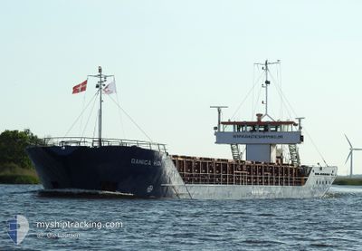
DANICA HAV
General Cargo
Current Trip
| Trip Time | 1 day |
|---|---|
| Trip Distance | 222.63 nm |
| AVG Speed | 8 Knots |
| MAX Speed | 9.1 Knots |
| Draught | 3.8 m |
| AVG Wind | 10.6 knots |
| MAX Wind | 15 knots |
| MIN Temp | 4.5°C / 40.1°F |
| MAX Temp | 10°C / 50°F |
| Position Received | 7 m ago |
Current Position
| Longitude | --- |
|---|---|
| Latitude | --- |
| Status | Moored |
| Speed | |
| Course | 344° |
| Area | Kattegat |
| Station | T-AIS |
| Position Received | 7 m ago |
Information
The current position of DANICA HAV is in Kattegat with coordinates 55.04036° / 9.42740° as reported on 2025-03-27 14:30 by AIS to our vessel tracker app. The vessel's current speed is 0 Knots and is currently inside the port of AABENRAA.
The vessel DANICA HAV (IMO: 8401535, MMSI: 308924000) is a General Cargo that was built in 1984 ( 41 years old ). It's sailing under the flag of [BS] Bahamas.
In this page you can find informations about the vessels current position, last detected port calls, and current voyage information. If the vessels is not in coverage by AIS you will find the latest position.
The current position of DANICA HAV is detected by our AIS receivers and we are not responsible for the reliability of the data. The last position was recorded while the vessel was in Coverage by the Ais receivers of our vessel tracking app.
The current draught of DANICA HAV as reported by AIS is 3.8 meters
Weather
| Temperature | 10.6°C / 51.08°F |
|---|---|
| Wind Speed | 14 knots |
| Direction | 251° WSW |
| Pressure | 1017.1 hPa |
| Humidity | 70.9 % |
| Cloud Coverage | 100 % |
Featured Company
Last Port Calls
| Port | Arrival | Departure | Time In Port |
|---|---|---|---|
| 2025-03-27 09:33 | |||
| 2025-03-25 15:46 | 2025-03-26 06:26 | 14 h | |
| 2025-03-21 09:10 | 2025-03-24 16:52 | 3 d | |
| 2025-03-18 13:13 | 2025-03-19 15:24 | 1 d | |
| 2025-03-13 17:18 | 2025-03-17 18:10 | 4 d | |
| 2025-03-08 21:50 | 2025-03-10 14:14 | 1 d | |
| 2025-03-07 07:31 | 2025-03-07 19:20 | 11 h | |
| 2025-03-06 08:15 | 2025-03-06 22:06 | 13 h | |
| 2025-03-03 19:29 | 2025-03-04 17:29 | 21 h | |
| 2025-03-02 04:18 | 2025-03-03 12:53 | 1 d |
Most Visited Ports (Last year)
| Port | Arrivals | |
|---|---|---|
| 7 | ||
| 6 | ||
| 6 | ||
| 6 | ||
| 5 | ||
| 5 |
Last Trips
| Origin | Departure | Destination | Arrival | Distance | |
|---|---|---|---|---|---|
| 2025-03-26 07:26 | 2025-03-27 10:33 | 222.63 nm | |||
| 2025-03-24 17:52 | 2025-03-25 16:46 | 210.60 nm | |||
| 2025-03-19 16:24 | 2025-03-21 10:10 | 350.23 nm | |||
| 2025-03-17 19:10 | 2025-03-18 14:13 | 177.46 nm | |||
| 2025-03-10 15:14 | 2025-03-13 18:18 | 376.54 nm | |||
| 2025-03-07 20:20 | 2025-03-08 22:50 | 212.81 nm | |||
| 2025-03-06 23:06 | 2025-03-07 08:31 | 83.45 nm | |||
| 2025-03-04 18:29 | 2025-03-06 09:15 | 246.17 nm | |||
| 2025-03-03 13:53 | 2025-03-03 20:29 | 68.09 nm | |||
| 2025-02-28 20:12 | 2025-03-02 05:18 | 234.56 nm |
Events
| Time | Event | Details | Position / Dest | Info |
|---|---|---|---|---|
| 2025-03-27 09:57 | Status Changed | Moored Under way using engine |
55.04031 / 9.42737
[DK] AABENRAA
|
Speed: Course: 344° |
| 2025-03-27 09:46 | STOP Moving |
55.04034 / 9.42768
[DK] AABENRAA
|
Speed: 0.3 kn Course: 333° |
|
| 2025-03-27 09:33 | PORT ARRIVAL |
|
55.03543 / 9.43324
[DK] AABENRAA
|
Speed: 3.3 kn Course: 319° |
| 2025-03-27 04:46 | Change Sea Area | Danish part of the Kattegat Danish part of the Baltic Sea |
54.81904 / 10.33486
Kattegat
DK AAB
|
Speed: 8.8 kn Course: 319.8° |
| 2025-03-27 01:58 | Change Sea Area | Danish part of the Baltic Sea German part of the Baltic Sea |
54.63964 / 10.93505
Baltic Sea
DK AAB
|
Speed: 8.1 kn Course: 283.1° |
| 2025-03-27 01:08 | Destination Changed | DK AAB DKAAR |
54.60827 / 11.11762
DK AAB
|
Speed: 8.2 kn Course: 269.2° |
| 2025-03-27 00:10 | Detected in Sea | German part of the Baltic Sea |
54.56411 / 11.32946
Baltic Sea
DKAAR
|
Speed: 8 kn Course: 292.6° |
| 2025-03-26 18:14 | Detected in Sea | Danish part of the Baltic Sea |
54.68184 / 12.42998
Baltic Sea
DKAAR
|
Speed: 8.4 kn Course: 238.4° |
| 2025-03-26 18:07 | Detected in Sea | German part of the Baltic Sea |
54.68952 / 12.45121
Baltic Sea
DKAAR
|
Speed: 8.5 kn Course: 238° |
| 2025-03-26 16:32 | Detected in Sea | Danish part of the Baltic Sea |
54.78454 / 12.79429
Baltic Sea
DKAAR
|
Speed: 8.4 kn Course: 272.3° |