

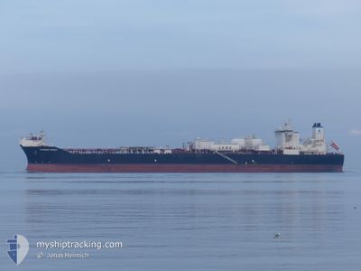
CURRENT SPIRIT
Tanker

Current Trip
TETNEY
| Time Travelled | 32 days |
|---|---|
| Remaining Time | --- |
| Distance Travelled | 1951.55 nm |
| Remaining Distance | --- |
| AVG Speed | 8.4 Knots |
| MAX Speed | 15.4 Knots |
| AVG Wind | 20.8 knots |
| MAX Wind | 41 knots |
| MIN Temp | 1°C / 33.8°F |
| MAX Temp | 11°C / 51.8°F |
| Draught | 13.5 m |
| Position Received | 1 m ago |
Current Position
| Longitude | --- |
|---|---|
| Latitude | --- |
| Status | Under way using engine |
| Speed | 11.1 Knots |
| Course | 180° |
| Area | Norwegian Sea |
| Station | T-AIS |
| Position Received | 1 m ago |
Information
The current position of CURRENT SPIRIT is in Norwegian Sea with coordinates 61.69268° / 3.98297° as reported on 2025-03-28 08:23 by AIS to our vessel tracker app. The vessel's current speed is 11.1 Knots
The vessel CURRENT SPIRIT (IMO: 9843924, MMSI: 311001594) is a Tanker It's sailing under the flag of [BS] Bahamas.
In this page you can find informations about the vessels current position, last detected port calls, and current voyage information. If the vessels is not in coverage by AIS you will find the latest position.
The current position of CURRENT SPIRIT is detected by our AIS receivers and we are not responsible for the reliability of the data. The last position was recorded while the vessel was in Coverage by the Ais receivers of our vessel tracking app.
The current draught of CURRENT SPIRIT as reported by AIS is 13.5 meters
Weather
| Temperature | 6.9°C / 44.42°F |
|---|---|
| Wind Speed | 21 knots |
| Direction | 228° SW |
| Pressure | 991.5 hPa |
| Humidity | 86.7 % |
| Cloud Coverage | 95 % |


Featured Company
Most Visited Ports (Last year)
| Port | Arrivals | |
|---|---|---|
| 1 |
Last Trips
| Origin | Departure | Destination | Arrival | Distance |
|---|
Events
| Time | Event | Details | Position / Dest | Info |
|---|---|---|---|---|
| 2025-03-28 06:05 | Draught Changed | 13.5 12.6 |
62.10051 / 3.99905
TETNEY
|
Speed: 10.6 kn Course: 180° |
| 2025-03-28 05:59 | Draught Changed | 12.6 9.6 |
62.11838 / 3.99828
TETNEY
|
Speed: 10.9 kn Course: 179° |
| 2025-03-27 20:38 | Destination Changed | TETNEY HEIDRUN |
63.63022 / 4.70552
TETNEY
|
Speed: 9.6 kn Course: 203.2° |
| 2025-03-27 20:38 | ETA Changed | 2025/03/30 09:00 2025/03/26 05:00 |
63.63022 / 4.70552
TETNEY
|
Speed: 9.6 kn Course: 203.2° |
| 2025-03-27 17:08 | IN Coverage |
64.15935 / 5.25816
Norwegian Sea
|
Speed: 9.6 kn Course: 209.1° |
|
| 2025-03-25 21:09 | OUT of Coverage |
64.25581 / 5.98618
Norwegian Sea
HEIDRUN
|
Speed: 11.5 kn Course: 36.1° |
|
| 2025-03-24 23:18 | Change Sea Area | Norwegian part of the Norwegian Sea Norwegian part of the North Sea |
61.00427 / 4.21613
Norwegian Sea
HEIDRUN
|
Speed: 9.3 kn Course: 1° |
| 2025-03-23 11:33 | ETA Changed | 2025/03/26 05:00 2025/03/26 06:00 |
58.58229 / 4.95675
HEIDRUN
|
Speed: 7 kn Course: 313.6° |
| 2025-03-23 00:19 | Detected in Sea | Norwegian part of the North Sea |
57.78220 / 7.37429
North Sea
HEIDRUN
|
Speed: 8.2 kn Course: 271° |
| 2025-03-22 17:37 | Detected in Sea | Norwegian part of the Skaggerak |
57.81327 / 9.07513
Skaggerak
HEIDRUN
|
Speed: 8.3 kn Course: 265.8° |