
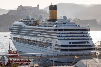
COSTA FORTUNA
Passengers Ship
Current Trip
| Trip Time | 1 day |
|---|---|
| Trip Distance | 375.30 nm |
| AVG Speed | 11.5 Knots |
| MAX Speed | 14.4 Knots |
| Draught | 8.2 m |
| AVG Wind | 20.2 knots |
| MAX Wind | 24.3 knots |
| MIN Temp | 23.7°C / 74.66°F |
| MAX Temp | 26.7°C / 80.06°F |
| Position Received | 18 h, 5 m ago |
Current Position
| Longitude | --- |
|---|---|
| Latitude | --- |
| Status | Under way using engine |
| Speed | 13.3 Knots |
| Course | 125.4° |
| Area | Caribbean Sea |
| Station | T-AIS |
| Position Received | 18 h, 5 m ago |
Info
Information
The current position of COSTA FORTUNA is in Caribbean Sea with coordinates 11.68131° / -61.90590° as reported on 2025-02-16 03:15 by AIS to our vessel tracker app. The vessel's current speed is 13.3 Knots and is currently inside the port of SCARBOROUGH.
The vessel COSTA FORTUNA (IMO: 9239783, MMSI: 247094800) is a Passengers Ship that was built in 2003 ( 22 years old ). It's sailing under the flag of [IT] Italy.
In this page you can find informations about the vessels current position, last detected port calls, and current voyage information. If the vessels is not in coverage by AIS you will find the latest position.
The current position of COSTA FORTUNA is detected by our AIS receivers and we are not responsible for the reliability of the data. The last position was recorded while the vessel was in Coverage by the Ais receivers of our vessel tracking app.
The current draught of COSTA FORTUNA as reported by AIS is 8.2 meters
Weather
| Temperature | 26.1°C / 78.98°F |
|---|---|
| Wind Speed | 16 knots |
| Direction | 89° E |
| Pressure | 1012.3 hPa |
| Humidity | 75.5 % |
| Cloud Coverage | 25 % |
Featured Company
Last Port Calls
| Port | Arrival | Departure | Time In Port |
|---|---|---|---|
| 2025-02-16 11:21 | |||
| 2025-02-14 10:47 | 2025-02-15 03:13 | 16 h | |
| 2025-02-13 10:53 | 2025-02-14 00:20 | 13 h | |
| 2025-02-12 12:04 | 2025-02-12 22:10 | 10 h | |
| 2025-02-11 11:06 | 2025-02-11 21:34 | 10 h | |
| 2025-02-10 10:08 | 2025-02-10 22:21 | 12 h | |
| 2025-02-09 11:22 | 2025-02-09 22:18 | 10 h | |
| 2025-02-07 11:09 | 2025-02-08 03:17 | 16 h | |
| 2025-02-06 11:05 | 2025-02-07 02:57 | 15 h | |
| 2025-02-05 12:13 | 2025-02-05 22:58 | 10 h |
Last Trips
| Origin | Departure | Destination | Arrival | Distance | |
|---|---|---|---|---|---|
| 2025-02-14 23:13 | 2025-02-16 07:21 | 375.30 nm | |||
| 2025-02-13 20:20 | 2025-02-14 06:47 | 120.64 nm | |||
| 2025-02-12 18:10 | 2025-02-13 06:53 | 198.35 nm | |||
| 2025-02-11 17:34 | 2025-02-12 08:04 | 136.70 nm | |||
| 2025-02-10 18:21 | 2025-02-11 07:06 | 132.33 nm | |||
| 2025-02-09 18:18 | 2025-02-10 06:08 | 128.54 nm | |||
| 2025-02-07 23:17 | 2025-02-09 07:22 | 335.96 nm | |||
| 2025-02-06 22:57 | 2025-02-07 07:09 | 133.53 nm | |||
| 2025-02-05 18:58 | 2025-02-06 07:05 | 123.26 nm | |||
| 2025-02-04 18:33 | 2025-02-05 08:13 | 210.80 nm |
Events
| Time | Event | Details | Position / Dest | Info |
|---|---|---|---|---|
| 2025-02-16 11:26 | STOP Moving |
11.17917 / -60.73741
[TT] SCARBOROUGH
|
Speed: 0.2 kn Course: 191° |
|
| 2025-02-16 11:21 | PORT ARRIVAL |
|
11.17784 / -60.73732
[TT] SCARBOROUGH
|
Speed: 1.9 kn Course: 168° |
| 2025-02-16 03:21 | Status Changed | Default Under way using engine |
11.66969 / -61.89006
TTSCA
|
Speed: 13.3 kn Course: 125.4° |
| 2025-02-16 03:15 | Status Changed | Under way using engine Default |
11.68131 / -61.90590
TTSCA
|
Speed: 10.8 kn Course: 128° |
| 2025-02-16 03:15 | OUT of Coverage |
11.68131 / -61.90590
Caribbean Sea
TTSCA
|
Speed: 13.3 kn Course: 125.4° |
|
| 2025-02-16 03:00 | Status Changed | Default Under way using engine |
11.70926 / -61.94353
TTSCA
|
Speed: 10.2 kn Course: 124.2° |
| 2025-02-16 02:41 | Status Changed | Under way using engine Default |
11.73897 / -61.98780
TTSCA
|
Speed: 10.4 kn Course: 124° |
| 2025-02-16 02:38 | Status Changed | Default Under way using engine |
11.74451 / -61.99617
TTSCA
|
Speed: 10.2 kn Course: 124.3° |
| 2025-02-16 02:26 | Status Changed | Under way using engine Default |
11.76339 / -62.02441
TTSCA
|
Speed: 10.9 kn Course: 124° |
| 2025-02-16 02:14 | IN Coverage |
11.76339 / -62.02441
Caribbean Sea
TTSCA
|
Speed: 10.7 kn Course: 126° |