
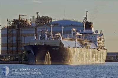
COOL RIDER
Lng Tanker
Current Trip
BRSSA
| Time Travelled | --- |
|---|---|
| Remaining Time | --- |
| Distance Travelled | 15534.32 nm |
| Remaining Distance | --- |
| AVG Speed | 14.5 Knots |
| MAX Speed | 19 Knots |
| AVG Wind | 11.9 knots |
| MAX Wind | 22.8 knots |
| MIN Temp | 22.5°C / 72.5°F |
| MAX Temp | 30.2°C / 86.36°F |
| Draught | 11.4 m |
| Position Received | 3 d ago |
Current Position
| Longitude | -37.64416° |
|---|---|
| Latitude | -13.04143° |
| Status | Under way using engine |
| Speed | 15.3 Knots |
| Course | 116.8° |
| Area | South Atlantic Ocean |
| Station | T-AIS |
| Position Received | 3 d ago |
Info
Information
The current position of COOL RIDER is in South Atlantic Ocean with coordinates -13.04143° / -37.64416° as reported on 2024-05-17 07:53 by AIS to our vessel tracker app. The vessel's current speed is 15.3 Knots
The vessel COOL RIDER (IMO: 9333591, MMSI: 256056000) is a Lng Tanker that was built in 2007 ( 17 years old ). It's sailing under the flag of [MT] Malta.
In this page you can find informations about the vessels current position, last detected port calls, and current voyage information. If the vessels is not in coverage by AIS you will find the latest position.
The current position of COOL RIDER is detected by our AIS receivers and we are not responsible for the reliability of the data. The last position was recorded while the vessel was in Coverage by the Ais receivers of our vessel tracking app.
The current draught of COOL RIDER as reported by AIS is 11.4 meters
Weather
| Temperature | 28.3°C / 82.94°F |
|---|---|
| Wind Speed | 13 knots |
| Direction | 138° SE |
| Pressure | 1016.3 hPa |
| Humidity | 66.4 % |
| Cloud Coverage | 91 % |
Featured Company
Last Port Calls
Most Visited Ports (Last year)
| Port | Arrivals | |
|---|---|---|
| 1 | ||
| 1 | ||
| 1 | ||
| 1 | ||
| 1 | ||
| 1 |
Last Trips
| Origin | Departure | Destination | Arrival | Distance |
|---|
Events
| Time | Event | Details | Position / Dest | Info |
|---|---|---|---|---|
| 2024-05-17 07:59 | Status Changed | Default Under way using engine |
-13.05263 / -37.62147
BRSSA
|
Speed: 15.3 kn Course: 116.8° |
| 2024-05-17 07:53 | OUT of Coverage |
-13.04143 / -37.64416
South Atlantic Ocean
|
Speed: 15.3 kn Course: 116.8° |
|
| 2024-05-17 07:46 | Status Changed | Under way using engine Default |
-13.02651 / -37.67430
BRSSA
|
Speed: 15 kn Course: 116° |
| 2024-05-17 07:29 | Status Changed | Default Under way using engine |
-12.99333 / -37.73833
BRSSA
|
Speed: 14.5 kn Course: 122.7° |
| 2024-05-17 06:55 | Status Changed | Under way using engine Default |
-12.90769 / -37.72195
BRSSA
|
Speed: 16.1 kn Course: 286° |
| 2024-05-17 06:53 | Status Changed | Default Under way using engine |
-12.91014 / -37.71307
BRSSA
|
Speed: 16.1 kn Course: 285.3° |
| 2024-05-17 06:47 | Status Changed | Under way using engine Default |
-12.91738 / -37.68644
BRSSA
|
Speed: 16.1 kn Course: 285° |
| 2024-05-17 06:47 | IN Coverage |
-12.91738 / -37.68644
South Atlantic Ocean
|
Speed: 16.1 kn Course: 285.3° |
|
| 2024-05-16 20:01 | START Moving |
-12.79995 / -37.47964
BRSSA
|
Speed: 6.1 kn Course: 117° |
|
| 2024-05-16 14:53 | STOP Moving |
-12.82667 / -37.41000
BRSSA
|
Speed: Course: -1° |