
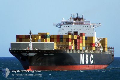
CONTI MAKALU
Not available
Current Trip
| Time Travelled | 6 days |
|---|---|
| Remaining Time | --- |
| Distance Travelled | 1356.27 nm |
| Remaining Distance | 54.13 nm |
| AVG Speed | 10.8 Knots |
| MAX Speed | 16.9 Knots |
| AVG Wind | 11.1 knots |
| MAX Wind | 18.4 knots |
| MIN Temp | 17.6°C / 63.68°F |
| MAX Temp | 28.2°C / 82.76°F |
| Draught | 9 m |
| Position Received | 21 h, 30 m ago |
Current Position
| Longitude | -79.88036° |
|---|---|
| Latitude | 9.44021° |
| Status | Under way using engine |
| Speed | |
| Course | 227° |
| Area | Caribbean Sea |
| Station | T-AIS |
| Position Received | 21 h, 30 m ago |
Info
Information
The current position of CONTI MAKALU is in Caribbean Sea with coordinates 9.44021° / -79.88036° as reported on 2024-04-28 20:55 by AIS to our vessel tracker app. The vessel's current speed is 0 Knots and is heading at the port of BALBOA.
The vessel CONTI MAKALU (MMSI: 636092927) is a Not available It's sailing under the flag of [LR] Liberia.
In this page you can find informations about the vessels current position, last detected port calls, and current voyage information. If the vessels is not in coverage by AIS you will find the latest position.
The current position of CONTI MAKALU is detected by our AIS receivers and we are not responsible for the reliability of the data. The last position was recorded while the vessel was in Coverage by the Ais receivers of our vessel tracking app.
The current draught of CONTI MAKALU as reported by AIS is 9 meters
Weather
| Temperature | 27.3°C / 81.14°F |
|---|---|
| Wind Speed | 8 knots |
| Direction | 26° NNE |
| Pressure | 1010.4 hPa |
| Humidity | 83.5 % |
| Cloud Coverage | 64 % |
Featured Company
Last Trips
| Origin | Departure | Destination | Arrival | Distance | |
|---|---|---|---|---|---|
| 2024-04-20 00:06 | 2024-04-22 03:16 | 399.04 nm | |||
| 2024-04-16 06:51 | 2024-04-19 06:43 | 560.10 nm | |||
| 2024-03-11 07:45 | 2024-04-14 10:11 | 11955.26 nm | |||
| 2024-02-14 15:19 | 2024-03-10 15:34 | 9899.90 nm | |||
| 2024-01-27 07:13 | 2024-02-14 04:16 | 1445.61 nm |
Events
| Time | Event | Details | Position / Dest | Info |
|---|---|---|---|---|
| 2024-04-28 20:55 | Status Changed | Default Under way using engine |
9.44024 / -79.88036
PABLB
|
Speed: Course: 227° |
| 2024-04-28 20:55 | Status Changed | Under way using engine Default |
9.44021 / -79.88036
PABLB
|
Speed: 0.2 kn Course: 233° |
| 2024-04-28 20:55 | OUT of Coverage |
9.44021 / -79.88036
Caribbean Sea
|
Speed: Course: 22° |
|
| 2024-04-28 20:55 | Change Sea Area | Panamanian part of the Caribbean Sea United States part of the Gulf of Mexico |
9.44021 / -79.88036
Caribbean Sea
|
Speed: Course: 22° |
| 2024-04-28 20:42 | IN Coverage |
9.44021 / -79.88036
Caribbean Sea
|
Speed: Course: 22° |
|
| 2024-04-28 20:34 | STOP Moving | 3.91 nm, North West of SAMBA BONITA |
9.43933 / -79.88057
PABLB
|
Speed: 0.2 kn Course: 228° |
| 2024-04-23 14:50 | Status Changed | Default Under way using engine |
27.60979 / -82.80208
PABLB
|
Speed: 12.2 kn Course: 284° |
| 2024-04-23 14:44 | OUT of Coverage |
27.61158 / -82.77743
Gulf of Mexico
|
Speed: 12.2 kn Course: 284° |
|
| 2024-04-23 14:33 | Status Changed | Under way using engine Default |
27.60455 / -82.73677
PABLB
|
Speed: 12.5 kn Course: 261° |
| 2024-04-23 14:30 | Status Changed | Default Under way using engine |
27.60556 / -82.72639
PABLB
|
Speed: 12.4 kn Course: 259° |