

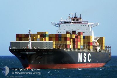
CONTI MAKALU
Container Ship

Current Trip
| Time Travelled | 6 days |
|---|---|
| Remaining Time | --- |
| Distance Travelled | 2860.72 nm |
| Remaining Distance | --- |
| AVG Speed | 17 Knots |
| MAX Speed | 22 Knots |
| AVG Wind | 9.2 knots |
| MAX Wind | 16 knots |
| MIN Temp | 23.3°C / 73.94°F |
| MAX Temp | 28.4°C / 83.12°F |
| Draught | 9.6 m |
| Position Received | 1 m ago |
Current Position
| Longitude | --- |
|---|---|
| Latitude | --- |
| Status | At anchor |
| Speed | |
| Course | 298° |
| Area | Singapore Strait |
| Station | T-AIS |
| Position Received | 1 m ago |
Information
The current position of CONTI MAKALU is in Singapore Strait with coordinates 1.30218° / 104.07230° as reported on 2025-02-19 23:56 by AIS to our vessel tracker app. The vessel's current speed is 0 Knots
The vessel CONTI MAKALU (IMO: 9286243, MMSI: 636092927) is a Container Ship that was built in 2004 ( 21 years old ). It's sailing under the flag of [LR] Liberia.
In this page you can find informations about the vessels current position, last detected port calls, and current voyage information. If the vessels is not in coverage by AIS you will find the latest position.
The current position of CONTI MAKALU is detected by our AIS receivers and we are not responsible for the reliability of the data. The last position was recorded while the vessel was in Coverage by the Ais receivers of our vessel tracking app.
The current draught of CONTI MAKALU as reported by AIS is 9.6 meters
Weather
| Temperature | 26°C / 78.8°F |
|---|---|
| Wind Speed | 11 knots |
| Direction | 14° NNE |
| Pressure | 1010.7 hPa |
| Humidity | 86 % |
| Cloud Coverage | 97 % |


Featured Company
Last Port Calls
| Port | Arrival | Departure | Time In Port |
|---|---|---|---|
| 2025-02-12 09:45 | 2025-02-13 07:21 | 21 h | |
| 2025-01-29 10:43 | 2025-01-30 10:45 | 1 d | |
| 2025-01-14 10:31 | 2025-01-14 11:25 | 53 m | |
| 2025-01-12 18:20 | 2025-01-13 17:48 | 23 h | |
| 2025-01-09 14:32 | 2025-01-10 16:02 | 1 d | |
| 2025-01-03 10:59 | 2025-01-04 04:40 | 17 h | |
| 2025-01-01 19:25 | 2025-01-02 17:29 | 22 h | |
| 2024-12-29 10:08 | 2024-12-30 12:03 | 1 d |
Last Trips
| Origin | Departure | Destination | Arrival | Distance | |
|---|---|---|---|---|---|
| 2025-01-30 12:45 | 2025-02-12 15:15 | 5241.36 nm | |||
| 2025-01-14 08:25 | 2025-01-29 12:43 | 4613.62 nm | |||
| 2025-01-13 14:48 | 2025-01-14 07:31 | 217.36 nm | |||
| 2025-01-10 13:02 | 2025-01-12 15:20 | 822.82 nm | |||
| 2025-01-04 01:40 | 2025-01-09 11:32 | 822.99 nm | |||
| 2025-01-02 14:29 | 2025-01-03 07:59 | 219.63 nm | |||
| 2024-12-30 09:03 | 2025-01-01 16:25 | 170.96 nm | |||
| 2024-11-15 08:14 | 2024-12-29 07:08 | 8327.92 nm |
Events
| Time | Event | Details | Position / Dest | Info |
|---|---|---|---|---|
| 2025-02-19 23:47 | Status Changed | At anchor Default |
1.30212 / 104.07215
SGSIN AEBA<>CNTAO
|
Speed: 0.1 kn Course: 293° |
| 2025-02-19 23:44 | Status Changed | Default At anchor |
1.30212 / 104.07225
SGSIN AEBA<>CNTAO
|
Speed: 0.1 kn Course: 289° |
| 2025-02-19 19:49 | ETA Changed | 2025/02/26 14:00 2025/02/27 14:00 |
1.30221 / 104.07161
SGSIN AEBA<>CNTAO
|
Speed: 0.1 kn Course: 19° |
| 2025-02-19 19:43 | Draught Changed | 9.6 9.3 |
1.30218 / 104.07157
SGSIN AEBA<>CNTAO
|
Speed: Course: 23° |
| 2025-02-19 19:06 | Status Changed | At anchor Default |
1.30217 / 104.07160
SGSIN AEBA<>CNTAO
|
Speed: Course: 43° |
| 2025-02-19 19:03 | Status Changed | Default At anchor |
1.30216 / 104.07157
SGSIN AEBA<>CNTAO
|
Speed: 0.1 kn Course: 44° |
| 2025-02-19 17:45 | Status Changed | At anchor Default |
1.30235 / 104.07145
SGSIN AEBA<>CNTAO
|
Speed: Course: 59° |
| 2025-02-19 17:39 | Status Changed | Default At anchor |
1.30234 / 104.07147
SGSIN AEBA<>CNTAO
|
Speed: Course: 59° |
| 2025-02-19 17:27 | Status Changed | At anchor Default |
1.30229 / 104.07146
SGSIN AEBA<>CNTAO
|
Speed: Course: 62° |
| 2025-02-19 17:21 | Status Changed | Default At anchor |
1.30234 / 104.07153
SGSIN AEBA<>CNTAO
|
Speed: Course: 62° |