
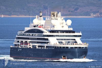
COMMANDANT CHARCOT
Passenger
Current Trip
| Time Travelled | 1 day |
|---|---|
| Remaining Time | 12 h, 55 mins |
| Distance Travelled | 652.24 nm |
| Remaining Distance | 236.63 nm |
| AVG Speed | 14.4 Knots |
| MAX Speed | 16.8 Knots |
| AVG Wind | 26.7 knots |
| MAX Wind | 46.5 knots |
| MIN Temp | -10.9°C / 12.38°F |
| MAX Temp | 0.7°C / 33.26°F |
| Draught | 10 m |
| Position Received | 5 d ago |
Current Position
| Longitude | --- |
|---|---|
| Latitude | --- |
| Status | Under way using engine |
| Speed | 10.2 Knots |
| Course | 55.8° |
| Area | Gulf of St-Lawrence |
| Station | T-AIS |
| Position Received | 5 d ago |
Info
Information
The current position of COMMANDANT CHARCOT is in Gulf of St-Lawrence with coordinates 48.62638° / -68.58073° as reported on 2025-02-11 18:53 by AIS to our vessel tracker app. The vessel's current speed is 10.2 Knots and is heading at the port of SEPT-ILES. The estimated time of arrival as calculated by MyShipTracking vessel tracking app is 2025-02-18 00:22 LT
The vessel COMMANDANT CHARCOT (IMO: 9846249, MMSI: 578001700) is a Passenger It's sailing under the flag of [WF] Wallis Futuna Is.
In this page you can find informations about the vessels current position, last detected port calls, and current voyage information. If the vessels is not in coverage by AIS you will find the latest position.
The current position of COMMANDANT CHARCOT is detected by our AIS receivers and we are not responsible for the reliability of the data. The last position was recorded while the vessel was in Coverage by the Ais receivers of our vessel tracking app.
The current draught of COMMANDANT CHARCOT as reported by AIS is 10 meters
Weather
| Temperature | -2.3°C / 27.86°F |
|---|---|
| Wind Speed | 29 knots |
| Direction | 200° SSW |
| Pressure | 967.5 hPa |
| Humidity | 88.9 % |
| Cloud Coverage | 100 % |
Featured Company
Last Port Calls
| Port | Arrival | Departure | Time In Port |
|---|---|---|---|
| 2025-02-14 07:24 | 2025-02-15 13:35 | 1 d | |
| 2025-02-12 07:11 | 2025-02-13 13:03 | 1 d | |
| 2025-02-10 16:39 | 2025-02-11 00:55 | 8 h | |
| 2025-02-05 12:03 | 2025-02-07 12:44 | 2 d | |
| 2025-02-03 11:35 | 2025-02-04 13:11 | 1 d | |
| 2025-01-28 11:31 | 2025-01-30 18:13 | 2 d | |
| 2025-01-25 23:25 | 2025-01-27 13:03 | 1 d | |
| 2025-01-23 11:23 | 2025-01-24 12:35 | 1 d | |
| 2025-01-21 13:16 | 2025-01-22 12:21 | 23 h | |
| 2025-01-05 06:24 | 2025-01-05 17:23 | 10 h |
Last Trips
| Origin | Departure | Destination | Arrival | Distance | |
|---|---|---|---|---|---|
| 2025-02-13 13:03 | 2025-02-14 07:24 | 150.69 nm | |||
| 2025-02-11 00:55 | 2025-02-12 07:11 | 293.40 nm | |||
| 2025-02-07 12:44 | 2025-02-10 16:39 | 1087.21 nm | |||
| 2025-02-04 13:11 | 2025-02-05 12:03 | 166.50 nm | |||
| 2025-01-30 18:13 | 2025-02-03 11:35 | 410.78 nm | |||
| 2025-01-27 13:03 | 2025-01-28 11:31 | 162.03 nm | |||
| 2025-01-24 12:35 | 2025-01-25 23:25 | 251.53 nm | |||
| 2025-01-22 12:21 | 2025-01-23 11:23 | 158.20 nm | |||
| 2025-01-05 17:23 | 2025-01-21 13:16 | 3902.85 nm | |||
| 2025-01-04 11:56 | 2025-01-05 06:24 | 247.73 nm |
Events
| Time | Event | Details | Position / Dest | Info |
|---|---|---|---|---|
| 2025-02-15 18:35 | START Moving | 0.32 nm, North East of GASPE |
48.82906 / -64.43464
CA SEI
|
Speed: 5.3 kn Course: 349° |
| 2025-02-15 18:35 | PORT DEPARTURE |
|
48.82906 / -64.43464
CA SEI
|
Speed: 1.2 kn Course: 245° |
| 2025-02-14 12:24 | STOP Moving |
48.82626 / -64.43915
[CA] GASPE
|
Speed: 0.1 kn Course: 278° |
|
| 2025-02-14 12:24 | PORT ARRIVAL |
|
48.82626 / -64.43915
[CA] GASPE
|
Speed: 1.7 kn Course: 263° |
| 2025-02-13 18:03 | START Moving | 0.46 nm, South of SEPT-ILES |
50.19381 / -66.38764
CA SEI
|
Speed: 3.7 kn Course: 193° |
| 2025-02-13 18:03 | PORT DEPARTURE |
|
50.19381 / -66.38764
CA SEI
|
Speed: 2.1 kn Course: 310° |
| 2025-02-12 12:15 | STOP Moving |
50.19709 / -66.38282
[CA] SEPT-ILES
|
Speed: 0.3 kn Course: 85° |
|
| 2025-02-12 12:11 | PORT ARRIVAL |
|
50.19697 / -66.38414
[CA] SEPT-ILES
|
Speed: 2 kn Course: 55° |
| 2025-02-11 19:01 | Status Changed | Default Under way using engine |
48.63790 / -68.55434
CA SEI
|
Speed: 10.2 kn Course: 55.8° |
| 2025-02-11 18:53 | OUT of Coverage |
48.62638 / -68.58073
Gulf of St-Lawrence
CA SEI
|
Speed: 10.2 kn Course: 55.8° |