
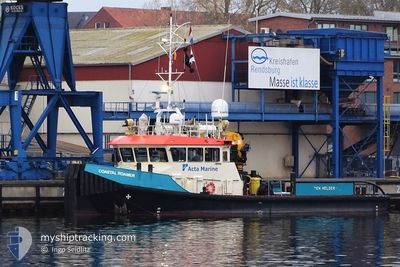
COASTAL ROAMER
Tug
Current Trip
NMDC
| Time Travelled | --- |
|---|---|
| Remaining Time | --- |
| Distance Travelled | 1031.89 nm |
| Remaining Distance | --- |
| AVG Speed | 7 Knots |
| MAX Speed | 21.7 Knots |
| AVG Wind | 10 knots |
| MAX Wind | 24 knots |
| MIN Temp | 18.3°C / 64.94°F |
| MAX Temp | 26.8°C / 80.24°F |
| Draught | 1.5 m |
| Position Received | 27 m ago |
Current Position
| Longitude | --- |
|---|---|
| Latitude | --- |
| Status | Restricted manoeuverability |
| Speed | |
| Course | 177° |
| Area | Persian Gulf |
| Station | T-AIS |
| Position Received | 27 m ago |
Info
Information
The current position of COASTAL ROAMER is in Persian Gulf with coordinates 24.66856° / 54.51665° as reported on 2024-12-02 11:32 by AIS to our vessel tracker app. The vessel's current speed is 0 Knots
The vessel COASTAL ROAMER (IMO: 9688893, MMSI: 244824000) is a Tug that was built in 2014 ( 10 years old ). It's sailing under the flag of [NL] Netherlands.
In this page you can find informations about the vessels current position, last detected port calls, and current voyage information. If the vessels is not in coverage by AIS you will find the latest position.
The current position of COASTAL ROAMER is detected by our AIS receivers and we are not responsible for the reliability of the data. The last position was recorded while the vessel was in Coverage by the Ais receivers of our vessel tracking app.
The current draught of COASTAL ROAMER as reported by AIS is 1.5 meters
Weather
| Temperature | 23.6°C / 74.48°F |
|---|---|
| Wind Speed | 13 knots |
| Direction | 319° NW |
| Pressure | 1013.6 hPa |
| Humidity | 55.5 % |
| Cloud Coverage | --- |
Featured Company
Last Port Calls
Most Visited Ports (Last year)
| Port | Arrivals | |
|---|---|---|
| 1 |
Last Trips
| Origin | Departure | Destination | Arrival | Distance |
|---|
Events
| Time | Event | Details | Position / Dest | Info |
|---|---|---|---|---|
| 2024-12-02 11:34 | Status Changed | Default Restricted manoeuverability |
24.66857 / 54.51664
NMDC
|
Speed: Course: 177° |
| 2024-12-02 11:32 | Status Changed | Restricted manoeuverability Default |
24.66856 / 54.51665
NMDC
|
Speed: 0.1 kn Course: 181° |
| 2024-12-02 11:17 | Status Changed | Default Restricted manoeuverability |
24.66848 / 54.51652
NMDC
|
Speed: 0.3 kn Course: 216° |
| 2024-12-02 11:09 | STOP Moving | 11.73 nm, South West of KHALIFA |
24.66866 / 54.51633
NMDC
|
Speed: 0.3 kn Course: 235° |
| 2024-12-02 10:57 | START Moving | 11.09 nm, South West of KHALIFA |
24.68886 / 54.51191
NMDC
|
Speed: 7.9 kn Course: 152.5° |
| 2024-12-02 10:43 | STOP Moving | 10.98 nm, South West of KHALIFA |
24.69177 / 54.51205
NMDC
|
Speed: 0.1 kn Course: 151° |
| 2024-12-02 10:16 | START Moving | 7.93 nm, South West of KHALIFA |
24.71855 / 54.56050
NMDC
|
Speed: 8 kn Course: 225.1° |
| 2024-12-02 09:14 | STOP Moving | 7.79 nm, South West of KHALIFA |
24.72016 / 54.56233
NMDC
|
Speed: 0.2 kn Course: 40° |
| 2024-12-02 09:06 | START Moving | 7.53 nm, South West of KHALIFA |
24.72780 / 54.56130
NMDC
|
Speed: 8 kn Course: 249.4° |
| 2024-12-02 08:45 | STOP Moving | 7.43 nm, South West of KHALIFA |
24.72824 / 54.56324
NMDC
|
Speed: 0.3 kn Course: 276° |