
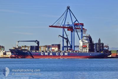
CMACGM FORT ST MARIE
Container Ship
Current Trip
| Trip Time | 1 day |
|---|---|
| Trip Distance | 562.66 nm |
| AVG Speed | 17.4 Knots |
| MAX Speed | 19 Knots |
| Draught | 9.8 m |
| AVG Wind | 16.4 knots |
| MAX Wind | 27.9 knots |
| MIN Temp | 3.6°C / 38.48°F |
| MAX Temp | 17.8°C / 64.04°F |
| Position Received | 1 d ago |
Current Position
| Longitude | --- |
|---|---|
| Latitude | --- |
| Status | Under way using engine |
| Speed | 18.6 Knots |
| Course | 157.3° |
| Area | Mediterranean Sea - Eastern Basin |
| Station | T-AIS |
| Position Received | 1 d ago |
Info
Information
The current position of CMACGM FORT ST MARIE is in Mediterranean Sea - Eastern Basin with coordinates 35.12016° / 27.76463° as reported on 2024-11-25 16:45 by AIS to our vessel tracker app. The vessel's current speed is 18.6 Knots and is currently inside the port of ALEXANDRIA.
The vessel CMACGM FORT ST MARIE (IMO: 9261906, MMSI: 215396000) is a Container Ship that was built in 2003 ( 21 years old ). It's sailing under the flag of [MT] Malta.
In this page you can find informations about the vessels current position, last detected port calls, and current voyage information. If the vessels is not in coverage by AIS you will find the latest position.
The current position of CMACGM FORT ST MARIE is detected by our AIS receivers and we are not responsible for the reliability of the data. The last position was recorded while the vessel was in Coverage by the Ais receivers of our vessel tracking app.
The current draught of CMACGM FORT ST MARIE as reported by AIS is 9.8 meters
Weather
| Temperature | 17.9°C / 64.22°F |
|---|---|
| Wind Speed | 13 knots |
| Direction | 313° NW |
| Pressure | 1021.5 hPa |
| Humidity | 63.8 % |
| Cloud Coverage | 100 % |
Featured Company
Last Port Calls
| Port | Arrival | Departure | Time In Port |
|---|---|---|---|
| 2024-11-27 00:14 | |||
| 2024-11-24 14:49 | 2024-11-25 03:36 | 12 h | |
| 2024-11-20 23:07 | 2024-11-23 00:48 | 2 d | |
| 2024-11-16 14:15 | 2024-11-18 04:58 | 1 d | |
| 2024-10-30 17:11 | 2024-11-13 23:52 | 14 d | |
| 2024-10-10 22:04 | 2024-10-12 02:44 | 1 d | |
| 2024-10-05 00:01 | 2024-10-05 19:31 | 19 h | |
| 2024-10-04 06:20 | |||
| 2024-09-30 23:44 | 2024-10-02 06:20 | 1 d | |
| 2024-09-16 17:30 | 2024-09-26 22:19 | 10 d |
Most Visited Ports (Last year)
| Port | Arrivals | |
|---|---|---|
| 11 | ||
| 7 | ||
| 5 | ||
| 4 | ||
| 4 | ||
| 4 |
Last Trips
| Origin | Departure | Destination | Arrival | Distance | |
|---|---|---|---|---|---|
| 2024-11-25 03:36 | 2024-11-27 00:14 | 562.66 nm | |||
| 2024-11-23 00:48 | 2024-11-24 14:49 | 622.64 nm | |||
| 2024-11-18 04:58 | 2024-11-20 23:07 | 1019.90 nm | |||
| 2024-11-13 23:52 | 2024-11-16 14:15 | 638.85 nm | |||
| 2024-10-12 02:44 | 2024-10-30 17:11 | 1048.09 nm | |||
| 2024-10-05 19:31 | 2024-10-10 22:04 | 946.59 nm | |||
| 2024-10-04 06:20 | 2024-10-05 00:01 | 288.30 nm | |||
| 2024-09-26 22:19 | 2024-09-30 23:44 | 1409.35 nm | |||
| 2024-09-02 15:20 | 2024-09-16 17:30 | 781.27 nm | |||
| 2024-09-01 06:32 | 2024-09-02 05:39 | 346.15 nm |
Events
| Time | Event | Details | Position / Dest | Info |
|---|---|---|---|---|
| 2024-11-26 22:47 | STOP Moving |
31.18562 / 29.86794
[EG] ALEXANDRIA
|
Speed: Course: 37° |
|
| 2024-11-26 22:14 | PORT ARRIVAL |
|
31.16276 / 29.84671
[EG] ALEXANDRIA
|
Speed: 9.3 kn Course: 79° |
| 2024-11-26 20:21 | START Moving | 3.94 nm, North West of EL DEKHEILA |
31.19947 / 29.76066
TRALI > EGALY
|
Speed: 3.5 kn Course: 152° |
| 2024-11-26 11:05 | STOP Moving | 4.08 nm, North West of EL DEKHEILA |
31.20003 / 29.75725
TRALI > EGALY
|
Speed: 0.3 kn Course: 43° |
| 2024-11-26 10:43 | START Moving | 4.07 nm, North West of EL DEKHEILA |
31.20180 / 29.76016
TRALI > EGALY
|
Speed: 3.4 kn Course: 169° |
| 2024-11-26 07:39 | STOP Moving | 4 nm, North West of EL DEKHEILA |
31.19890 / 29.75791
TRALI > EGALY
|
Speed: Course: 6° |
| 2024-11-25 16:57 | Status Changed | Default Under way using engine |
35.06232 / 27.79541
TRALI > EGALY
|
Speed: 18.6 kn Course: 157.3° |
| 2024-11-25 16:45 | OUT of Coverage |
35.12016 / 27.76463
Mediterranean Sea - Eastern Basin
TRALI > EGALY
|
Speed: 18.6 kn Course: 157.3° |
|
| 2024-11-25 14:40 | Change Sea Area | Greek part of the Mediterranean Sea - Eastern Basin Greek part of the Aegean Sea |
35.71525 / 27.44147
Mediterranean Sea - Eastern Basin
TRALI > EGALY
|
Speed: 18.9 kn Course: 158.5° |
| 2024-11-25 13:40 | Status Changed | Under way using engine Default |
35.99770 / 27.29119
TRALI > EGALY
|
Speed: 18 kn Course: 144° |