
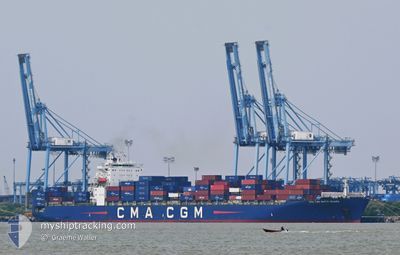
CMA CGM WHITE SHARK
Container Ship
Current Trip
| Time Travelled | 20 h, 39 mins |
|---|---|
| Remaining Time | 8 h, 46 mins |
| Distance Travelled | 299.32 nm |
| Remaining Distance | 382.71 nm |
| AVG Speed | 15.3 Knots |
| MAX Speed | 21.3 Knots |
| AVG Wind | 17.9 knots |
| MAX Wind | 20.5 knots |
| MIN Temp | 6.9°C / 44.42°F |
| MAX Temp | 10.3°C / 50.54°F |
| Draught | 11 m |
| Position Received | 9 d ago |
Current Position
| Longitude | --- |
|---|---|
| Latitude | --- |
| Status | Under way using engine |
| Speed | 10.9 Knots |
| Course | 179.5° |
| Area | Japan Sea |
| Station | T-AIS |
| Position Received | 9 d ago |
Info
Information
The current position of CMA CGM WHITE SHARK is in Japan Sea with coordinates 34.74143° / 128.85169° as reported on 2025-02-25 13:12 by AIS to our vessel tracker app. The vessel's current speed is 10.9 Knots and is heading at the port of BUSAN. The estimated time of arrival as calculated by MyShipTracking vessel tracking app is 2025-03-07 13:02 LT
The vessel CMA CGM WHITE SHARK (IMO: 9317975, MMSI: 215230000) is a Container Ship that was built in 2007 ( 18 years old ). It's sailing under the flag of [MT] Malta.
In this page you can find informations about the vessels current position, last detected port calls, and current voyage information. If the vessels is not in coverage by AIS you will find the latest position.
The current position of CMA CGM WHITE SHARK is detected by our AIS receivers and we are not responsible for the reliability of the data. The last position was recorded while the vessel was in Coverage by the Ais receivers of our vessel tracking app.
The current draught of CMA CGM WHITE SHARK as reported by AIS is 11 meters
Weather
| Temperature | 10°C / 50°F |
|---|---|
| Wind Speed | 14 knots |
| Direction | 81° E |
| Pressure | 1027.9 hPa |
| Humidity | 60.6 % |
| Cloud Coverage | 100 % |
Featured Company
Last Port Calls
| Port | Arrival | Departure | Time In Port |
|---|---|---|---|
| 2025-03-05 19:20 | 2025-03-06 07:37 | 12 h | |
| 2025-03-03 15:34 | 2025-03-04 12:45 | 21 h | |
| 2025-02-25 21:13 | 2025-02-26 10:35 | 13 h | |
| 2025-02-25 01:05 | 2025-02-25 11:22 | 10 h | |
| 2025-02-14 15:07 | 2025-02-17 05:47 | 2 d | |
| 2025-02-08 00:01 | 2025-02-09 02:29 | 1 d | |
| 2025-01-31 22:52 | 2025-02-01 12:10 | 13 h | |
| 2025-01-28 13:24 | 2025-01-30 03:37 | 1 d | |
| 2025-01-15 18:44 | 2025-01-16 07:05 | 12 h | |
| 2025-01-13 11:25 | 2025-01-14 14:25 | 1 d |
Last Trips
| Origin | Departure | Destination | Arrival | Distance | |
|---|---|---|---|---|---|
| 2025-03-04 20:45 | 2025-03-06 03:20 | 251.59 nm | |||
| 2025-02-26 19:35 | 2025-03-03 23:34 | 776.63 nm | |||
| 2025-02-25 20:22 | 2025-02-26 06:13 | 102.42 nm | |||
| 2025-02-16 20:47 | 2025-02-25 10:05 | 2971.33 nm | |||
| 2025-02-08 16:29 | 2025-02-14 06:07 | 2285.28 nm | |||
| 2025-02-01 04:10 | 2025-02-07 14:01 | 2272.09 nm | |||
| 2025-01-29 19:37 | 2025-01-31 14:52 | 405.18 nm | |||
| 2025-01-16 15:05 | 2025-01-28 05:24 | 5813.89 nm | |||
| 2025-01-14 22:25 | 2025-01-16 02:44 | 258.96 nm | |||
| 2025-01-11 14:37 | 2025-01-13 19:25 | 540.21 nm |
Events
| Time | Event | Details | Position / Dest | Info |
|---|---|---|---|---|
| 2025-03-06 07:38 | START Moving | 0.72 nm, North West of SHANGHAI |
31.37345 / 121.59496
KRPUS
|
Speed: 7.1 kn Course: -1° |
| 2025-03-06 07:37 | PORT DEPARTURE |
|
31.37345 / 121.59496
KRPUS
|
Speed: 0.7 kn Course: 112° |
| 2025-03-05 19:20 | PORT ARRIVAL |
|
31.37353 / 121.58389
[CN] SHANGHAI
|
Speed: 0.8 kn Course: 116° |
| 2025-03-05 18:37 | STOP Moving | 1.21 nm, North West of SHANGHAI |
31.37739 / 121.58607
KRPUS
|
Speed: 0.2 kn Course: 102° |
| 2025-03-05 07:23 | START Moving |
30.87644 / 123.33643
KRPUS
|
Speed: 4.5 kn Course: 55° |
|
| 2025-03-05 03:48 | STOP Moving |
30.93401 / 123.34344
KRPUS
|
Speed: Course: 86° |
|
| 2025-03-04 12:54 | START Moving | 1.05 nm, East of NINGBO |
29.94254 / 121.86672
KRPUS
|
Speed: 5 kn Course: 68° |
| 2025-03-04 12:45 | PORT DEPARTURE |
|
29.94184 / 121.86017
KRPUS
|
Speed: 1.2 kn Course: 123° |
| 2025-03-03 15:34 | STOP Moving |
29.93890 / 121.85965
[CN] NINGBO
|
Speed: Course: 112° |
|
| 2025-03-03 15:34 | PORT ARRIVAL |
|
29.93890 / 121.85965
[CN] NINGBO
|
Speed: 1 kn Course: 112° |