
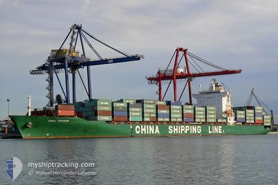
CMA CGM CHIWAN
Container Ship
Current Trip
| Time Travelled | 17 h, 42 mins |
|---|---|
| Remaining Time | --- |
| Distance Travelled | 297.46 nm |
| Remaining Distance | --- |
| AVG Speed | 40.7 Knots |
| MAX Speed | 40.7 Knots |
| AVG Wind | 6.6 knots |
| MAX Wind | 18.2 knots |
| MIN Temp | 19.9°C / 67.82°F |
| MAX Temp | 21.9°C / 71.42°F |
| Draught | 10.4 m |
| Position Received | 7 h, 54 m ago |
Current Position
| Longitude | 32.18227° |
|---|---|
| Latitude | 34.14251° |
| Status | Under way using engine |
| Speed | 17 Knots |
| Course | 275.6° |
| Area | Mediterranean Sea - Eastern Basin |
| Station | T-AIS |
| Position Received | 7 h, 54 m ago |
Info
Information
The current position of CMA CGM CHIWAN is in Mediterranean Sea - Eastern Basin with coordinates 34.14251° / 32.18227° as reported on 2024-05-27 04:26 by AIS to our vessel tracker app. The vessel's current speed is 17 Knots and is heading at the port of TANGER MED. The estimated time of arrival as calculated by MyShipTracking vessel tracking app is 2024-05-31 21:00 LT
The vessel CMA CGM CHIWAN (IMO: 9224312, MMSI: 311001150) is a Container Ship that was built in 2001 ( 23 years old ). It's sailing under the flag of [BS] Bahamas.
In this page you can find informations about the vessels current position, last detected port calls, and current voyage information. If the vessels is not in coverage by AIS you will find the latest position.
The current position of CMA CGM CHIWAN is detected by our AIS receivers and we are not responsible for the reliability of the data. The last position was recorded while the vessel was in Coverage by the Ais receivers of our vessel tracking app.
The current draught of CMA CGM CHIWAN as reported by AIS is 10.4 meters
Weather
| Temperature | 20.7°C / 69.26°F |
|---|---|
| Wind Speed | 12 knots |
| Direction | 303° WNW |
| Pressure | 1010.4 hPa |
| Humidity | 86.4 % |
| Cloud Coverage | --- |
Featured Company
Last Port Calls
| Port | Arrival | Departure | Time In Port |
|---|---|---|---|
| 2024-05-26 07:19 | 2024-05-26 18:39 | 11 h | |
| 2024-05-24 20:52 | 2024-05-25 18:52 | 22 h | |
| 2024-05-23 01:59 | 2024-05-24 06:15 | 1 d | |
| 2024-05-21 09:24 | 2024-05-22 00:55 | 15 h | |
| 2024-05-16 05:10 | 2024-05-18 02:04 | 1 d | |
| 2024-05-12 11:11 | 2024-05-13 05:20 | 18 h | |
| 2024-05-09 12:20 | 2024-05-10 10:08 | 21 h | |
| 2024-05-03 19:02 | 2024-05-04 07:33 | 12 h | |
| 2024-04-15 18:43 | 2024-04-17 23:57 | 2 d | |
| 2024-04-02 05:41 | 2024-04-03 02:25 | 20 h |
Most Visited Ports (Last year)
| Port | Arrivals | |
|---|---|---|
| 11 | ||
| 10 | ||
| 6 | ||
| 6 | ||
| 2 | ||
| 1 |
Last Trips
| Origin | Departure | Destination | Arrival | Distance | |
|---|---|---|---|---|---|
| 2024-05-25 21:52 | 2024-05-26 10:19 | 199.20 nm | |||
| 2024-05-24 09:15 | 2024-05-24 23:52 | 88.10 nm | |||
| 2024-05-22 02:55 | 2024-05-23 04:59 | 441.35 nm | |||
| 2024-05-18 04:04 | 2024-05-21 11:24 | 840.19 nm | |||
| 2024-05-13 08:20 | 2024-05-16 07:10 | 686.95 nm | |||
| 2024-05-10 12:08 | 2024-05-12 14:11 | 690.64 nm | |||
| 2024-05-04 08:33 | 2024-05-09 14:20 | 1173.38 nm | |||
| 2024-04-18 00:57 | 2024-05-03 20:02 | 3236.89 nm | |||
| 2024-04-03 02:25 | 2024-04-15 19:43 | 3205.39 nm | |||
| 2024-03-15 09:33 | 2024-04-02 05:41 | 3619.44 nm |
Events
| Time | Event | Details | Position / Dest | Info |
|---|---|---|---|---|
| 2024-05-27 04:26 | OUT of Coverage |
34.14251 / 32.18227
Mediterranean Sea - Eastern Basin
LBBEY=>MAPTM
|
Speed: 17 kn Course: 275.6° |
|
| 2024-05-27 03:14 | Change Sea Area | Cypriote part of the Mediterranean Sea - Eastern Basin Lebanese part of the Mediterranean Sea - Eastern Basin |
34.11122 / 32.58817
Mediterranean Sea - Eastern Basin
LBBEY=>MAPTM
|
Speed: 16.7 kn Course: 274.4° |
| 2024-05-27 03:12 | IN Coverage |
34.11122 / 32.58817
Mediterranean Sea - Eastern Basin
LBBEY=>MAPTM
|
Speed: 16.7 kn Course: 274.4° |
|
| 2024-05-27 00:42 | OUT of Coverage |
33.81677 / 35.48964
Mediterranean Sea - Eastern Basin
LBBEY=>MAPTM
|
Speed: 38.8 kn Course: 212.7° |
|
| 2024-05-26 22:59 | STOP Moving | 6.14 nm, South of BEIRUT |
33.81827 / 35.49081
LBBEY=>MAPTM
|
Speed: Course: 272° |
| 2024-05-26 22:55 | START Moving | 6.17 nm, South of BEIRUT |
33.81696 / 35.49323
LBBEY=>MAPTM
|
Speed: 69.6 kn Course: 122.8° |
| 2024-05-26 21:31 | STOP Moving | 6.13 nm, South of BEIRUT |
33.81839 / 35.49123
LBBEY=>MAPTM
|
Speed: 0.1 kn Course: 274° |
| 2024-05-26 21:26 | START Moving | 6.11 nm, South of BEIRUT |
33.81802 / 35.49343
LBBEY=>MAPTM
|
Speed: 58.1 kn Course: 95.7° |
| 2024-05-26 21:25 | STOP Moving | 6.14 nm, South of BEIRUT |
33.81824 / 35.49079
LBBEY=>MAPTM
|
Speed: Course: 274° |
| 2024-05-26 21:23 | START Moving | 6.13 nm, South of BEIRUT |
33.81742 / 35.49416
LBBEY=>MAPTM
|
Speed: 77.4 kn Course: 106.2° |