
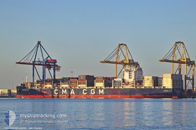
CMA CGM BOLDNESS
Cargo D
Current Trip
| Time Travelled | 9 h, 18 mins |
|---|---|
| Remaining Time | 1 day |
| Distance Travelled | 110.47 nm |
| Remaining Distance | 303.07 nm |
| AVG Speed | 11.9 Knots |
| MAX Speed | 13.1 Knots |
| AVG Wind | 6.6 knots |
| MAX Wind | 11.2 knots |
| MIN Temp | 13.9°C / 57.02°F |
| MAX Temp | 15.9°C / 60.62°F |
| Draught | 12.9 m |
| Position Received | 1 m ago |
Current Position
| Longitude | --- |
|---|---|
| Latitude | --- |
| Status | Under way using engine |
| Speed | 11.9 Knots |
| Course | 207.2° |
| Area | Mediterranean Sea - Western Basin |
| Station | T-AIS |
| Position Received | 1 m ago |
Info
Information
The current position of CMA CGM BOLDNESS is in Mediterranean Sea - Western Basin with coordinates 37.95257° / -0.23017° as reported on 2025-12-12 05:29 by AIS to our vessel tracker app. The vessel's current speed is 11.9 Knots and is heading at the port of TANGER MED. The estimated time of arrival as calculated by MyShipTracking vessel tracking app is 2025-12-13 08:05 LT
The vessel CMA CGM BOLDNESS (IMO: 9948243, MMSI: 256744000) is a Cargo D It's sailing under the flag of [MT] Malta.
In this page you can find informations about the vessels current position, last detected port calls, and current voyage information. If the vessels is not in coverage by AIS you will find the latest position.
The current position of CMA CGM BOLDNESS is detected by our AIS receivers and we are not responsible for the reliability of the data. The last position was recorded while the vessel was in Coverage by the Ais receivers of our vessel tracking app.
The current draught of CMA CGM BOLDNESS as reported by AIS is 12.9 meters
Weather
| Temperature | 15.9°C / 60.62°F |
|---|---|
| Wind Speed | 10 knots |
| Direction | 26° NNE |
| Pressure | 1018.9 hPa |
| Humidity | 80.7 % |
| Cloud Coverage | 66 % |
Featured Company
Last Port Calls
| Port | Arrival | Departure | Time In Port |
|---|---|---|---|
| 2025-12-10 19:01 | 2025-12-11 21:13 | 1 d | |
| 2025-12-08 05:18 | 2025-12-09 00:41 | 19 h | |
| 2025-12-07 06:56 | 2025-12-07 15:21 | 8 h | |
| 2025-12-05 07:09 | 2025-12-06 16:52 | 1 d | |
| 2025-12-03 15:48 | 2025-12-05 01:17 | 1 d | |
| 2025-11-29 21:23 | 2025-11-30 23:22 | 1 d | |
| 2025-11-26 01:08 | 2025-11-27 08:50 | 1 d | |
| 2025-11-15 02:26 | 2025-11-16 09:15 | 1 d | |
| 2025-11-07 07:53 | 2025-11-09 03:57 | 1 d | |
| 2025-11-05 13:31 | 2025-11-06 00:25 | 10 h |
Last Trips
| Origin | Departure | Destination | Arrival | Distance | |
|---|---|---|---|---|---|
| 2025-12-09 00:41 | 2025-12-10 19:01 | 216.56 nm | |||
| 2025-12-07 15:21 | 2025-12-08 05:18 | 195.91 nm | |||
| 2025-12-06 16:52 | 2025-12-07 06:56 | 261.73 nm | |||
| 2025-12-05 01:17 | 2025-12-05 07:09 | 88.43 nm | |||
| 2025-11-30 23:22 | 2025-12-03 15:48 | 652.50 nm | |||
| 2025-11-27 08:50 | 2025-11-29 21:23 | 1035.61 nm | |||
| 2025-11-16 09:15 | 2025-11-26 01:08 | 4224.46 nm | |||
| 2025-11-09 03:57 | 2025-11-15 02:26 | 1512.46 nm | |||
| 2025-11-06 00:25 | 2025-11-07 07:53 | 228.98 nm | |||
| 2025-11-03 16:56 | 2025-11-05 13:31 | 675.99 nm |
Events
| Time | Event | Details | Position / Dest | Info |
|---|---|---|---|---|
| 2025-12-12 03:42 | ETA Changed | 2025/12/13 06:00 2025/12/10 17:00 |
38.25733 / -.02243
MAPTM
|
Speed: 11.5 kn Course: 210.8° |
| 2025-12-12 03:41 | Detected in Sea | Spanish part of the Mediterranean Sea - Western Basin |
38.26149 / -.01928
Mediterranean Sea - Western Basin
|
Speed: 11.5 kn Course: 210.8° |
| 2025-12-12 03:38 | Status Changed | Under way using engine Default |
38.26840 / -.01406
MAPTM
|
Speed: 11.7 kn Course: 210° |
| 2025-12-12 03:38 | IN Coverage |
38.26149 / -.01928
Mediterranean Sea - Western Basin
|
Speed: 11.5 kn Course: 210.8° |
|
| 2025-12-11 23:02 | Status Changed | Default Under way using engine |
39.01387 / .19018
MAPTM
|
Speed: 12.2 kn Course: 146.4° |
| 2025-12-11 23:02 | OUT of Coverage |
39.01481 / .18937
Balearic Sea
|
Speed: 12.2 kn Course: 146.4° |
|
| 2025-12-11 20:13 | PORT DEPARTURE |
|
39.43064 / -.30255
MAPTM
|
Speed: 6 kn Course: 130° |
| 2025-12-11 20:02 | START Moving |
39.43588 / -.31689
[ES] VALENCIA
|
Speed: 3.1 kn Course: 77° |
|
| 2025-12-11 19:42 | Draught Changed | 12.9 12 |
39.43181 / -.31934
[ES] VALENCIA
|
Speed: Course: 113° |
| 2025-12-11 19:42 | Destination Changed | MAPTM ESVLC |
39.43181 / -.31934
[ES] VALENCIA
|
Speed: Course: 113° |