
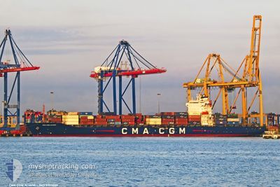
CMA CGM ALIAGA
Container Ship
Current Trip
| Time Travelled | 11 h, 22 mins |
|---|---|
| Remaining Time | --- |
| Distance Travelled | 168.15 nm |
| Remaining Distance | --- |
| AVG Speed | 16.6 Knots |
| MAX Speed | 17.2 Knots |
| AVG Wind | 12.5 knots |
| MAX Wind | 20 knots |
| MIN Temp | 18.5°C / 65.3°F |
| MAX Temp | 20.4°C / 68.72°F |
| Draught | 12 m |
| Position Received | 2 m ago |
Current Position
| Longitude | 11.41790° |
|---|---|
| Latitude | 37.35893° |
| Status | Under way using engine |
| Speed | 15.9 Knots |
| Course | 305.3° |
| Area | Mediterranean Sea - Eastern Basin |
| Station | T-AIS |
| Position Received | 2 m ago |
Info
Information
The current position of CMA CGM ALIAGA is in Mediterranean Sea - Eastern Basin with coordinates 37.35893° / 11.41790° as reported on 2024-05-16 09:16 by AIS to our vessel tracker app. The vessel's current speed is 15.9 Knots
The vessel CMA CGM ALIAGA (IMO: 9323039, MMSI: 229573000) is a Container Ship that was built in 2008 ( 16 years old ). It's sailing under the flag of [MT] Malta.
In this page you can find informations about the vessels current position, last detected port calls, and current voyage information. If the vessels is not in coverage by AIS you will find the latest position.
The current position of CMA CGM ALIAGA is detected by our AIS receivers and we are not responsible for the reliability of the data. The last position was recorded while the vessel was in Coverage by the Ais receivers of our vessel tracking app.
The current draught of CMA CGM ALIAGA as reported by AIS is 12 meters
Weather
| Temperature | 18.2°C / 64.76°F |
|---|---|
| Wind Speed | 14 knots |
| Direction | 320° NW |
| Pressure | 1008.5 hPa |
| Humidity | 85.4 % |
| Cloud Coverage | 9 % |
Featured Company
Last Port Calls
| Port | Arrival | Departure | Time In Port |
|---|---|---|---|
| 2024-05-14 08:28 | 2024-05-15 23:56 | 1 d | |
| 2024-05-09 04:18 | 2024-05-09 17:45 | 13 h | |
| 2024-05-07 06:59 | 2024-05-08 07:06 | 1 d | |
| 2024-05-05 05:51 | 2024-05-06 09:10 | 1 d | |
| 2024-05-01 03:08 | 2024-05-03 22:19 | 2 d | |
| 2024-04-25 20:08 | 2024-04-26 07:51 | 11 h | |
| 2024-04-21 16:44 | 2024-04-23 17:02 | 2 d | |
| 2024-04-18 13:36 | 2024-04-19 10:59 | 21 h | |
| 2024-04-15 23:12 | 2024-04-17 00:56 | 1 d | |
| 2024-04-08 12:24 | 2024-04-12 15:14 | 4 d |
Most Visited Ports (Last year)
| Port | Arrivals | |
|---|---|---|
| 17 | ||
| 12 | ||
| 10 | ||
| 10 | ||
| 9 | ||
| 8 |
Last Trips
| Origin | Departure | Destination | Arrival | Distance | |
|---|---|---|---|---|---|
| 2024-05-09 17:45 | 2024-05-14 08:28 | 727.66 nm | |||
| 2024-05-08 07:06 | 2024-05-09 04:18 | 302.65 nm | |||
| 2024-05-06 09:10 | 2024-05-07 06:59 | 58.80 nm | |||
| 2024-05-03 22:19 | 2024-05-05 05:51 | 221.99 nm | |||
| 2024-04-26 07:51 | 2024-05-01 03:08 | 606.39 nm | |||
| 2024-04-23 17:02 | 2024-04-25 20:08 | 548.61 nm | |||
| 2024-04-19 10:59 | 2024-04-21 16:44 | 767.17 nm | |||
| 2024-04-17 00:56 | 2024-04-18 13:36 | 430.40 nm | |||
| 2024-04-12 15:14 | 2024-04-15 23:12 | 418.22 nm | |||
| 2024-04-03 20:56 | 2024-04-08 12:24 | 719.97 nm |
Events
| Time | Event | Details | Position / Dest | Info |
|---|---|---|---|---|
| 2024-05-16 09:16 | Change Sea Area | Tunisian part of the Mediterranean Sea - Western Basin Tunisian part of the Mediterranean Sea - Eastern Basin |
37.35893 / 11.41790
Mediterranean Sea - Western Basin
ESVLC
|
Speed: 15.9 kn Course: 305.3° |
| 2024-05-16 09:16 | Status Changed | Under way using engine Default |
37.35893 / 11.41790
ESVLC
|
Speed: 15.9 kn Course: 306° |
| 2024-05-16 09:05 | IN Coverage |
37.35893 / 11.41790
Mediterranean Sea - Western Basin
ESVLC
|
Speed: 15.9 kn Course: 305.3° |
|
| 2024-05-16 08:16 | Status Changed | Default Under way using engine |
37.20298 / 11.68534
ESVLC
|
Speed: 16.2 kn Course: 302.3° |
| 2024-05-16 08:13 | OUT of Coverage |
37.19454 / 11.70205
Mediterranean Sea - Eastern Basin
ESVLC
|
Speed: 16.2 kn Course: 302.3° |
|
| 2024-05-16 08:07 | Change Sea Area | Tunisian part of the Mediterranean Sea - Eastern Basin Italian part of the Mediterranean Sea - Eastern Basin |
37.18059 / 11.72967
Mediterranean Sea - Eastern Basin
ESVLC
|
Speed: 16.1 kn Course: 302.3° |
| 2024-05-16 08:06 | Status Changed | Under way using engine Default |
37.17707 / 11.73673
ESVLC
|
Speed: 16 kn Course: 307° |
| 2024-05-16 08:06 | IN Coverage |
37.18059 / 11.72967
Mediterranean Sea - Eastern Basin
ESVLC
|
Speed: 16.1 kn Course: 302.3° |
|
| 2024-05-16 07:09 | Status Changed | Default Under way using engine |
37.03279 / 11.99757
ESVLC
|
Speed: 16.3 kn Course: 304.2° |
| 2024-05-16 07:03 | OUT of Coverage |
37.01762 / 12.02463
Mediterranean Sea - Eastern Basin
ESVLC
|
Speed: 16.3 kn Course: 304.2° |