
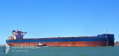
CL PEARL RIVER
Cargo
Current Trip
QING DAO,CHINA
| Time Travelled | 1 day |
|---|---|
| Remaining Time | --- |
| Distance Travelled | 431.85 nm |
| Remaining Distance | --- |
| AVG Speed | 10.2 Knots |
| MAX Speed | 14 Knots |
| AVG Wind | 8.3 knots |
| MAX Wind | 13 knots |
| MIN Temp | 15.7°C / 60.26°F |
| MAX Temp | 28.6°C / 83.48°F |
| Draught | 18.5 m |
| Position Received | 5 d ago |
Current Position
| Longitude | 120.41949° |
|---|---|
| Latitude | 35.17570° |
| Status | Under way using engine |
| Speed | 9.5 Knots |
| Course | 254.4° |
| Area | Yellow Sea |
| Station | T-AIS |
| Position Received | 5 d ago |
Info
Information
The current position of CL PEARL RIVER is in Yellow Sea with coordinates 35.17570° / 120.41949° as reported on 2024-05-18 09:50 by AIS to our vessel tracker app. The vessel's current speed is 9.5 Knots
The vessel CL PEARL RIVER (IMO: 9844564, MMSI: 636018987) is a Cargo It's sailing under the flag of [LR] Liberia.
In this page you can find informations about the vessels current position, last detected port calls, and current voyage information. If the vessels is not in coverage by AIS you will find the latest position.
The current position of CL PEARL RIVER is detected by our AIS receivers and we are not responsible for the reliability of the data. The last position was recorded while the vessel was in Coverage by the Ais receivers of our vessel tracking app.
The current draught of CL PEARL RIVER as reported by AIS is 18.5 meters
Weather
| Temperature | 22.1°C / 71.78°F |
|---|---|
| Wind Speed | 11 knots |
| Direction | 104° ESE |
| Pressure | 1010.9 hPa |
| Humidity | 85.7 % |
| Cloud Coverage | 12 % |
Featured Company
Last Port Calls
| Port | Arrival | Departure | Time In Port |
|---|---|---|---|
| 2024-05-19 03:28 | 2024-05-22 22:08 | 3 d | |
| 2024-05-03 20:57 | 2024-05-05 20:03 | 1 d | |
| 2024-03-23 16:07 | 2024-03-24 23:01 | 1 d | |
| 2024-03-09 08:37 | 2024-03-10 14:16 | 1 d |
Most Visited Ports (Last year)
| Port | Arrivals | |
|---|---|---|
| 10 | ||
| 3 | ||
| 2 | ||
| 1 | ||
| 1 | ||
| 1 |
Last Trips
| Origin | Departure | Destination | Arrival | Distance | |
|---|---|---|---|---|---|
| 2024-05-05 20:03 | 2024-05-19 03:28 | 3626.48 nm | |||
| 2024-03-24 23:01 | 2024-05-03 20:57 | 5875.66 nm | |||
| 2024-03-10 14:16 | 2024-03-23 16:07 | 3837.92 nm | |||
| 2024-02-19 16:56 | 2024-03-09 08:37 | 3928.57 nm |
Events
| Time | Event | Details | Position / Dest | Info |
|---|---|---|---|---|
| 2024-05-24 07:31 | STOP Moving | 13.27 nm, North West of SHANGHAI |
31.51678 / 121.41625
QING DAO,CHINA
|
Speed: 0.1 kn Course: 254° |
| 2024-05-22 14:08 | PORT DEPARTURE |
|
35.33584 / 119.56020
QING DAO,CHINA
|
Speed: 7.5 kn Course: 118° |
| 2024-05-22 13:52 | START Moving |
35.35913 / 119.54268
[CN] RIZHAO
|
Speed: 4.7 kn Course: 187° |
|
| 2024-05-18 20:12 | STOP Moving |
35.35574 / 119.54550
[CN] RIZHAO
|
Speed: 0.2 kn Course: 8° |
|
| 2024-05-18 19:28 | PORT ARRIVAL |
|
35.33961 / 119.55334
[CN] RIZHAO
|
Speed: 5.4 kn Course: 300° |
| 2024-05-18 16:53 | START Moving | 13.2 nm, East of RIZHAO |
35.26538 / 119.79525
QING DAO,CHINA
|
Speed: 3.1 kn Course: 281° |
| 2024-05-18 13:20 | STOP Moving | 13.94 nm, East of RIZHAO |
35.27312 / 119.81287
QING DAO,CHINA
|
Speed: 0.3 kn Course: 207° |
| 2024-05-18 09:56 | Status Changed | Default Under way using engine |
35.17468 / 120.39993
QING DAO,CHINA
|
Speed: 9.5 kn Course: 254.4° |
| 2024-05-18 09:50 | OUT of Coverage |
35.17570 / 120.41949
Yellow Sea
|
Speed: 9.5 kn Course: 254.4° |
|
| 2024-05-18 09:44 | Change Sea Area | Chinese part of the Yellow Sea Australian part of the Indian Ocean |
35.17713 / 120.43898
Yellow Sea
|
Speed: 9.9 kn Course: 260.9° |