
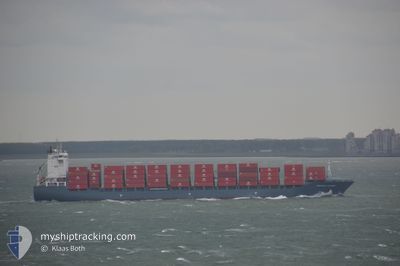
CHIQUITA CENTURY
Container Ship
Current Trip
| Time Travelled | 17 days |
|---|---|
| Remaining Time | --- |
| Distance Travelled | 4932.68 nm |
| Remaining Distance | --- |
| AVG Speed | 15 Knots |
| MAX Speed | 20.1 Knots |
| AVG Wind | 12.3 knots |
| MAX Wind | 25 knots |
| MIN Temp | 14.5°C / 58.1°F |
| MAX Temp | 30.3°C / 86.54°F |
| Draught | 8.5 m |
| Position Received | 2 h, 24 m ago |
Current Position
| Longitude | -82.38291° |
|---|---|
| Latitude | 9.27599° |
| Status | At anchor |
| Speed | |
| Course | 304° |
| Area | Caribbean Sea |
| Station | T-AIS |
| Position Received | 2 h, 24 m ago |
Info
Information
The current position of CHIQUITA CENTURY is in Caribbean Sea with coordinates 9.27599° / -82.38291° as reported on 2024-09-21 22:43 by AIS to our vessel tracker app. The vessel's current speed is 0 Knots
The vessel CHIQUITA CENTURY (IMO: 9339595, MMSI: 636092995) is a Container Ship that was built in 2008 ( 16 years old ). It's sailing under the flag of [LR] Liberia.
In this page you can find informations about the vessels current position, last detected port calls, and current voyage information. If the vessels is not in coverage by AIS you will find the latest position.
The current position of CHIQUITA CENTURY is detected by our AIS receivers and we are not responsible for the reliability of the data. The last position was recorded while the vessel was in Coverage by the Ais receivers of our vessel tracking app.
The current draught of CHIQUITA CENTURY as reported by AIS is 8.5 meters
Weather
| Temperature | 23.5°C / 74.3°F |
|---|---|
| Wind Speed | 2 knots |
| Direction | 11° N |
| Pressure | 1007.1 hPa |
| Humidity | 96.2 % |
| Cloud Coverage | 99 % |
Featured Company
Last Port Calls
| Port | Arrival | Departure | Time In Port |
|---|---|---|---|
| 2024-09-01 21:37 | 2024-09-04 18:36 | 2 d | |
| 2024-08-31 22:38 | 2024-09-01 09:13 | 10 h | |
| 2024-08-15 07:42 | 2024-08-16 10:04 | 1 d | |
| 2024-07-28 19:07 | 2024-07-31 20:32 | 3 d | |
| 2024-07-27 16:24 | 2024-07-28 03:36 | 11 h | |
| 2024-07-12 06:17 |
Most Visited Ports (Last year)
| Port | Arrivals | |
|---|---|---|
| 14 | ||
| 10 | ||
| 10 | ||
| 1 |
Last Trips
| Origin | Departure | Destination | Arrival | Distance | |
|---|---|---|---|---|---|
| 2024-09-01 09:13 | 2024-09-01 21:37 | 120.22 nm | |||
| 2024-08-16 10:04 | 2024-08-31 22:38 | 4846.35 nm | |||
| 2024-07-31 20:32 | 2024-08-15 07:42 | 4984.51 nm | |||
| 2024-07-28 03:36 | 2024-07-28 19:07 | 129.27 nm | |||
| 2024-07-12 06:17 | 2024-07-27 16:24 | 4880.28 nm |
Events
| Time | Event | Details | Position / Dest | Info |
|---|---|---|---|---|
| 2024-09-21 22:43 | OUT of Coverage |
9.27600 / -82.38291
Caribbean Sea
|
Speed: Course: 49.3° |
|
| 2024-09-21 22:43 | IN Coverage |
9.27600 / -82.38291
Caribbean Sea
|
Speed: Course: 49.3° |
|
| 2024-09-21 07:13 | OUT of Coverage |
9.27586 / -82.38338
Caribbean Sea
|
Speed: Course: 30.5° |
|
| 2024-09-21 07:13 | IN Coverage |
9.27586 / -82.38338
Caribbean Sea
|
Speed: Course: 30.5° |
|
| 2024-09-21 04:07 | OUT of Coverage |
9.27592 / -82.38299
Caribbean Sea
|
Speed: Course: 210.5° |
|
| 2024-09-21 04:07 | IN Coverage |
9.27592 / -82.38299
Caribbean Sea
|
Speed: Course: 210.5° |
|
| 2024-09-19 12:26 | OUT of Coverage |
9.26779 / -82.37417
Caribbean Sea
|
Speed: 7.4 kn Course: 307.6° |
|
| 2024-09-19 11:47 | Change Sea Area | Panamanian part of the Caribbean Sea United Kingdom part of the Celtic Sea |
9.37601 / -82.33149
Caribbean Sea
|
Speed: 11.4 kn Course: 145.1° |
| 2024-09-19 11:43 | Status Changed | Under way using engine Default |
9.38570 / -82.33831
CRMOB
|
Speed: 18.6 kn Course: 159° |
| 2024-09-19 11:43 | IN Coverage |
9.37601 / -82.33149
Caribbean Sea
|
Speed: 11.4 kn Course: 145.1° |