

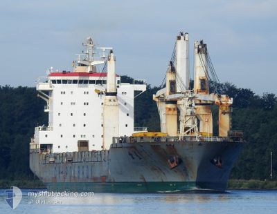
CHIPOLBROK STAR
General Cargo

Current Trip
| Time Travelled | 17 days |
|---|---|
| Remaining Time | 4 days |
| Distance Travelled | 5064.77 nm |
| Remaining Distance | 1394.74 nm |
| AVG Speed | 12.9 Knots |
| MAX Speed | 15.3 Knots |
| AVG Wind | 10.7 knots |
| MAX Wind | 24 knots |
| MIN Temp | 8.8°C / 47.84°F |
| MAX Temp | 28.6°C / 83.48°F |
| Draught | 10 m |
| Position Received | 1 d ago |
Current Position
| Longitude | --- |
|---|---|
| Latitude | --- |
| Status | Under way using engine |
| Speed | 13.1 Knots |
| Course | 107.5° |
| Area | Laccadive Sea |
| Station | T-AIS |
| Position Received | 1 d ago |
Information
The current position of CHIPOLBROK STAR is in Laccadive Sea with coordinates 6.88345° / 76.41180° as reported on 2025-03-03 16:25 by AIS to our vessel tracker app. The vessel's current speed is 13.1 Knots and is heading at the port of SINGAPORE. The estimated time of arrival as calculated by MyShipTracking vessel tracking app is 2025-03-09 19:16 LT
The vessel CHIPOLBROK STAR (IMO: 9432127, MMSI: 477748600) is a General Cargo that was built in 2010 ( 15 years old ). It's sailing under the flag of [HK] Hong Kong.
In this page you can find informations about the vessels current position, last detected port calls, and current voyage information. If the vessels is not in coverage by AIS you will find the latest position.
The current position of CHIPOLBROK STAR is detected by our AIS receivers and we are not responsible for the reliability of the data. The last position was recorded while the vessel was in Coverage by the Ais receivers of our vessel tracking app.
The current draught of CHIPOLBROK STAR as reported by AIS is 10 meters
Weather
| Temperature | 27.9°C / 82.22°F |
|---|---|
| Wind Speed | 12 knots |
| Direction | 14° NNE |
| Pressure | 1009 hPa |
| Humidity | 71.7 % |
| Cloud Coverage | 100 % |


Featured Company
Last Port Calls
| Port | Arrival | Departure | Time In Port |
|---|---|---|---|
| 2025-02-21 04:41 | 2025-02-21 13:59 | 9 h | |
| 2025-02-07 07:30 | 2025-02-15 14:40 | 8 d | |
| 2025-01-26 22:40 | 2025-01-31 08:25 | 4 d | |
| 2025-01-23 09:49 | 2025-01-24 17:53 | 1 d | |
| 2025-01-21 07:16 | 2025-01-22 11:25 | 1 d | |
| 2025-01-15 05:52 | 2025-01-17 19:36 | 2 d | |
| 2025-01-06 23:34 | 2025-01-10 13:41 | 3 d |
Most Visited Ports (Last year)
| Port | Arrivals | |
|---|---|---|
| 3 | ||
| 2 | ||
| 2 | ||
| 2 | ||
| 2 | ||
| 2 |
Last Trips
| Origin | Departure | Destination | Arrival | Distance | |
|---|---|---|---|---|---|
| 2025-02-15 15:40 | 2025-02-21 06:41 | 1506.53 nm | |||
| 2025-01-31 09:25 | 2025-02-07 08:30 | 827.43 nm | |||
| 2025-01-24 20:53 | 2025-01-26 23:40 | 735.74 nm | |||
| 2025-01-22 14:25 | 2025-01-23 12:49 | 283.76 nm | |||
| 2025-01-17 20:36 | 2025-01-21 10:16 | 1004.46 nm | |||
| 2025-01-10 14:41 | 2025-01-15 06:52 | 30.98 nm | |||
| 2024-12-22 09:05 | 2025-01-07 00:34 | 1463.42 nm |
Events
| Time | Event | Details | Position / Dest | Info |
|---|---|---|---|---|
| 2025-03-03 16:25 | Status Changed | Default Under way using engine |
6.88235 / 76.41448
SGSIN
|
Speed: 13.1 kn Course: 107.5° |
| 2025-03-03 16:25 | Status Changed | Under way using engine Default |
6.88345 / 76.41180
SGSIN
|
Speed: 12.8 kn Course: 112° |
| 2025-03-03 16:25 | OUT of Coverage |
6.88345 / 76.41180
Laccadive Sea
SGSIN
|
Speed: 13.1 kn Course: 107.5° |
|
| 2025-03-03 16:10 | Status Changed | Default Under way using engine |
6.90366 / 76.36320
SGSIN
|
Speed: 12.8 kn Course: 112.8° |
| 2025-03-03 15:52 | Detected in Sea | Indian part of the Laccadive Sea |
6.92945 / 76.30091
Laccadive Sea
SGSIN
|
Speed: 12.8 kn Course: 112.8° |
| 2025-03-03 15:52 | Status Changed | Under way using engine Default |
6.92945 / 76.30091
SGSIN
|
Speed: 12.9 kn Course: 119° |
| 2025-03-03 15:35 | IN Coverage |
6.92945 / 76.30091
Laccadive Sea
SGSIN
|
Speed: 12.8 kn Course: 112.8° |