
CH CLARE
Bulk Carrier
Current Trip
| Trip Time | 8 days |
|---|---|
| Trip Distance | 1862.12 nm |
| AVG Speed | 9.4 Knots |
| MAX Speed | 12.6 Knots |
| Draught | 6 m |
| AVG Wind | 12 knots |
| MAX Wind | 32 knots |
| MIN Temp | 16.1°C / 60.98°F |
| MAX Temp | 29°C / 84.2°F |
| Position Received | 2024-12-13 23:08 |
Current Position
| Longitude | --- |
|---|---|
| Latitude | --- |
| Status | Under way using engine |
| Speed | 10.3 Knots |
| Course | 36° |
| Area | South China Sea |
| Station | T-AIS |
| Position Received | 2024-12-13 23:08 |
Info
Information
The current position of CH CLARE is in South China Sea with coordinates 1.33933° / 104.38297° as reported on 2024-12-13 23:08 by AIS to our vessel tracker app. The vessel's current speed is 10.3 Knots and is currently inside the port of TAICHUNG.
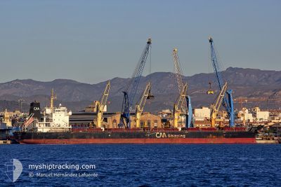
The vessel CH CLARE (IMO: 9489223, MMSI: 441698000) is a Bulk Carrier that was built in 2010 ( 15 years old ). It's sailing under the flag of [KR] Korea.
In this page you can find informations about the vessels current position, last detected port calls, and current voyage information. If the vessels is not in coverage by AIS you will find the latest position.
The current position of CH CLARE is detected by our AIS receivers and we are not responsible for the reliability of the data. The last position was recorded while the vessel was in Coverage by the Ais receivers of our vessel tracking app.
The current draught of CH CLARE as reported by AIS is 6 meters
Weather
| Temperature | 15.4°C / 59.72°F |
|---|---|
| Wind Speed | 33 knots |
| Direction | 23° NNE |
| Pressure | 1024.5 hPa |
| Humidity | 74.1 % |
| Cloud Coverage | 100 % |
Featured Company
Last Port Calls
| Port | Arrival | Departure | Time In Port |
|---|---|---|---|
| 2025-01-13 19:57 | |||
| 2025-01-01 18:00 | 2025-01-05 10:12 | 3 d | |
| 2024-12-09 11:40 | 2024-12-13 18:44 | 4 d |
Most Visited Ports (Last year)
| Port | Arrivals | |
|---|---|---|
| 2 | ||
| 1 | ||
| 1 | ||
| 1 | ||
| 1 | ||
| 1 |
Last Trips
| Origin | Departure | Destination | Arrival | Distance | |
|---|---|---|---|---|---|
| 2025-01-05 18:12 | 2025-01-14 03:57 | 1862.12 nm | |||
| 2024-12-14 02:44 | 2025-01-02 02:00 | 2882.49 nm | |||
| 2024-10-12 15:49 | 2024-12-09 19:40 | 3792.29 nm |
Events
| Time | Event | Details | Position / Dest | Info |
|---|---|---|---|---|
| 2025-01-13 20:53 | STOP Moving |
24.23103 / 120.48265
[TW] TAICHUNG
|
Speed: 0.2 kn Course: 18° |
|
| 2025-01-13 19:57 | PORT ARRIVAL |
|
24.29155 / 120.50180
[TW] TAICHUNG
|
Speed: 7.2 kn Course: 83° |
| 2025-01-11 10:15 | START Moving |
17.28167 / 119.50040
IDTJK
|
Speed: 4 kn Course: 10° |
|
| 2025-01-11 10:02 | STOP Moving |
17.27607 / 119.50446
IDTJK
|
Speed: 0.2 kn Course: 333° |
|
| 2025-01-05 12:08 | START Moving | 3.2 nm, South West of BIRINGKASSI |
-4.83792 / 119.43391
IDTJK
|
Speed: 3.4 kn Course: 230° |
| 2025-01-05 10:48 | STOP Moving | 3 nm, South West of BIRINGKASSI |
-4.83797 / 119.43750
IDTJK
|
Speed: Course: 280° |
| 2025-01-05 10:12 | START Moving | 0.96 nm, West of BIRINGKASSI |
-4.81977 / 119.46730
IDTJK
|
Speed: 5.5 kn Course: 253° |
| 2025-01-05 10:12 | PORT DEPARTURE |
|
-4.81977 / 119.46730
IDTJK
|
Speed: 1.7 kn Course: 256° |