

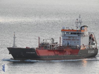
CGAS MASTER
Lpg Tanker

Current Trip
| Time Travelled | 2 days |
|---|---|
| Remaining Time | --- |
| Distance Travelled | 676.24 nm |
| Remaining Distance | --- |
| AVG Speed | 10.8 Knots |
| MAX Speed | 15.1 Knots |
| AVG Wind | 13.1 knots |
| MAX Wind | 36 knots |
| MIN Temp | 6.1°C / 42.98°F |
| MAX Temp | 13.9°C / 57.02°F |
| Draught | 6.4 m |
| Position Received | Now |
Current Position
| Longitude | --- |
|---|---|
| Latitude | --- |
| Status | Under way using engine |
| Speed | 9.8 Knots |
| Course | 40.8° |
| Area | English Channel |
| Station | T-AIS |
| Position Received | Now |
Information
The current position of CGAS MASTER is in English Channel with coordinates 51.00751° / 1.60624° as reported on 2025-02-04 10:37 by AIS to our vessel tracker app. The vessel's current speed is 9.8 Knots and is heading at the port of STADE. The estimated time of arrival as calculated by MyShipTracking vessel tracking app is 2025-02-05 15:00 LT
The vessel CGAS MASTER (IMO: 9344203, MMSI: 215389000) is a Lpg Tanker that was built in 2007 ( 18 years old ). It's sailing under the flag of [MT] Malta.
In this page you can find informations about the vessels current position, last detected port calls, and current voyage information. If the vessels is not in coverage by AIS you will find the latest position.
The current position of CGAS MASTER is detected by our AIS receivers and we are not responsible for the reliability of the data. The last position was recorded while the vessel was in Coverage by the Ais receivers of our vessel tracking app.
The current draught of CGAS MASTER as reported by AIS is 6.4 meters
Weather
| Temperature | 7°C / 44.6°F |
|---|---|
| Wind Speed | 22 knots |
| Direction | 202° SSW |
| Pressure | 1024.5 hPa |
| Humidity | 77.6 % |
| Cloud Coverage | 4 % |


Featured Company
Last Port Calls
| Port | Arrival | Departure | Time In Port |
|---|---|---|---|
| 2025-01-31 04:41 | 2025-02-01 17:19 | 1 d | |
| 2025-01-19 13:45 | 2025-01-20 06:00 | 16 h | |
| 2025-01-13 01:08 | 2025-01-14 13:00 | 1 d | |
| 2024-12-31 10:31 | 2025-01-01 20:39 | 1 d | |
| 2024-12-25 19:21 | 2024-12-27 08:01 | 1 d | |
| 2024-12-18 16:14 | 2024-12-21 21:27 | 3 d | |
| 2024-12-13 01:27 | 2024-12-14 14:15 | 1 d | |
| 2024-12-06 22:20 | 2024-12-07 20:24 | 22 h | |
| 2024-12-03 22:30 | 2024-12-06 20:56 | 2 d |
Most Visited Ports (Last year)
| Port | Arrivals | |
|---|---|---|
| 22 | ||
| 12 | ||
| 9 | ||
| 7 | ||
| 3 | ||
| 2 |
Last Trips
| Origin | Departure | Destination | Arrival | Distance | |
|---|---|---|---|---|---|
| 2025-01-20 07:00 | 2025-01-31 05:41 | 1402.04 nm | |||
| 2025-01-14 14:00 | 2025-01-19 14:45 | 1067.41 nm | |||
| 2025-01-01 20:39 | 2025-01-13 02:08 | 1116.48 nm | |||
| 2024-12-27 09:01 | 2024-12-31 10:31 | 1087.30 nm | |||
| 2024-12-21 21:27 | 2024-12-25 20:21 | 1078.19 nm | |||
| 2024-12-14 15:15 | 2024-12-18 16:14 | 1086.41 nm | |||
| 2024-12-07 21:24 | 2024-12-13 02:27 | 1374.16 nm | |||
| 2024-12-06 21:56 | 2024-12-06 23:20 | 10.36 nm | |||
| 2024-11-27 19:05 | 2024-12-03 23:30 | 1425.73 nm |
Events
| Time | Event | Details | Position / Dest | Info |
|---|---|---|---|---|
| 2025-02-04 06:48 | Status Changed | Under way using engine Default |
50.49961 / .97648
DESTA
|
Speed: 10.8 kn Course: 69° |
| 2025-02-04 06:41 | Status Changed | Default Under way using engine |
50.49260 / .94719
DESTA
|
Speed: 10.8 kn Course: 69.6° |
| 2025-02-04 06:33 | Change Sea Area | French part of the English Channel United Kingdom part of the English Channel |
50.48409 / .91194
English Channel
DESTA
|
Speed: 10.8 kn Course: 69.6° |
| 2025-02-04 05:46 | Status Changed | Under way using engine Default |
50.43885 / .70095
DESTA
|
Speed: 10.8 kn Course: 70° |
| 2025-02-04 05:41 | Status Changed | Default Under way using engine |
50.43416 / .67949
DESTA
|
Speed: 10.8 kn Course: 74.6° |
| 2025-02-04 05:36 | Status Changed | Under way using engine Default |
50.43001 / .65383
DESTA
|
Speed: 10.8 kn Course: 76° |
| 2025-02-04 05:29 | Status Changed | Default Under way using engine |
50.42533 / .62503
DESTA
|
Speed: 10.8 kn Course: 76.1° |
| 2025-02-04 05:16 | Status Changed | Under way using engine Default |
50.41440 / .56742
DESTA
|
Speed: 10.9 kn Course: 73° |
| 2025-02-04 05:13 | Status Changed | Default Under way using engine |
50.41171 / .55404
DESTA
|
Speed: 10.9 kn Course: 72.4° |
| 2025-02-04 05:06 | Status Changed | Under way using engine Default |
50.40497 / .52032
DESTA
|
Speed: 10.9 kn Course: 73° |