
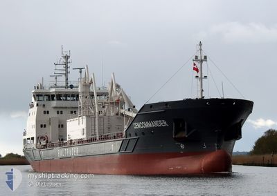
CEMCOMMANDER
Cargo
Current Trip
| Time Travelled | 21 h, 53 mins |
|---|---|
| Remaining Time | 8 h, 7 mins |
| Distance Travelled | 192.35 nm |
| Remaining Distance | 80.68 nm |
| AVG Speed | 8.4 Knots |
| MAX Speed | 10.9 Knots |
| AVG Wind | 12.8 knots |
| MAX Wind | 27 knots |
| MIN Temp | 8.2°C / 46.76°F |
| MAX Temp | 9.8°C / 49.64°F |
| Draught | 4.2 m |
| Position Received | Now |
Current Position
| Longitude | --- |
|---|---|
| Latitude | --- |
| Status | Under way using engine |
| Speed | 10.1 Knots |
| Course | 54.1° |
| Area | Skaggerak |
| Station | T-AIS |
| Position Received | Now |
Info
Information
The current position of CEMCOMMANDER is in Skaggerak with coordinates 58.06970° / 8.26457° as reported on 2024-12-02 13:31 by AIS to our vessel tracker app. The vessel's current speed is 10.1 Knots and is heading at the port of BREVIK. The estimated time of arrival as calculated by MyShipTracking vessel tracking app is 2024-12-02 22:39 LT
The vessel CEMCOMMANDER (IMO: 9975753, MMSI: 209903000) is a Cargo It's sailing under the flag of [CY] Cyprus.
In this page you can find informations about the vessels current position, last detected port calls, and current voyage information. If the vessels is not in coverage by AIS you will find the latest position.
The current position of CEMCOMMANDER is detected by our AIS receivers and we are not responsible for the reliability of the data. The last position was recorded while the vessel was in Coverage by the Ais receivers of our vessel tracking app.
The current draught of CEMCOMMANDER as reported by AIS is 4.2 meters
Weather
| Temperature | 8.7°C / 47.66°F |
|---|---|
| Wind Speed | 13 knots |
| Direction | 239° WSW |
| Pressure | 1000.9 hPa |
| Humidity | 98.7 % |
| Cloud Coverage | 100 % |
Featured Company
Last Port Calls
| Port | Arrival | Departure | Time In Port |
|---|---|---|---|
| 2024-11-30 11:59 | 2024-12-01 16:39 | 1 d | |
| 2024-11-29 13:59 | 2024-11-30 05:03 | 15 h | |
| 2024-11-25 22:54 | 2024-11-28 03:32 | 2 d | |
| 2024-11-22 23:59 | 2024-11-24 10:51 | 1 d | |
| 2024-11-19 10:57 | 2024-11-20 13:18 | 1 d | |
| 2024-11-17 15:46 | 2024-11-18 09:32 | 17 h | |
| 2024-11-15 02:43 | 2024-11-15 20:04 | 17 h | |
| 2024-11-14 08:41 | 2024-11-14 20:54 | 12 h | |
| 2024-11-12 05:44 | 2024-11-13 00:52 | 19 h | |
| 2024-11-11 07:36 | 2024-11-11 22:20 | 14 h |
Last Trips
| Origin | Departure | Destination | Arrival | Distance | |
|---|---|---|---|---|---|
| 2024-11-30 05:03 | 2024-11-30 11:59 | 56.37 nm | |||
| 2024-11-28 03:32 | 2024-11-29 13:59 | 303.77 nm | |||
| 2024-11-24 10:51 | 2024-11-25 22:54 | 372.46 nm | |||
| 2024-11-20 13:18 | 2024-11-22 23:59 | 492.89 nm | |||
| 2024-11-18 09:32 | 2024-11-19 10:57 | 184.22 nm | |||
| 2024-11-15 20:04 | 2024-11-17 15:46 | 290.43 nm | |||
| 2024-11-14 20:54 | 2024-11-15 02:43 | 55.85 nm | |||
| 2024-11-13 00:52 | 2024-11-14 08:41 | 306.49 nm | |||
| 2024-11-11 22:20 | 2024-11-12 05:44 | 79.85 nm | |||
| 2024-11-11 06:25 | 2024-11-11 07:36 | 9.50 nm |
Events
| Time | Event | Details | Position / Dest | Info |
|---|---|---|---|---|
| 2024-12-02 09:28 | Detected in Sea | Norwegian part of the Skaggerak |
57.95128 / 7.08103
Skaggerak
NOBVK
|
Speed: 9.5 kn Course: 106.9° |
| 2024-12-02 09:06 | Destination Changed | NOBVK NOZFR |
57.96760 / 6.97110
NOBVK
|
Speed: 9.8 kn Course: 106.5° |
| 2024-12-01 15:39 | PORT DEPARTURE |
|
59.62167 / 5.79338
NOZFR
|
Speed: 10.6 kn Course: 17° |
| 2024-12-01 15:30 | START Moving |
59.60234 / 5.76385
[NO] OLEN
|
Speed: 6 kn Course: 70° |
|
| 2024-12-01 15:26 | Status Changed | Under way using engine Moored |
59.60419 / 5.76042
[NO] OLEN
|
Speed: 0.2 kn Course: 261° |
| 2024-12-01 14:47 | Destination Changed | NOZFR NOBVK |
59.60453 / 5.76090
[NO] OLEN
|
Speed: Course: 258° |
| 2024-12-01 08:44 | Draught Changed | 4.2 5.2 |
59.60448 / 5.76085
[NO] OLEN
|
Speed: Course: 258° |
| 2024-12-01 08:44 | ETA Changed | 2024/12/02 23:00 2025/11/30 11:00 |
59.60448 / 5.76085
[NO] OLEN
|
Speed: Course: 258° |
| 2024-12-01 08:38 | Destination Changed | NOBVK NOOLN |
59.60450 / 5.76089
[NO] OLEN
|
Speed: Course: 258° |
| 2024-12-01 00:06 | ETA Changed | 2025/11/30 11:00 2024/11/30 11:00 |
59.60448 / 5.76088
[NO] OLEN
|
Speed: Course: 258° |