
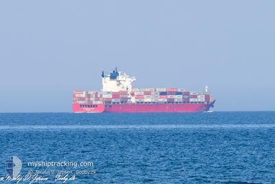
CELSIUS LONDON
Container Ship
Current Trip
| Time Travelled | 1 day |
|---|---|
| Remaining Time | --- |
| Distance Travelled | 337.50 nm |
| Remaining Distance | --- |
| AVG Speed | 9.5 Knots |
| MAX Speed | 14.9 Knots |
| AVG Wind | 7.9 knots |
| MAX Wind | 15.8 knots |
| MIN Temp | 15.3°C / 59.54°F |
| MAX Temp | 17.2°C / 62.96°F |
| Draught | 9.5 m |
| Position Received | Now |
Current Position
| Longitude | 8.58990° |
|---|---|
| Latitude | 44.05581° |
| Status | Under way using engine |
| Speed | 0.4 Knots |
| Course | 88° |
| Area | Ligurian Sea |
| Station | T-AIS |
| Position Received | Now |
Info
Information
The current position of CELSIUS LONDON is in Ligurian Sea with coordinates 44.05581° / 8.58990° as reported on 2024-05-07 04:59 by AIS to our vessel tracker app. The vessel's current speed is 0.4 Knots
The vessel CELSIUS LONDON (IMO: 9303778, MMSI: 538009350) is a Container Ship that was built in 2007 ( 17 years old ). It's sailing under the flag of [MH] Marshall Is.
In this page you can find informations about the vessels current position, last detected port calls, and current voyage information. If the vessels is not in coverage by AIS you will find the latest position.
The current position of CELSIUS LONDON is detected by our AIS receivers and we are not responsible for the reliability of the data. The last position was recorded while the vessel was in Coverage by the Ais receivers of our vessel tracking app.
The current draught of CELSIUS LONDON as reported by AIS is 9.5 meters
Weather
| Temperature | 15.3°C / 59.54°F |
|---|---|
| Wind Speed | 10 knots |
| Direction | 183° S |
| Pressure | 1010.9 hPa |
| Humidity | 86.9 % |
| Cloud Coverage | 100 % |
Featured Company
Last Port Calls
| Port | Arrival | Departure | Time In Port |
|---|---|---|---|
| 2024-05-04 12:56 | 2024-05-05 16:40 | 1 d | |
| 2024-04-26 04:52 | 2024-04-27 04:18 | 23 h | |
| 2024-04-21 15:53 | 2024-04-22 18:22 | 1 d | |
| 2024-04-18 10:50 | 2024-04-19 12:36 | 1 d | |
| 2024-04-11 20:35 | 2024-04-12 23:38 | 1 d | |
| 2024-04-02 05:55 | 2024-04-03 08:54 | 1 d | |
| 2024-03-28 21:29 | 2024-03-28 22:22 | 52 m | |
| 2024-03-23 21:29 | 2024-03-25 02:58 | 1 d | |
| 2024-03-17 09:51 | 2024-03-17 20:08 | 10 h | |
| 2024-03-16 14:02 | 2024-03-17 06:36 | 16 h |
Most Visited Ports (Last year)
| Port | Arrivals | |
|---|---|---|
| 17 | ||
| 15 | ||
| 12 | ||
| 5 | ||
| 5 | ||
| 5 |
Last Trips
| Origin | Departure | Destination | Arrival | Distance | |
|---|---|---|---|---|---|
| 2024-04-22 20:22 | 2024-05-04 14:56 | 3138.16 nm | |||
| 2024-04-22 20:22 | 2024-04-26 06:52 | 1460.76 nm | |||
| 2024-04-19 14:36 | 2024-04-21 17:53 | 372.20 nm | |||
| 2024-04-03 10:54 | 2024-04-18 12:50 | 4592.01 nm | |||
| 2024-04-03 10:54 | 2024-04-11 22:35 | 2896.86 nm | |||
| 2024-03-28 23:22 | 2024-04-02 07:55 | 194.94 nm | |||
| 2024-03-17 20:08 | 2024-03-28 22:29 | 3474.54 nm | |||
| 2024-03-17 20:08 | 2024-03-23 23:29 | 2007.85 nm | |||
| 2024-03-17 07:36 | 2024-03-17 09:51 | 30.50 nm | |||
| 2024-03-15 07:43 | 2024-03-16 15:02 | 525.46 nm |
Events
| Time | Event | Details | Position / Dest | Info |
|---|---|---|---|---|
| 2024-05-07 03:13 | STOP Moving | 11.91 nm, South East of NOLI |
44.05076 / 8.59581
ITVDL
|
Speed: 0.3 kn Course: 122° |
| 2024-05-06 23:49 | ETA Changed | 2024/05/08 15:00 2024/05/07 04:00 |
43.73968 / 8.17271
ITVDL
|
Speed: 8.9 kn Course: 41.8° |
| 2024-05-06 22:26 | Detected in Sea | Italian part of the Ligurian Sea |
43.60025 / 7.98163
Ligurian Sea
ITVDL
|
Speed: 8.3 kn Course: 49.7° |
| 2024-05-06 20:26 | Detected in Sea | Italian part of the Mediterranean Sea - Western Basin |
43.41657 / 7.68382
Mediterranean Sea - Western Basin
ITVDL
|
Speed: 8.9 kn Course: 49.2° |
| 2024-05-06 19:56 | Detected in Sea | French part of the Mediterranean Sea - Western Basin |
43.36647 / 7.60627
Mediterranean Sea - Western Basin
ITVDL
|
Speed: 9.1 kn Course: 46.3° |
| 2024-05-06 19:44 | Detected in Sea | Mon�gasque part of the Mediterranean Sea - Western Basin |
43.34504 / 7.57544
Mediterranean Sea - Western Basin
ITVDL
|
Speed: 9.3 kn Course: 46.2° |
| 2024-05-06 14:25 | ETA Changed | 2024/05/07 04:00 2024/05/06 16:00 |
42.80799 / 6.68768
ITVDL
|
Speed: 9.6 kn Course: 65.2° |
| 2024-05-06 14:07 | Status Changed | Under way using engine Default |
42.78931 / 6.63265
ITVDL
|
Speed: 9.5 kn Course: 66° |
| 2024-05-06 14:07 | IN Coverage |
42.79021 / 6.63539
Mediterranean Sea - Western Basin
ITVDL
|
Speed: 9.5 kn Course: 66.6° |
|
| 2024-05-06 11:17 | OUT of Coverage |
42.60590 / 6.08222
Mediterranean Sea - Western Basin
ITVDL
|
Speed: 9.7 kn Course: 66° |