
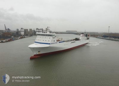
CAROLINE RUSS
Ro-Ro Cargo
Current Trip
| Time Travelled | 1 day |
|---|---|
| Remaining Time | 7 h, 32 mins |
| Distance Travelled | 456.98 nm |
| Remaining Distance | 140.15 nm |
| AVG Speed | 17.8 Knots |
| MAX Speed | 18.5 Knots |
| AVG Wind | 4.5 knots |
| MAX Wind | 8.9 knots |
| MIN Temp | 12.1°C / 53.78°F |
| MAX Temp | 18.5°C / 65.3°F |
| Draught | 6.2 m |
| Position Received | 1 m ago |
Current Position
| Longitude | 12.52567° |
|---|---|
| Latitude | 37.43167° |
| Status | Under way using engine |
| Speed | 17.7 Knots |
| Course | 127.4° |
| Area | Mediterranean Sea - Eastern Basin |
| Station | T-AIS |
| Position Received | 1 m ago |
Info
Information
The current position of CAROLINE RUSS is in Mediterranean Sea - Eastern Basin with coordinates 37.43167° / 12.52567° as reported on 2024-05-05 19:17 by AIS to our vessel tracker app. The vessel's current speed is 17.7 Knots and is heading at the port of VALLETTA. The estimated time of arrival as calculated by MyShipTracking vessel tracking app is 2024-05-06 02:51 LT
The vessel CAROLINE RUSS (IMO: 9197533, MMSI: 255805834) is a Ro-Ro Cargo that was built in 1999 ( 25 years old ). It's sailing under the flag of [PT] Portugal.
In this page you can find informations about the vessels current position, last detected port calls, and current voyage information. If the vessels is not in coverage by AIS you will find the latest position.
The current position of CAROLINE RUSS is detected by our AIS receivers and we are not responsible for the reliability of the data. The last position was recorded while the vessel was in Coverage by the Ais receivers of our vessel tracking app.
The current draught of CAROLINE RUSS as reported by AIS is 6.2 meters
Weather
| Temperature | 17.7°C / 63.86°F |
|---|---|
| Wind Speed | 5 knots |
| Direction | 309° NW |
| Pressure | 1016.7 hPa |
| Humidity | 65.2 % |
| Cloud Coverage | 5 % |
Featured Company
Last Port Calls
| Port | Arrival | Departure | Time In Port |
|---|---|---|---|
| 2024-05-04 14:51 | 2024-05-04 17:21 | 2 h | |
| 2024-05-02 04:02 | 2024-05-04 04:02 | 1 d | |
| 2024-04-30 20:45 | 2024-05-01 00:57 | 4 h | |
| 2024-04-28 12:35 | 2024-04-29 21:16 | 1 d | |
| 2024-04-27 10:18 | 2024-04-27 12:36 | 2 h | |
| 2024-04-26 12:27 | 2024-04-26 19:16 | 6 h | |
| 2024-04-25 19:36 | 2024-04-25 22:32 | 2 h | |
| 2024-04-24 10:12 | 2024-04-24 21:16 | 11 h | |
| 2024-04-23 05:59 | 2024-04-23 11:48 | 5 h | |
| 2024-04-22 03:24 | 2024-04-22 15:48 | 12 h |
Last Trips
| Origin | Departure | Destination | Arrival | Distance | |
|---|---|---|---|---|---|
| 2024-05-04 06:02 | 2024-05-04 16:51 | 7.83 nm | |||
| 2024-05-01 02:57 | 2024-05-02 06:02 | 430.85 nm | |||
| 2024-04-29 23:16 | 2024-04-30 22:45 | 431.57 nm | |||
| 2024-04-27 14:36 | 2024-04-28 14:35 | 431.14 nm | |||
| 2024-04-26 21:16 | 2024-04-27 12:18 | 265.92 nm | |||
| 2024-04-26 00:32 | 2024-04-26 14:27 | 263.96 nm | |||
| 2024-04-24 23:16 | 2024-04-25 21:36 | 431.26 nm | |||
| 2024-04-23 13:48 | 2024-04-24 12:12 | 430.49 nm | |||
| 2024-04-22 17:48 | 2024-04-23 07:59 | 263.90 nm | |||
| 2024-04-20 20:24 | 2024-04-22 05:24 | 598.43 nm |
Events
| Time | Event | Details | Position / Dest | Info |
|---|---|---|---|---|
| 2024-05-05 19:17 | Status Changed | Under way using engine Default |
37.43167 / 12.52567
MTMLA
|
Speed: 17.8 kn Course: 128° |
| 2024-05-05 19:16 | Status Changed | Default Under way using engine |
37.43674 / 12.51743
MTMLA
|
Speed: 18.3 kn Course: 128.7° |
| 2024-05-05 18:54 | Status Changed | Under way using engine Default |
37.50583 / 12.40833
MTMLA
|
Speed: 18.2 kn Course: 130° |
| 2024-05-05 18:52 | Status Changed | Default Under way using engine |
37.51155 / 12.39945
MTMLA
|
Speed: 18.1 kn Course: 129.7° |
| 2024-05-05 18:46 | Change Sea Area | Italian part of the Mediterranean Sea - Eastern Basin Italian part of the Mediterranean Sea - Western Basin |
37.53033 / 12.37133
Mediterranean Sea - Eastern Basin
MTMLA
|
Speed: 18.1 kn Course: 129.7° |
| 2024-05-05 18:46 | Status Changed | Under way using engine Default |
37.53033 / 12.37133
MTMLA
|
Speed: 17.9 kn Course: 130° |
| 2024-05-05 18:41 | IN Coverage |
37.53033 / 12.37133
Mediterranean Sea - Eastern Basin
MTMLA
|
Speed: 18.1 kn Course: 129.7° |
|
| 2024-05-05 17:48 | Status Changed | Default Under way using engine |
37.71815 / 12.09797
MTMLA
|
Speed: 17.8 kn Course: 146.7° |
| 2024-05-05 17:42 | OUT of Coverage |
37.74483 / 12.07550
Mediterranean Sea - Western Basin
MTMLA
|
Speed: 17.8 kn Course: 146.7° |
|
| 2024-05-05 16:55 | Change Sea Area | Italian part of the Mediterranean Sea - Western Basin Italian part of the Tyrrhenian Sea |
37.93855 / 11.91210
Mediterranean Sea - Western Basin
MTMLA
|
Speed: 17.9 kn Course: 146.4° |