
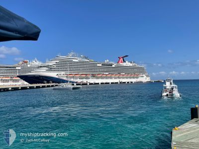
CARNIVAL DREAM
Passengers Ship
Current Trip
| Time Travelled | 9 h, 32 mins |
|---|---|
| Remaining Time | 1 day |
| Distance Travelled | 167.30 nm |
| Remaining Distance | 679.92 nm |
| AVG Speed | 16.7 Knots |
| MAX Speed | 19.7 Knots |
| AVG Wind | 12.6 knots |
| MAX Wind | 16 knots |
| MIN Temp | 19.2°C / 66.56°F |
| MAX Temp | 22.1°C / 71.78°F |
| Draught | 8.4 m |
| Position Received | 6 h, 48 m ago |
Current Position
| Longitude | --- |
|---|---|
| Latitude | --- |
| Status | Under way using engine |
| Speed | 18.7 Knots |
| Course | 132° |
| Area | Gulf of Mexico |
| Station | T-AIS |
| Position Received | 6 h, 48 m ago |
Information
The current position of CARNIVAL DREAM is in Gulf of Mexico with coordinates 28.98598° / -94.12748° as reported on 2025-03-22 23:34 by AIS to our vessel tracker app. The vessel's current speed is 18.7 Knots and is heading at the port of KEY WEST. The estimated time of arrival as calculated by MyShipTracking vessel tracking app is 2025-03-24 14:43 LT
The vessel CARNIVAL DREAM (IMO: 9378474, MMSI: 370490000) is a Passengers Ship that was built in 2009 ( 16 years old ). It's sailing under the flag of [PA] Panama.
In this page you can find informations about the vessels current position, last detected port calls, and current voyage information. If the vessels is not in coverage by AIS you will find the latest position.
The current position of CARNIVAL DREAM is detected by our AIS receivers and we are not responsible for the reliability of the data. The last position was recorded while the vessel was in Coverage by the Ais receivers of our vessel tracking app.
The current draught of CARNIVAL DREAM as reported by AIS is 8.4 meters
Weather
| Temperature | 22°C / 71.6°F |
|---|---|
| Wind Speed | 16 knots |
| Direction | 157° SSE |
| Pressure | 1017.2 hPa |
| Humidity | 79.4 % |
| Cloud Coverage | 100 % |
Featured Company
Last Port Calls
| Port | Arrival | Departure | Time In Port |
|---|---|---|---|
| 2025-03-22 11:06 | 2025-03-22 20:50 | 9 h | |
| 2025-03-20 13:26 | 2025-03-20 22:25 | 8 h | |
| 2025-03-19 12:24 | 2025-03-20 00:33 | 12 h | |
| 2025-03-18 17:35 | 2025-03-19 01:05 | 7 h | |
| 2025-03-16 11:06 | 2025-03-16 21:02 | 9 h | |
| 2025-03-13 11:55 | 2025-03-13 21:41 | 9 h | |
| 2025-03-12 12:16 | 2025-03-12 21:14 | 8 h | |
| 2025-03-10 14:08 | 2025-03-11 09:53 | 19 h | |
| 2025-03-08 12:12 | 2025-03-08 21:58 | 9 h | |
| 2025-03-06 13:57 | 2025-03-06 23:12 | 9 h |
Most Visited Ports (Last year)
| Port | Arrivals | |
|---|---|---|
| 51 | ||
| 24 | ||
| 24 | ||
| 24 | ||
| 23 | ||
| 21 |
Last Trips
| Origin | Departure | Destination | Arrival | Distance | |
|---|---|---|---|---|---|
| 2025-03-20 17:25 | 2025-03-22 06:06 | 720.14 nm | |||
| 2025-03-19 18:33 | 2025-03-20 08:26 | 219.07 nm | |||
| 2025-03-18 20:05 | 2025-03-19 06:24 | 138.22 nm | |||
| 2025-03-16 16:02 | 2025-03-18 12:35 | 835.70 nm | |||
| 2025-03-13 17:41 | 2025-03-16 06:06 | 1118.83 nm | |||
| 2025-03-12 17:14 | 2025-03-13 07:55 | 163.37 nm | |||
| 2025-03-11 05:53 | 2025-03-12 08:16 | 450.23 nm | |||
| 2025-03-08 15:58 | 2025-03-10 10:08 | 794.54 nm | |||
| 2025-03-06 18:12 | 2025-03-08 06:12 | 722.48 nm | |||
| 2025-03-05 17:47 | 2025-03-06 08:57 | 220.05 nm |
Events
| Time | Event | Details | Position / Dest | Info |
|---|---|---|---|---|
| 2025-03-22 23:38 | Status Changed | Default Under way using engine |
28.97287 / -94.11139
US GLS > US EYW
|
Speed: 18.7 kn Course: 132° |
| 2025-03-22 23:34 | OUT of Coverage |
28.98598 / -94.12748
Gulf of Mexico
US GLS > US EYW
|
Speed: 18.7 kn Course: 132° |
|
| 2025-03-22 22:21 | Status Changed | Under way using engine Default |
29.17527 / -94.48573
US GLS > US EYW
|
Speed: 18.6 kn Course: 124° |
| 2025-03-22 22:20 | Status Changed | Default Under way using engine |
29.17742 / -94.48968
US GLS > US EYW
|
Speed: 18.3 kn Course: 137.6° |
| 2025-03-22 20:50 | PORT DEPARTURE |
|
29.32229 / -94.77995
US GLS > US EYW
|
Speed: 7.5 kn Course: 30° |
| 2025-03-22 20:39 | START Moving |
29.31012 / -94.79884
[US] GALVESTON
|
Speed: 4.1 kn Course: 76° |
|
| 2025-03-22 20:25 | Status Changed | Under way using engine Default |
29.30855 / -94.80019
[US] GALVESTON
|
Speed: Course: 87° |
| 2025-03-22 20:21 | Status Changed | Default Moored |
29.30855 / -94.80019
[US] GALVESTON
|
Speed: Course: 87° |
| 2025-03-22 19:54 | Status Changed | Moored Default |
29.30855 / -94.80019
[US] GALVESTON
|
Speed: Course: 87° |
| 2025-03-22 19:51 | Status Changed | Default Moored |
29.30855 / -94.80019
[US] GALVESTON
|
Speed: Course: 87° |