
CAPTAIN D LEMPESIS
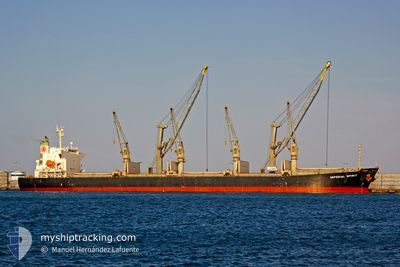
Bulk Carrier
Current Trip
| Time Travelled | 11 days |
|---|---|
| Remaining Time | --- |
| Distance Travelled | 2503.24 nm |
| Remaining Distance | --- |
| AVG Speed | 10 Knots |
| MAX Speed | 14.7 Knots |
| AVG Wind | 16.1 knots |
| MAX Wind | 35.7 knots |
| MIN Temp | 0.3°C / 32.54°F |
| MAX Temp | 11°C / 51.8°F |
| Draught | 12 m |
| Position Received | 22 m ago |
Current Position
| Longitude | --- |
|---|---|
| Latitude | --- |
| Status | Under way using engine |
| Speed | 9.7 Knots |
| Course | 236° |
| Area | Baltic Sea |
| Station | T-AIS |
| Position Received | 22 m ago |
Info
Information
The current position of CAPTAIN D LEMPESIS is in Baltic Sea with coordinates 56.17980° / 18.23808° as reported on 2024-12-13 12:53 by AIS to our vessel tracker app. The vessel's current speed is 9.7 Knots and is heading at the port of BAIA DE VITORIA. The estimated time of arrival as calculated by MyShipTracking vessel tracking app is 2025-01-03 21:00 LT
The vessel CAPTAIN D LEMPESIS (IMO: 9364801, MMSI: 636020117) is a Bulk Carrier that was built in 2005 ( 19 years old ). It's sailing under the flag of [LR] Liberia.
In this page you can find informations about the vessels current position, last detected port calls, and current voyage information. If the vessels is not in coverage by AIS you will find the latest position.
The current position of CAPTAIN D LEMPESIS is detected by our AIS receivers and we are not responsible for the reliability of the data. The last position was recorded while the vessel was in Coverage by the Ais receivers of our vessel tracking app.
The current draught of CAPTAIN D LEMPESIS as reported by AIS is 12 meters
Weather
| Temperature | 4.5°C / 40.1°F |
|---|---|
| Wind Speed | 20 knots |
| Direction | 242° WSW |
| Pressure | 1029.3 hPa |
| Humidity | 70.9 % |
| Cloud Coverage | 78 % |
Featured Company
Last Port Calls
| Port | Arrival | Departure | Time In Port |
|---|---|---|---|
| 2024-11-30 04:54 | 2024-12-02 01:28 | 1 d | |
| 2024-11-05 02:21 | 2024-11-06 09:40 | 1 d | |
| 2024-10-24 08:11 |
Last Trips
| Origin | Departure | Destination | Arrival | Distance | |
|---|---|---|---|---|---|
| 2024-11-06 06:40 | 2024-11-30 04:54 | 4813.65 nm | |||
| 2024-10-24 08:11 | 2024-11-04 23:21 | 2822.15 nm |
Events
| Time | Event | Details | Position / Dest | Info |
|---|---|---|---|---|
| 2024-12-13 12:53 | Status Changed | Default Under way using engine |
56.17955 / 18.23742
BRVIX
|
Speed: 9.7 kn Course: 236° |
| 2024-12-13 12:52 | Status Changed | Under way using engine Default |
56.18005 / 18.23877
BRVIX
|
Speed: 9.7 kn Course: 236° |
| 2024-12-13 12:37 | Status Changed | Default Under way using engine |
56.20355 / 18.30157
BRVIX
|
Speed: 9.7 kn Course: 238° |
| 2024-12-13 12:30 | Status Changed | Under way using engine Default |
56.21327 / 18.32925
BRVIX
|
Speed: 9.7 kn Course: 238° |
| 2024-12-13 12:13 | IN Coverage |
56.21237 / 18.32657
Baltic Sea
BRVIX
|
Speed: 9.7 kn Course: 238° |
|
| 2024-12-13 11:37 | Status Changed | Default Under way using engine |
56.28977 / 18.55438
BRVIX
|
Speed: 10 kn Course: 240° |
| 2024-12-13 11:29 | OUT of Coverage |
56.30093 / 18.58907
Baltic Sea
BRVIX
|
Speed: 10 kn Course: 240° |
|
| 2024-12-13 11:27 | Status Changed | Under way using engine Default |
56.30368 / 18.59763
BRVIX
|
Speed: 10 kn Course: 240° |
| 2024-12-13 11:09 | IN Coverage |
56.30293 / 18.59533
Baltic Sea
BRVIX
|
Speed: 10 kn Course: 240° |
|
| 2024-12-13 09:44 | OUT of Coverage |
56.51837 / 18.91550
Baltic Sea
BRVIX
|
Speed: 10.1 kn Course: 208° |