
CAPTAIN ADAM 1
Cargo
Current Trip
| Time Travelled | 16 days |
|---|---|
| Remaining Time | --- |
| Distance Travelled | 2059.05 nm |
| Remaining Distance | --- |
| AVG Speed | 9.5 Knots |
| MAX Speed | 9.5 Knots |
| AVG Wind | 10.5 knots |
| MAX Wind | 19.3 knots |
| MIN Temp | 10.3°C / 50.54°F |
| MAX Temp | 29.9°C / 85.82°F |
| Draught | 4.6 m |
| Position Received | 1 h, 44 m ago |
Current Position
| Longitude | 35.49079° |
|---|---|
| Latitude | 33.81826° |
| Status | Under way using engine |
| Speed | |
| Course | --- |
| Area | Mediterranean Sea - Eastern Basin |
| Station | T-AIS |
| Position Received | 1 h, 44 m ago |
Info
Information
The current position of CAPTAIN ADAM 1 is in Mediterranean Sea - Eastern Basin with coordinates 33.81826° / 35.49079° as reported on 2024-06-07 08:58 by AIS to our vessel tracker app. The vessel's current speed is 0 Knots and is heading at the port of MERSIN.
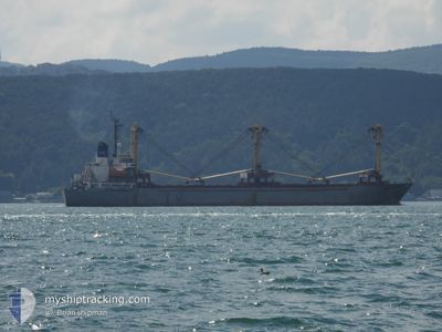
The vessel CAPTAIN ADAM 1 (MMSI: 677022000) is a Cargo It's sailing under the flag of [TZ] Tanzania.
In this page you can find informations about the vessels current position, last detected port calls, and current voyage information. If the vessels is not in coverage by AIS you will find the latest position.
The current position of CAPTAIN ADAM 1 is detected by our AIS receivers and we are not responsible for the reliability of the data. The last position was recorded while the vessel was in Coverage by the Ais receivers of our vessel tracking app.
The current draught of CAPTAIN ADAM 1 as reported by AIS is 4.6 meters
Weather
| Temperature | 29.3°C / 84.74°F |
|---|---|
| Wind Speed | 6 knots |
| Direction | 249° WSW |
| Pressure | 1009 hPa |
| Humidity | 48.1 % |
| Cloud Coverage | --- |
Featured Company
Last Port Calls
| Port | Arrival | Departure | Time In Port |
|---|---|---|---|
| 2024-05-16 12:48 | 2024-05-21 15:24 | 5 d | |
| 2024-04-24 08:28 | 2024-04-26 14:16 | 2 d | |
| 2024-04-17 05:46 | 2024-04-18 09:38 | 1 d | |
| 2024-04-06 09:39 |
Last Trips
| Origin | Departure | Destination | Arrival | Distance | |
|---|---|---|---|---|---|
| 2024-04-26 17:16 | 2024-05-16 15:48 | 62.21 nm | |||
| 2024-04-18 12:38 | 2024-04-24 11:28 | 100.09 nm | |||
| 2024-03-01 17:29 | 2024-04-06 12:39 | 388.30 nm |
Events
| Time | Event | Details | Position / Dest | Info |
|---|---|---|---|---|
| 2024-06-07 08:58 | OUT of Coverage |
33.81826 / 35.49079
Mediterranean Sea - Eastern Basin
|
Speed: Course: 511° |
|
| 2024-06-07 08:47 | IN Coverage |
33.81824 / 35.49079
Mediterranean Sea - Eastern Basin
|
Speed: Course: 511° |
|
| 2024-06-03 04:06 | Status Changed | Default At anchor |
40.11492 / 32.99872
TR MER
|
Speed: 27.5 kn Course: 165.3° |
| 2024-06-03 03:12 | OUT of Coverage |
40.12036 / 32.99338
Mediterranean Sea - Eastern Basin
|
Speed: 27.5 kn Course: 165.3° |
|
| 2024-06-03 03:10 | IN Coverage |
40.12082 / 32.98605
Mediterranean Sea - Eastern Basin
|
Speed: 27.2 kn Course: 15.3° |
|
| 2024-06-02 09:39 | OUT of Coverage |
36.74254 / 34.64147
Mediterranean Sea - Eastern Basin
|
Speed: 0.5 kn Course: 511° |
|
| 2024-06-02 08:38 | IN Coverage |
36.74251 / 34.64126
Mediterranean Sea - Eastern Basin
|
Speed: Course: 511° |
|
| 2024-06-01 22:50 | OUT of Coverage |
33.81901 / 35.49067
Mediterranean Sea - Eastern Basin
|
Speed: 0.9 kn Course: 511° |
|
| 2024-06-01 22:00 | STOP Moving | 6.14 nm, South of BEIRUT |
33.81828 / 35.49078
TR MER
|
Speed: Course: 511° |
| 2024-06-01 21:37 | IN Coverage |
33.81788 / 35.49156
Mediterranean Sea - Eastern Basin
|
Speed: 0.7 kn Course: 511° |