
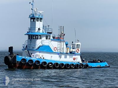
CAPT WILLIE LANDERS
Tug
Current Trip
| Time Travelled | 17 days |
|---|---|
| Remaining Time | --- |
| Distance Travelled | 2057.29 nm |
| Remaining Distance | --- |
| AVG Speed | 6 Knots |
| MAX Speed | 11.1 Knots |
| AVG Wind | 11.5 knots |
| MAX Wind | 23 knots |
| MIN Temp | 1.8°C / 35.24°F |
| MAX Temp | 25.7°C / 78.26°F |
| Draught | 3.7 m |
| Position Received | 5 d ago |
Current Position
| Longitude | --- |
|---|---|
| Latitude | --- |
| Status | Under way using engine |
| Speed | 4.9 Knots |
| Course | 253° |
| Area | Gulf of Mexico |
| Station | T-AIS |
| Position Received | 5 d ago |
Info
Information
The current position of CAPT WILLIE LANDERS is in Gulf of Mexico with coordinates 30.25413° / -87.02505° as reported on 2025-12-07 03:00 by AIS to our vessel tracker app. The vessel's current speed is 4.9 Knots and is heading at the port of MOBILE. The estimated time of arrival as calculated by MyShipTracking vessel tracking app is 2025-12-08 10:00 LT
The vessel CAPT WILLIE LANDERS (IMO: 1108809, MMSI: 367596940) is a Tug It's sailing under the flag of [US] USA.
In this page you can find informations about the vessels current position, last detected port calls, and current voyage information. If the vessels is not in coverage by AIS you will find the latest position.
The current position of CAPT WILLIE LANDERS is detected by our AIS receivers and we are not responsible for the reliability of the data. The last position was recorded while the vessel was in Coverage by the Ais receivers of our vessel tracking app.
The current draught of CAPT WILLIE LANDERS as reported by AIS is 3.7 meters
Weather
| Temperature | 20.8°C / 69.44°F |
|---|---|
| Wind Speed | 3 knots |
| Direction | 135° SE |
| Pressure | 1018.8 hPa |
| Humidity | 72.6 % |
| Cloud Coverage | 11 % |
Featured Company
Last Port Calls
| Port | Arrival | Departure | Time In Port |
|---|---|---|---|
| 2025-11-24 12:41 | 2025-11-24 15:34 | 2 h | |
| 2025-11-24 01:05 | 2025-11-24 05:33 | 4 h | |
| 2025-11-21 15:57 | 2025-11-23 07:00 | 1 d | |
| 2025-11-06 02:52 | 2025-11-06 04:46 | 1 h | |
| 2025-10-31 21:37 | 2025-10-31 21:59 | 22 m | |
| 2025-10-31 18:02 | 2025-10-31 18:41 | 38 m | |
| 2025-10-31 16:54 |
Most Visited Ports (Last year)
| Port | Arrivals | |
|---|---|---|
| 11 | ||
| 10 | ||
| 2 | ||
| 2 | ||
| 2 | ||
| 1 |
Last Trips
| Origin | Departure | Destination | Arrival | Distance | |
|---|---|---|---|---|---|
| 2025-11-24 05:33 | 2025-11-24 12:41 | 19.69 nm | |||
| 2025-11-23 07:00 | 2025-11-24 01:05 | 131.06 nm | |||
| 2025-11-06 04:46 | 2025-11-21 15:57 | 2319.77 nm | |||
| 2025-10-31 21:59 | 2025-11-06 02:52 | 605.40 nm | |||
| 2025-10-31 18:41 | 2025-10-31 21:37 | 24.18 nm | |||
| 2025-10-31 16:54 | 2025-10-31 18:02 | 10.56 nm |
Events
| Time | Event | Details | Position / Dest | Info |
|---|---|---|---|---|
| 2025-12-08 19:07 | STOP Moving | 3.14 nm, North West of CUT OFF |
29.57565 / -90.38197
MOBILE, AL
|
Speed: 0.1 kn Course: 223° |
| 2025-12-07 16:43 | START Moving | 3.26 nm, East of DAUPHIN ISLAND |
30.24833 / -88.01833
MOBILE, AL
|
Speed: 4 kn Course: -1° |
| 2025-12-07 16:15 | STOP Moving | 3.36 nm, East of DAUPHIN ISLAND |
30.25306 / -88.01645
MOBILE, AL
|
Speed: 0.2 kn Course: 249° |
| 2025-12-07 03:15 | Status Changed | Default Under way using engine |
30.24833 / -87.04833
MOBILE, AL
|
Speed: 4.9 kn Course: 253° |
| 2025-12-07 03:00 | OUT of Coverage |
30.25413 / -87.02505
Gulf of Mexico
MOBILE, AL
|
Speed: 4.9 kn Course: 254.9° |
|
| 2025-12-07 00:31 | Status Changed | Under way using engine Default |
30.30349 / -86.79697
MOBILE, AL
|
Speed: 4.9 kn Course: 270° |
| 2025-12-07 00:25 | Status Changed | Default Under way using engine |
30.30320 / -86.78830
MOBILE, AL
|
Speed: 4.9 kn Course: 271° |
| 2025-12-06 22:27 | Change Sea Area | United States part of the Gulf of Mexico United States part of the North Atlantic Ocean |
30.29801 / -86.59832
Gulf of Mexico
MOBILE, AL
|
Speed: 5.6 kn Course: 272.3° |
| 2025-12-06 22:26 | Status Changed | Under way using engine Default |
30.29793 / -86.59623
MOBILE, AL
|
Speed: 5 kn Course: 272° |
| 2025-12-06 22:26 | IN Coverage |
30.29801 / -86.59832
Gulf of Mexico
MOBILE, AL
|
Speed: 5.6 kn Course: 272.3° |