

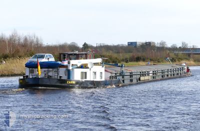
CAPRI
Cargo

Current Trip
GENTHIN
| Time Travelled | 17 days |
|---|---|
| Remaining Time | --- |
| Distance Travelled | 453.51 nm |
| Remaining Distance | --- |
| AVG Speed | 5.8 Knots |
| MAX Speed | 7.7 Knots |
| AVG Wind | 7.3 knots |
| MAX Wind | 20 knots |
| MIN Temp | 2.3°C / 36.14°F |
| MAX Temp | 15.7°C / 60.26°F |
| Draught | 0.3 m |
| Position Received | 1 h, 55 m ago |
Current Position
| Longitude | --- |
|---|---|
| Latitude | --- |
| Status | Under way using engine |
| Speed | 5.9 Knots |
| Course | 117.6° |
| Area | North Sea |
| Station | T-AIS |
| Position Received | 1 h, 55 m ago |
Information
The current position of CAPRI is in North Sea with coordinates 52.40803° / 9.73857° as reported on 2025-03-22 17:00 by AIS to our vessel tracker app. The vessel's current speed is 5.9 Knots
The vessel CAPRI (MMSI: 211472030) is a Cargo It's sailing under the flag of [DE] Germany.
In this page you can find informations about the vessels current position, last detected port calls, and current voyage information. If the vessels is not in coverage by AIS you will find the latest position.
The current position of CAPRI is detected by our AIS receivers and we are not responsible for the reliability of the data. The last position was recorded while the vessel was in Coverage by the Ais receivers of our vessel tracking app.
The current draught of CAPRI as reported by AIS is 0.3 meters
Weather
| Temperature | 13.8°C / 56.84°F |
|---|---|
| Wind Speed | 15 knots |
| Direction | 98° E |
| Pressure | 1007.3 hPa |
| Humidity | 42.4 % |
| Cloud Coverage | 2 % |


Featured Company
Last Port Calls
| Port | Arrival | Departure | Time In Port |
|---|---|---|---|
| 2025-03-05 17:21 | 2025-03-05 17:41 | 19 m | |
| 2025-02-16 19:07 | 2025-02-17 09:37 | 14 h | |
| 2025-02-13 15:47 | 2025-02-14 14:37 | 22 h | |
| 2025-01-26 13:38 | 2025-01-26 14:22 | 44 m | |
| 2025-01-24 15:10 | |||
| 2025-01-22 21:35 | 2025-01-23 07:40 | 10 h | |
| 2025-01-22 16:14 | 2025-01-22 20:20 | 4 h | |
| 2025-01-22 10:24 | 2025-01-22 14:06 | 3 h | |
| 2025-01-21 19:04 | 2025-01-22 06:22 | 11 h | |
| 2025-01-20 18:40 | 2025-01-21 06:21 | 11 h |
Last Trips
| Origin | Departure | Destination | Arrival | Distance | |
|---|---|---|---|---|---|
| 2025-02-17 09:37 | 2025-03-05 17:21 | 454.79 nm | |||
| 2025-02-14 14:37 | 2025-02-16 19:07 | 88.19 nm | |||
| 2025-01-26 14:22 | 2025-02-13 15:47 | 525.70 nm | |||
| 2025-01-23 07:40 | 2025-01-24 15:10 | 91.26 nm | |||
| 2025-01-22 20:20 | 2025-01-22 21:35 | 9.40 nm | |||
| 2025-01-22 14:06 | 2025-01-22 16:14 | 9.62 nm | |||
| 2025-01-22 06:22 | 2025-01-22 10:24 | 19.66 nm | |||
| 2025-01-21 06:21 | 2025-01-21 19:04 | 58.01 nm | |||
| 2024-12-14 16:49 | 2025-01-13 14:57 | 540.76 nm |
Events
| Time | Event | Details | Position / Dest | Info |
|---|---|---|---|---|
| 2025-03-22 17:00 | OUT of Coverage |
52.40803 / 9.73857
North Sea
|
Speed: 5.9 kn Course: 117.6° |
|
| 2025-03-22 16:51 | IN Coverage |
52.41566 / 9.71634
North Sea
|
Speed: 6.4 kn Course: 117.2° |
|
| 2025-03-22 15:09 | OUT of Coverage |
52.39370 / 9.42953
North Sea
|
Speed: 6.9 kn Course: 79.6° |
|
| 2025-03-22 15:05 | IN Coverage |
52.39256 / 9.41751
North Sea
|
Speed: 7 kn Course: 83.1° |
|
| 2025-03-22 12:51 | OUT of Coverage |
52.31227 / 9.05602
North Sea
|
Speed: 5.9 kn Course: 55.3° |
|
| 2025-03-22 12:13 | Destination Changed | GENTHIN HAREN/EMS |
52.30391 / 8.95758
GENTHIN
|
Speed: 6.7 kn Course: 98.7° |
| 2025-03-22 12:04 | IN Coverage |
52.30393 / 8.93690
North Sea
|
Speed: 5.2 kn Course: 84° |
|
| 2025-03-22 07:16 | OUT of Coverage |
52.39791 / 8.16586
North Sea
|
Speed: 6.3 kn Course: 114.7° |
|
| 2025-03-22 05:33 | IN Coverage |
52.37806 / 7.88388
North Sea
|
Speed: 6.6 kn Course: 84° |
|
| 2025-03-17 16:27 | OUT of Coverage |
52.37842 / 7.88685
North Sea
HAREN/EMS
|
Speed: 5.3 kn Course: 263.7° |