
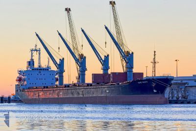
CAPE SCOTT
Bulk Carrier
Current Trip
| Time Travelled | 34 days |
|---|---|
| Remaining Time | 2 days |
| Distance Travelled | 3053.33 nm |
| Remaining Distance | 685.87 nm |
| AVG Speed | 10.2 Knots |
| MAX Speed | 10.2 Knots |
| AVG Wind | 14.9 knots |
| MAX Wind | 35 knots |
| MIN Temp | 1.4°C / 34.52°F |
| MAX Temp | 17°C / 62.6°F |
| Draught | 10 m |
| Position Received | 14 h, 34 m ago |
Current Position
| Longitude | --- |
|---|---|
| Latitude | --- |
| Status | Under way using engine |
| Speed | 12.2 Knots |
| Course | 208.2° |
| Area | Aegean Sea |
| Station | T-AIS |
| Position Received | 14 h, 34 m ago |
Info
Information
The current position of CAPE SCOTT is in Aegean Sea with coordinates 37.30228° / 23.93447° as reported on 2025-01-17 14:13 by AIS to our vessel tracker app. The vessel's current speed is 12.2 Knots and is heading at the port of VENEZIA. The estimated time of arrival as calculated by MyShipTracking vessel tracking app is 2025-01-20 14:18 LT
The vessel CAPE SCOTT (IMO: 9159737, MMSI: 312417000) is a Bulk Carrier that was built in 1997 ( 28 years old ). It's sailing under the flag of [BZ] Belize.
In this page you can find informations about the vessels current position, last detected port calls, and current voyage information. If the vessels is not in coverage by AIS you will find the latest position.
The current position of CAPE SCOTT is detected by our AIS receivers and we are not responsible for the reliability of the data. The last position was recorded while the vessel was in Coverage by the Ais receivers of our vessel tracking app.
The current draught of CAPE SCOTT as reported by AIS is 10 meters
Weather
| Temperature | 14.8°C / 58.64°F |
|---|---|
| Wind Speed | 14 knots |
| Direction | 117° ESE |
| Pressure | 1025.6 hPa |
| Humidity | 64.2 % |
| Cloud Coverage | 18 % |
Featured Company
Most Visited Ports (Last year)
| Port | Arrivals | |
|---|---|---|
| 4 | ||
| 3 | ||
| 3 | ||
| 2 | ||
| 2 | ||
| 2 |
Events
| Time | Event | Details | Position / Dest | Info |
|---|---|---|---|---|
| 2025-01-17 14:25 | Status Changed | Default Under way using engine |
37.26624 / 23.90930
IT VCE
|
Speed: 12.2 kn Course: 208.2° |
| 2025-01-17 14:13 | OUT of Coverage |
37.30228 / 23.93447
Aegean Sea
IT VCE
|
Speed: 12.2 kn Course: 208.2° |
|
| 2025-01-17 04:47 | Status Changed | Under way using engine Default |
38.85207 / 25.14593
IT VCE
|
Speed: 11.1 kn Course: 210° |
| 2025-01-17 04:43 | Status Changed | Default Under way using engine |
38.86318 / 25.15407
IT VCE
|
Speed: 11.1 kn Course: 203.6° |
| 2025-01-17 04:18 | Status Changed | Under way using engine Default |
38.93218 / 25.19868
IT VCE
|
Speed: 11.4 kn Course: 206° |
| 2025-01-17 04:18 | IN Coverage |
38.93218 / 25.19868
Aegean Sea
IT VCE
|
Speed: 11 kn Course: 203.2° |
|
| 2025-01-17 02:43 | Status Changed | Default Under way using engine |
39.20233 / 25.36605
IT VCE
|
Speed: 11.2 kn Course: 202.6° |
| 2025-01-17 02:29 | Status Changed | Under way using engine Default |
39.24012 / 25.38838
IT VCE
|
Speed: 11.4 kn Course: 206° |
| 2025-01-17 02:29 | OUT of Coverage |
39.24012 / 25.38838
Aegean Sea
IT VCE
|
Speed: 11.2 kn Course: 202.6° |
|
| 2025-01-17 02:12 | Status Changed | Default Under way using engine |
39.28842 / 25.41726
IT VCE
|
Speed: 11.3 kn Course: 210.1° |