
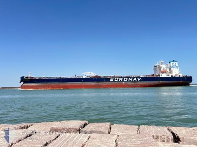
CAP PORT ARTHUR
Tanker
Current Trip
TR CEY>US GLS
| Time Travelled | 8 days |
|---|---|
| Remaining Time | --- |
| Distance Travelled | 1968.15 nm |
| Remaining Distance | --- |
| AVG Speed | 10.5 Knots |
| MAX Speed | 16 Knots |
| AVG Wind | 10.7 knots |
| MAX Wind | 28 knots |
| MIN Temp | 9.9°C / 49.82°F |
| MAX Temp | 23.2°C / 73.76°F |
| Draught | 16.3 m |
| Position Received | 4 d ago |
Current Position
| Longitude | --- |
|---|---|
| Latitude | --- |
| Status | Under way using engine |
| Speed | 12.3 Knots |
| Course | 4.7° |
| Area | North Atlantic Ocean |
| Station | T-AIS |
| Position Received | 4 d ago |
Info
Information
The current position of CAP PORT ARTHUR is in North Atlantic Ocean with coordinates 26.82011° / -79.32722° as reported on 2026-01-03 20:50 by AIS to our vessel tracker app. The vessel's current speed is 12.3 Knots
The vessel CAP PORT ARTHUR (IMO: 9829801, MMSI: 241613000) is a Tanker It's sailing under the flag of [GR] Greece.
In this page you can find informations about the vessels current position, last detected port calls, and current voyage information. If the vessels is not in coverage by AIS you will find the latest position.
The current position of CAP PORT ARTHUR is detected by our AIS receivers and we are not responsible for the reliability of the data. The last position was recorded while the vessel was in Coverage by the Ais receivers of our vessel tracking app.
The current draught of CAP PORT ARTHUR as reported by AIS is 16.3 meters
Weather
| Temperature | 18.8°C / 65.84°F |
|---|---|
| Wind Speed | 13 knots |
| Direction | 320° NW |
| Pressure | 1017.5 hPa |
| Humidity | 60.9 % |
| Cloud Coverage | --- |
Featured Company
Last Port Calls
| Port | Arrival | Departure | Time In Port |
|---|---|---|---|
| 2025-12-28 16:57 | 2025-12-30 08:02 | 1 d | |
| 2025-12-26 10:31 | 2025-12-28 15:46 | 2 d | |
| 2025-12-23 16:52 | 2025-12-26 09:22 | 2 d | |
| 2025-11-25 12:40 | 2025-11-26 20:01 | 1 d | |
| 2025-11-13 12:04 | 2025-11-15 03:51 | 1 d |
Most Visited Ports (Last year)
| Port | Arrivals | |
|---|---|---|
| 9 | ||
| 4 | ||
| 2 | ||
| 1 | ||
| 1 | ||
| 1 |
Last Trips
| Origin | Departure | Destination | Arrival | Distance | |
|---|---|---|---|---|---|
| 2025-12-28 15:46 | 2025-12-28 16:57 | 8.58 nm | |||
| 2025-12-26 09:22 | 2025-12-26 10:31 | 2.74 nm | |||
| 2025-11-26 20:01 | 2025-12-23 16:52 | 7214.81 nm | |||
| 2025-11-15 03:51 | 2025-11-25 12:40 | 3228.55 nm | |||
| 2025-10-25 11:10 | 2025-11-13 12:04 | 5319.90 nm |
Events
| Time | Event | Details | Position / Dest | Info |
|---|---|---|---|---|
| 2026-01-07 23:17 | STOP Moving |
34.62167 / -68.63834
TR CEY>US GLS
|
Speed: Course: -1° |
|
| 2026-01-03 20:53 | Status Changed | Default Under way using engine |
26.83167 / -79.32500
TR CEY>US GLS
|
Speed: 12.3 kn Course: 4.7° |
| 2026-01-03 20:50 | Status Changed | Under way using engine Default |
26.82011 / -79.32722
TR CEY>US GLS
|
Speed: 12.2 kn Course: 3° |
| 2026-01-03 20:50 | OUT of Coverage |
26.82011 / -79.32722
North Atlantic Ocean
|
Speed: 12.3 kn Course: 4.7° |
|
| 2026-01-03 20:44 | Status Changed | Default Under way using engine |
26.80016 / -79.32896
TR CEY>US GLS
|
Speed: 12.3 kn Course: 11.6° |
| 2026-01-03 20:19 | Status Changed | Under way using engine Default |
26.71839 / -79.34981
TR CEY>US GLS
|
Speed: 12.4 kn Course: 15° |
| 2026-01-03 19:47 | Status Changed | Default Under way using engine |
26.60684 / -79.37012
TR CEY>US GLS
|
Speed: 12.7 kn Course: 5.5° |
| 2026-01-03 19:43 | Change Sea Area | Bahamas part of the North Atlantic Ocean United States part of the Gulf of Mexico |
26.59203 / -79.37170
North Atlantic Ocean
|
Speed: 12.7 kn Course: 5.5° |
| 2026-01-03 19:43 | Status Changed | Under way using engine Default |
26.59203 / -79.37170
TR CEY>US GLS
|
Speed: 12 kn Course: 5° |
| 2026-01-03 19:26 | IN Coverage |
26.59203 / -79.37170
North Atlantic Ocean
|
Speed: 12.7 kn Course: 5.5° |