
CANKA
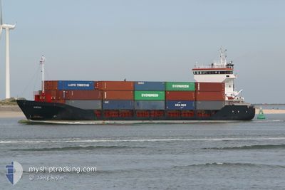
General Cargo
Current Trip
| Time Travelled | 1 day |
|---|---|
| Remaining Time | --- |
| Distance Travelled | 196.89 nm |
| Remaining Distance | 10.76 nm |
| AVG Speed | 10 Knots |
| MAX Speed | 14.2 Knots |
| AVG Wind | 11.2 knots |
| MAX Wind | 16.4 knots |
| MIN Temp | 3.6°C / 38.48°F |
| MAX Temp | 7.6°C / 45.68°F |
| Draught | 3.8 m |
| Position Received | 1 m ago |
Current Position
| Longitude | --- |
|---|---|
| Latitude | --- |
| Status | At anchor |
| Speed | |
| Course | 52° |
| Area | Sea of Marmara |
| Station | T-AIS |
| Position Received | 1 m ago |
Info
Information
The current position of CANKA is in Sea of Marmara with coordinates 40.97714° / 28.91386° as reported on 2025-02-17 00:43 by AIS to our vessel tracker app. The vessel's current speed is 0 Knots and is heading at the port of AMBARLI. The estimated time of arrival as calculated by MyShipTracking vessel tracking app is 2025-02-16 14:00 LT
The vessel CANKA (IMO: 9103740, MMSI: 354562000) is a General Cargo that was built in 1995 ( 30 years old ). It's sailing under the flag of [PA] Panama.
In this page you can find informations about the vessels current position, last detected port calls, and current voyage information. If the vessels is not in coverage by AIS you will find the latest position.
The current position of CANKA is detected by our AIS receivers and we are not responsible for the reliability of the data. The last position was recorded while the vessel was in Coverage by the Ais receivers of our vessel tracking app.
The current draught of CANKA as reported by AIS is 3.8 meters
Weather
| Temperature | 6.6°C / 43.88°F |
|---|---|
| Wind Speed | 9 knots |
| Direction | 51° NE |
| Pressure | 1015.9 hPa |
| Humidity | 91.7 % |
| Cloud Coverage | 100 % |
Featured Company
Last Port Calls
| Port | Arrival | Departure | Time In Port |
|---|---|---|---|
| 2025-02-15 10:44 | 2025-02-15 17:47 | 7 h | |
| 2025-02-10 07:04 | 2025-02-10 18:41 | 11 h | |
| 2025-02-03 20:32 | 2025-02-05 20:32 | 2 d | |
| 2025-01-24 09:32 | 2025-01-25 12:07 | 1 d | |
| 2025-01-15 12:23 | 2025-01-18 01:45 | 2 d | |
| 2025-01-04 08:14 | 2025-01-05 06:09 | 21 h | |
| 2024-12-27 15:41 | 2024-12-30 02:25 | 2 d | |
| 2024-12-16 00:21 | 2024-12-16 21:48 | 21 h | |
| 2024-12-15 16:25 |
Last Trips
| Origin | Departure | Destination | Arrival | Distance | |
|---|---|---|---|---|---|
| 2025-02-10 18:41 | 2025-02-15 10:44 | 1237.25 nm | |||
| 2025-02-05 20:32 | 2025-02-10 07:04 | 762.92 nm | |||
| 2025-01-25 12:07 | 2025-02-03 20:32 | 1586.16 nm | |||
| 2025-01-18 01:45 | 2025-01-24 09:32 | 1583.77 nm | |||
| 2025-01-05 06:09 | 2025-01-15 12:23 | 1596.68 nm | |||
| 2024-12-30 02:25 | 2025-01-04 08:14 | 1585.57 nm | |||
| 2024-12-16 21:48 | 2024-12-27 15:41 | 1716.40 nm | |||
| 2024-12-15 16:25 | 2024-12-16 00:21 | 44.00 nm |
Events
| Time | Event | Details | Position / Dest | Info |
|---|---|---|---|---|
| 2025-02-16 19:43 | STOP Moving | 0.97 nm, East of ZEYTINBURNU |
40.97770 / 28.91406
TR AMB
|
Speed: 0.3 kn Course: 77° |
| 2025-02-16 19:43 | Status Changed | At anchor Under way using engine |
40.97771 / 28.91415
TR AMB
|
Speed: 0.6 kn Course: 72° |
| 2025-02-16 17:38 | Change Sea Area | Turkish part of the Sea of Marmara Turkish part of the Black Sea |
41.23264 / 29.12782
Sea of Marmara
|
Speed: 7.1 kn Course: 166.3° |
| 2025-02-16 16:55 | START Moving | 3.45 nm, North West of RUMELI FENERI |
41.27223 / 29.05951
TR AMB
|
Speed: 3.6 kn Course: 55° |
| 2025-02-16 16:53 | Status Changed | Under way using engine At anchor |
41.27200 / 29.05756
TR AMB
|
Speed: 2.5 kn Course: 99° |
| 2025-02-16 16:47 | ETA Changed | 2025/02/16 11:00 2025/02/16 07:00 |
41.27323 / 29.05716
TR AMB
|
Speed: 0.7 kn Course: 75° |
| 2025-02-16 15:43 | Status Changed | At anchor Default |
41.27293 / 29.05583
TR AMB
|
Speed: 0.9 kn Course: 72° |
| 2025-02-16 15:40 | Status Changed | Default At anchor |
41.27299 / 29.05585
TR AMB
|
Speed: 0.9 kn Course: 80° |
| 2025-02-16 10:28 | Status Changed | At anchor Default |
41.27213 / 29.05662
TR AMB
|
Speed: 0.7 kn Course: 62° |
| 2025-02-16 10:23 | Status Changed | Default At anchor |
41.27232 / 29.05636
TR AMB
|
Speed: 0.2 kn Course: 48° |