
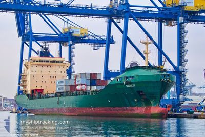
CACHALOT
Container Ship
Current Trip
| Trip Time | --- |
|---|---|
| Trip Distance | --- |
| AVG Speed | --- |
| MAX Speed | --- |
| Draught | --- |
| AVG Wind | --- |
| MAX Wind | --- |
| MIN Temp | --- |
| MAX Temp | --- |
| Position Received | 7 d ago |
Current Position
| Longitude | --- |
|---|---|
| Latitude | --- |
| Status | Under way using engine |
| Speed | 11.9 Knots |
| Course | 130.9° |
| Area | Aegean Sea |
| Station | T-AIS |
| Position Received | 7 d ago |
Info
Information
The current position of CACHALOT is in Aegean Sea with coordinates 36.23931° / 27.02434° as reported on 2025-11-30 05:52 by AIS to our vessel tracker app. The vessel's current speed is 11.9 Knots and is currently inside the port of MISURATA.
The vessel CACHALOT (IMO: 9212022, MMSI: 538005039) is a Container Ship that was built in 2000 ( 25 years old ). It's sailing under the flag of [MH] Marshall Is.
In this page you can find informations about the vessels current position, last detected port calls, and current voyage information. If the vessels is not in coverage by AIS you will find the latest position.
The current position of CACHALOT is detected by our AIS receivers and we are not responsible for the reliability of the data. The last position was recorded while the vessel was in Coverage by the Ais receivers of our vessel tracking app.
The current draught of CACHALOT as reported by AIS is 9.9 meters
Weather
| Temperature | 16.2°C / 61.16°F |
|---|---|
| Wind Speed | 23 knots |
| Direction | 305° NW |
| Pressure | 1012.1 hPa |
| Humidity | 59.1 % |
| Cloud Coverage | 93 % |
Featured Company
Last Port Calls
| Port | Arrival | Departure | Time In Port |
|---|---|---|---|
| 2025-12-02 10:32 | 2025-12-03 05:01 | 18 h | |
| 2025-11-28 08:01 | 2025-11-28 22:40 | 14 h | |
| 2025-11-27 13:24 | 2025-11-27 20:39 | 7 h | |
| 2025-11-26 00:16 | 2025-11-26 13:32 | 13 h | |
| 2025-11-09 02:41 | 2025-11-18 21:28 | 9 d | |
| 2025-10-17 19:17 | 2025-11-08 13:36 | 21 d | |
| 2025-10-17 18:29 |
Last Trips
| Origin | Departure | Destination | Arrival | Distance | |
|---|---|---|---|---|---|
| 2025-11-28 22:40 | 2025-12-02 10:32 | 734.72 nm | |||
| 2025-11-27 20:39 | 2025-11-28 08:01 | 46.64 nm | |||
| 2025-11-26 13:32 | 2025-11-27 13:24 | 271.02 nm | |||
| 2025-11-18 21:28 | 2025-11-26 00:16 | 315.45 nm | |||
| 2025-11-08 13:36 | 2025-11-09 02:41 | 1.46 nm | |||
| 2025-10-17 18:29 | 2025-10-17 19:17 | 2.29 nm |
Events
| Time | Event | Details | Position / Dest | Info |
|---|---|---|---|---|
| 2025-12-03 03:01 | PORT DEPARTURE |
|
31.16135 / 29.82860
EGALY
|
Speed: 9 kn Course: 228° |
| 2025-12-03 02:41 | START Moving |
31.18424 / 29.86273
[EG] ALEXANDRIA
|
Speed: 5.1 kn Course: 221° |
|
| 2025-12-02 09:01 | STOP Moving |
31.18552 / 29.86797
[EG] ALEXANDRIA
|
Speed: 0.1 kn Course: 37° |
|
| 2025-12-02 08:32 | PORT ARRIVAL |
|
31.16519 / 29.84858
[EG] ALEXANDRIA
|
Speed: 6.7 kn Course: 73° |
| 2025-12-02 07:24 | START Moving | 6.67 nm, North West of EL DEKHEILA |
31.22001 / 29.70875
EGALY
|
Speed: 6.4 kn Course: 58° |
| 2025-12-01 10:26 | STOP Moving | 6.54 nm, North West of EL DEKHEILA |
31.21646 / 29.70868
EGALY
|
Speed: Course: 312° |
| 2025-11-30 05:58 | Status Changed | Default Under way using engine |
36.22504 / 27.04453
EGALY
|
Speed: 11.9 kn Course: 130.9° |
| 2025-11-30 05:52 | OUT of Coverage |
36.23931 / 27.02434
Aegean Sea
EGALY
|
Speed: 11.9 kn Course: 130.9° |
|
| 2025-11-30 05:36 | Status Changed | Under way using engine Default |
36.27469 / 26.97523
EGALY
|
Speed: 11.5 kn Course: 143° |
| 2025-11-30 05:10 | Status Changed | Default Under way using engine |
36.34056 / 26.91161
EGALY
|
Speed: 11.3 kn Course: 141.3° |