
BWEK ANHOLT
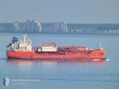
Lpg Tanker
Current Trip
| Time Travelled | 7 days |
|---|---|
| Remaining Time | --- |
| Distance Travelled | 828.10 nm |
| Remaining Distance | 0.50 nm |
| AVG Speed | 11.4 Knots |
| MAX Speed | 15.3 Knots |
| AVG Wind | 8.8 knots |
| MAX Wind | 21.9 knots |
| MIN Temp | 21.8°C / 71.24°F |
| MAX Temp | 28.3°C / 82.94°F |
| Draught | 7.5 m |
| Position Received | 1 d ago |
Current Position
| Longitude | -43.15357° |
|---|---|
| Latitude | -22.76403° |
| Status | Under way using engine |
| Speed | |
| Course | 348° |
| Area | South Atlantic Ocean |
| Station | T-AIS |
| Position Received | 1 d ago |
Info
Information
The current position of BWEK ANHOLT is in South Atlantic Ocean with coordinates -22.76403° / -43.15357° as reported on 2024-04-25 17:12 by AIS to our vessel tracker app. The vessel's current speed is 0 Knots and is heading at the port of RIO DE JANEIRO. The estimated time of arrival as calculated by MyShipTracking vessel tracking app is 2024-04-24 10:00 LT
The vessel BWEK ANHOLT (IMO: 9403786, MMSI: 256691000) is a Lpg Tanker that was built in 2008 ( 16 years old ). It's sailing under the flag of [MT] Malta.
In this page you can find informations about the vessels current position, last detected port calls, and current voyage information. If the vessels is not in coverage by AIS you will find the latest position.
The current position of BWEK ANHOLT is detected by our AIS receivers and we are not responsible for the reliability of the data. The last position was recorded while the vessel was in Coverage by the Ais receivers of our vessel tracking app.
The current draught of BWEK ANHOLT as reported by AIS is 7.5 meters
Weather
| Temperature | 21.4°C / 70.52°F |
|---|---|
| Wind Speed | 2 knots |
| Direction | 66° ENE |
| Pressure | 1014.8 hPa |
| Humidity | 86.8 % |
| Cloud Coverage | 12 % |
Featured Company
Last Port Calls
| Port | Arrival | Departure | Time In Port |
|---|---|---|---|
| 2024-04-17 23:30 | 2024-04-20 04:41 | 2 d | |
| 2024-04-06 17:50 | 2024-04-08 05:50 | 1 d | |
| 2024-03-11 18:54 | 2024-03-13 06:45 | 1 d | |
| 2024-03-01 20:42 | 2024-03-03 07:16 | 1 d | |
| 2024-02-21 01:38 | 2024-02-22 14:04 | 1 d | |
| 2024-02-07 22:59 | 2024-02-09 12:31 | 1 d |
Most Visited Ports (Last year)
| Port | Arrivals | |
|---|---|---|
| 24 |
Last Trips
| Origin | Departure | Destination | Arrival | Distance | |
|---|---|---|---|---|---|
| 2024-04-08 02:50 | 2024-04-17 20:30 | 1593.55 nm | |||
| 2024-03-13 03:45 | 2024-04-06 14:50 | 3737.56 nm | |||
| 2024-03-03 04:16 | 2024-03-11 15:54 | 1551.68 nm | |||
| 2024-02-22 11:04 | 2024-03-01 17:42 | 1605.15 nm | |||
| 2024-02-09 09:31 | 2024-02-20 22:38 | 1627.31 nm | |||
| 2024-01-30 06:19 | 2024-02-07 19:59 | 1585.61 nm |
Events
| Time | Event | Details | Position / Dest | Info |
|---|---|---|---|---|
| 2024-04-25 17:14 | Status Changed | Default Under way using engine |
-22.76403 / -43.15357
BR RIO
|
Speed: Course: 348° |
| 2024-04-25 17:12 | OUT of Coverage |
-22.76403 / -43.15357
South Atlantic Ocean
|
Speed: Course: 195.3° |
|
| 2024-04-25 12:10 | Status Changed | Under way using engine Default |
-22.76403 / -43.15360
BR RIO
|
Speed: Course: 348° |
| 2024-04-25 12:09 | Status Changed | Default Under way using engine |
-22.76403 / -43.15359
BR RIO
|
Speed: Course: 348° |
| 2024-04-25 12:01 | Status Changed | Under way using engine Default |
-22.76402 / -43.15359
BR RIO
|
Speed: Course: 348° |
| 2024-04-25 11:53 | Status Changed | Default Under way using engine |
-22.76403 / -43.15357
BR RIO
|
Speed: Course: 348° |
| 2024-04-25 11:14 | STOP Moving | 7.25 nm, North of NITEROI |
-22.76393 / -43.15332
BR RIO
|
Speed: 0.2 kn Course: 339° |
| 2024-04-25 08:01 | START Moving |
-23.27733 / -42.99473
BR RIO
|
Speed: 4.1 kn Course: 10° |
|
| 2024-04-25 07:59 | Status Changed | Under way using engine Default |
-23.27908 / -42.99585
BR RIO
|
Speed: 1.8 kn Course: 149° |
| 2024-04-25 07:53 | IN Coverage |
-23.27908 / -42.99585
South Atlantic Ocean
|
Speed: 3 kn Course: 58.5° |