
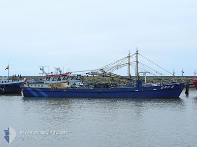
BRU-8 MARINUS
Fishing Vessel
Current Trip
WERP
| Time Travelled | 18 days |
|---|---|
| Remaining Time | --- |
| Distance Travelled | 349.65 nm |
| Remaining Distance | --- |
| AVG Speed | 5.7 Knots |
| MAX Speed | 11.8 Knots |
| AVG Wind | 9.4 knots |
| MAX Wind | 19 knots |
| MIN Temp | -1.8°C / 28.76°F |
| MAX Temp | 8.4°C / 47.12°F |
| Draught | 1.5 m |
| Position Received | 42 m ago |
Current Position
| Longitude | --- |
|---|---|
| Latitude | --- |
| Status | Under way using engine |
| Speed | |
| Course | 116° |
| Area | North Sea |
| Station | T-AIS |
| Position Received | 42 m ago |
Info
Information
The current position of BRU-8 MARINUS is in North Sea with coordinates 51.65281° / 4.09965° as reported on 2025-02-18 00:17 by AIS to our vessel tracker app. The vessel's current speed is 0 Knots
The vessel BRU-8 MARINUS (IMO: 8911970, MMSI: 244035000) is a Fishing Vessel that was built in 1990 ( 35 years old ). It's sailing under the flag of [NL] Netherlands.
In this page you can find informations about the vessels current position, last detected port calls, and current voyage information. If the vessels is not in coverage by AIS you will find the latest position.
The current position of BRU-8 MARINUS is detected by our AIS receivers and we are not responsible for the reliability of the data. The last position was recorded while the vessel was in Coverage by the Ais receivers of our vessel tracking app.
The current draught of BRU-8 MARINUS as reported by AIS is 1.5 meters
Weather
| Temperature | -0.7°C / 30.74°F |
|---|---|
| Wind Speed | 11 knots |
| Direction | 91° E |
| Pressure | 1024.7 hPa |
| Humidity | 60.6 % |
| Cloud Coverage | 55 % |
Featured Company
Last Port Calls
| Port | Arrival | Departure | Time In Port |
|---|---|---|---|
| 2025-01-03 08:20 | 2025-01-30 15:36 | 27 d | |
| 2024-12-19 03:48 | 2024-12-19 04:08 | 20 m | |
| 2024-12-12 18:10 | 2024-12-16 06:05 | 3 d | |
| 2024-12-12 09:31 | 2024-12-12 10:35 | 1 h | |
| 2024-12-11 11:08 | 2024-12-11 11:43 | 35 m | |
| 2024-12-10 05:35 | 2024-12-10 09:35 | 3 h | |
| 2024-12-05 15:24 | 2024-12-09 06:05 | 3 d | |
| 2024-12-02 06:02 |
Most Visited Ports (Last year)
| Port | Arrivals | |
|---|---|---|
| 69 | ||
| 9 | ||
| 8 | ||
| 6 | ||
| 5 | ||
| 2 |
Last Trips
| Origin | Departure | Destination | Arrival | Distance | |
|---|---|---|---|---|---|
| 2024-12-19 04:08 | 2025-01-03 08:20 | 55.03 nm | |||
| 2024-12-16 06:05 | 2024-12-19 03:48 | 244.79 nm | |||
| 2024-12-12 10:35 | 2024-12-12 18:10 | 25.97 nm | |||
| 2024-12-11 11:43 | 2024-12-12 09:31 | 58.09 nm | |||
| 2024-12-10 09:35 | 2024-12-11 11:08 | 68.95 nm | |||
| 2024-12-09 06:05 | 2024-12-10 05:35 | 75.70 nm | |||
| 2024-12-02 06:02 | 2024-12-05 15:24 | 174.86 nm |
Events
| Time | Event | Details | Position / Dest | Info |
|---|---|---|---|---|
| 2025-02-17 22:40 | IN Coverage |
51.65281 / 4.09965
North Sea
|
Speed: Course: 276.5° |
|
| 2025-02-17 20:38 | OUT of Coverage |
51.65281 / 4.09965
North Sea
|
Speed: Course: 100.1° |
|
| 2025-02-17 16:19 | STOP Moving | 1.05 nm, South of BRUINISSE |
51.65281 / 4.09964
WERP
|
Speed: Course: 116° |
| 2025-02-17 13:31 | START Moving | 1.34 nm, East of HET SAS |
51.54451 / 3.95992
WERP
|
Speed: 3.2 kn Course: 1° |
| 2025-02-17 13:17 | STOP Moving | 1.23 nm, East of HET SAS |
51.54342 / 3.95730
WERP
|
Speed: 0.3 kn Course: 194° |
| 2025-02-17 12:57 | START Moving | 1.35 nm, East of HET SAS |
51.54507 / 3.95991
WERP
|
Speed: 3.4 kn Course: 11° |
| 2025-02-17 12:52 | STOP Moving | 1.27 nm, East of HET SAS |
51.54354 / 3.95834
WERP
|
Speed: 0.3 kn Course: 170° |
| 2025-02-17 12:49 | START Moving | 1.31 nm, East of HET SAS |
51.54605 / 3.95825
WERP
|
Speed: 3.1 kn Course: 224° |
| 2025-02-17 12:08 | STOP Moving | 1.24 nm, East of HET SAS |
51.54355 / 3.95740
WERP
|
Speed: 0.3 kn Course: 182° |
| 2025-02-17 11:22 | START Moving | 1.32 nm, East of HET SAS |
51.54550 / 3.95886
WERP
|
Speed: 3.1 kn Course: 277° |