
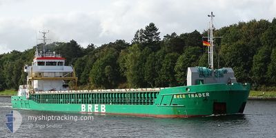
BREB TRADER
General Cargo
Current Trip
| Time Travelled | 11 days |
|---|---|
| Remaining Time | --- |
| Distance Travelled | 1497.97 nm |
| Remaining Distance | 12.13 nm |
| AVG Speed | 7.9 Knots |
| MAX Speed | 12.9 Knots |
| AVG Wind | 13.8 knots |
| MAX Wind | 34.5 knots |
| MIN Temp | -1.8°C / 28.76°F |
| MAX Temp | 17.3°C / 63.14°F |
| Draught | 5.3 m |
| Position Received | 4 d ago |
Current Position
| Longitude | --- |
|---|---|
| Latitude | --- |
| Status | Under way using engine |
| Speed | 6.7 Knots |
| Course | 178.2° |
| Area | North Atlantic Ocean |
| Station | T-AIS |
| Position Received | 4 d ago |
Info
Information
The current position of BREB TRADER is in North Atlantic Ocean with coordinates 38.82520° / -10.10534° as reported on 2026-01-03 07:02 by AIS to our vessel tracker app. The vessel's current speed is 6.7 Knots and is heading at the port of JORF LASFAR. The estimated time of arrival as calculated by MyShipTracking vessel tracking app is 2026-01-07 13:43 LT
The vessel BREB TRADER (IMO: 9369526, MMSI: 255802570) is a General Cargo that was built in 2007 ( 19 years old ). It's sailing under the flag of [PT] Portugal.
In this page you can find informations about the vessels current position, last detected port calls, and current voyage information. If the vessels is not in coverage by AIS you will find the latest position.
The current position of BREB TRADER is detected by our AIS receivers and we are not responsible for the reliability of the data. The last position was recorded while the vessel was in Coverage by the Ais receivers of our vessel tracking app.
The current draught of BREB TRADER as reported by AIS is 5.3 meters
Weather
| Temperature | 12.9°C / 55.22°F |
|---|---|
| Wind Speed | 3 knots |
| Direction | 138° SE |
| Pressure | 1030.5 hPa |
| Humidity | 58.4 % |
| Cloud Coverage | 44 % |
Featured Company
Last Port Calls
| Port | Arrival | Departure | Time In Port |
|---|---|---|---|
| 2025-12-25 15:34 | 2025-12-27 12:43 | 1 d | |
| 2025-12-19 20:16 | 2025-12-20 21:27 | 1 d | |
| 2025-12-13 21:53 | 2025-12-16 15:15 | 2 d | |
| 2025-12-10 09:00 | 2025-12-11 08:59 | 23 h | |
| 2025-12-08 06:44 | 2025-12-09 00:59 | 18 h | |
| 2025-12-05 15:50 | 2025-12-07 08:07 | 1 d | |
| 2025-11-30 11:08 | 2025-12-02 02:11 | 1 d | |
| 2025-11-27 06:19 | 2025-11-27 20:34 | 14 h | |
| 2025-11-22 17:54 | 2025-11-24 22:47 | 2 d | |
| 2025-11-12 21:58 | 2025-11-15 16:26 | 2 d |
Last Trips
| Origin | Departure | Destination | Arrival | Distance | |
|---|---|---|---|---|---|
| 2025-12-20 21:27 | 2025-12-25 15:34 | 432.63 nm | |||
| 2025-12-16 15:15 | 2025-12-19 20:16 | 545.51 nm | |||
| 2025-12-11 08:59 | 2025-12-13 21:53 | 526.46 nm | |||
| 2025-12-09 00:59 | 2025-12-10 09:00 | 275.51 nm | |||
| 2025-12-07 08:07 | 2025-12-08 06:44 | 208.38 nm | |||
| 2025-12-02 02:11 | 2025-12-05 15:50 | 742.91 nm | |||
| 2025-11-27 20:34 | 2025-11-30 11:08 | 633.00 nm | |||
| 2025-11-24 22:47 | 2025-11-27 06:19 | 416.48 nm | |||
| 2025-11-15 16:26 | 2025-11-22 17:54 | 961.22 nm | |||
| 2025-11-12 03:06 | 2025-11-12 21:58 | 129.29 nm |
Events
| Time | Event | Details | Position / Dest | Info |
|---|---|---|---|---|
| 2026-01-03 07:10 | Status Changed | Default Under way using engine |
38.81102 / -10.10533
MA JFL
|
Speed: 6.7 kn Course: 178.2° |
| 2026-01-03 07:02 | OUT of Coverage |
38.82520 / -10.10534
North Atlantic Ocean
MA JFL
|
Speed: 6.7 kn Course: 178.2° |
|
| 2026-01-03 05:47 | Draught Changed | 5.3 5.4 |
38.96550 / -10.10499
MA JFL
|
Speed: 6.6 kn Course: 182.7° |
| 2026-01-03 05:47 | ETA Changed | 2026/01/04 12:00 2026/01/03 12:00 |
38.96550 / -10.10499
MA JFL
|
Speed: 6.6 kn Course: 182.7° |
| 2026-01-03 05:42 | Status Changed | Under way using engine Default |
38.97497 / -10.10451
MA JFL
|
Speed: 6 kn Course: 181° |
| 2026-01-03 05:36 | Status Changed | Default Under way using engine |
38.98667 / -10.10333
MA JFL
|
Speed: 6.8 kn Course: 181.8° |
| 2026-01-03 05:29 | Change Sea Area | Portuguese part of the North Atlantic Ocean United Kingdom part of the English Channel |
39.00065 / -10.10353
North Atlantic Ocean
MA JFL
|
Speed: 7.2 kn Course: 180.6° |
| 2026-01-03 05:27 | Status Changed | Under way using engine Default |
39.00470 / -10.10348
MA JFL
|
Speed: 7.1 kn Course: 180° |
| 2026-01-03 05:27 | IN Coverage |
39.00065 / -10.10353
North Atlantic Ocean
MA JFL
|
Speed: 7.2 kn Course: 180.6° |
|
| 2025-12-30 04:26 | OUT of Coverage |
49.69878 / -3.76413
English Channel
MA JFL
|
Speed: 9.3 kn Course: 239.5° |