
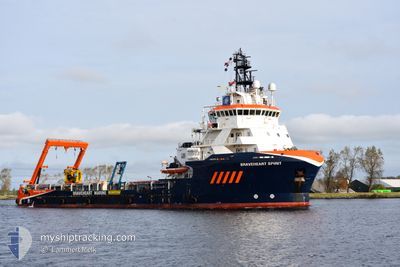
BRAVEHEART SPIRIT
Tug
Current Trip
| Trip Time | 4 days |
|---|---|
| Trip Distance | 181.75 nm |
| AVG Speed | 7.1 Knots |
| MAX Speed | 11 Knots |
| Draught | 4.5 m |
| AVG Wind | 12 knots |
| MAX Wind | 19.9 knots |
| MIN Temp | 0.9°C / 33.62°F |
| MAX Temp | 7.3°C / 45.14°F |
| Position Received | Now |
Current Position
| Longitude | --- |
|---|---|
| Latitude | --- |
| Status | Under way using engine |
| Speed | |
| Course | 29° |
| Area | North Sea |
| Station | T-AIS |
| Position Received | Now |
Information
The current position of BRAVEHEART SPIRIT is in North Sea with coordinates 52.46222° / 4.58103° as reported on 2025-02-15 19:42 by AIS to our vessel tracker app. The vessel's current speed is 0 Knots and is currently inside the port of IJMUIDEN.
The vessel BRAVEHEART SPIRIT (IMO: 9507049, MMSI: 244367000) is a Tug It's sailing under the flag of [NL] Netherlands.
In this page you can find informations about the vessels current position, last detected port calls, and current voyage information. If the vessels is not in coverage by AIS you will find the latest position.
The current position of BRAVEHEART SPIRIT is detected by our AIS receivers and we are not responsible for the reliability of the data. The last position was recorded while the vessel was in Coverage by the Ais receivers of our vessel tracking app.
The current draught of BRAVEHEART SPIRIT as reported by AIS is 4.5 meters
Weather
| Temperature | 2°C / 35.6°F |
|---|---|
| Wind Speed | 9 knots |
| Direction | 97° E |
| Pressure | 1022.4 hPa |
| Humidity | 75.7 % |
| Cloud Coverage | 100 % |
Featured Company
Last Port Calls
| Port | Arrival | Departure | Time In Port |
|---|---|---|---|
| 2025-02-13 06:35 | |||
| 2025-02-06 07:17 | 2025-02-08 11:17 | 2 d | |
| 2025-01-27 06:39 | 2025-01-30 16:23 | 3 d | |
| 2025-01-23 09:11 | 2025-01-24 19:42 | 1 d | |
| 2025-01-13 04:12 | 2025-01-13 14:29 | 10 h | |
| 2025-01-04 06:34 | 2025-01-08 04:18 | 3 d | |
| 2025-01-04 06:26 |
Most Visited Ports (Last year)
| Port | Arrivals | |
|---|---|---|
| 30 | ||
| 4 | ||
| 3 | ||
| 2 | ||
| 1 | ||
| 1 |
Last Trips
| Origin | Departure | Destination | Arrival | Distance | |
|---|---|---|---|---|---|
| 2025-02-08 11:17 | 2025-02-13 07:35 | 181.75 nm | |||
| 2025-01-30 16:23 | 2025-02-06 07:17 | 444.69 nm | |||
| 2025-01-24 19:42 | 2025-01-27 06:39 | 165.13 nm | |||
| 2025-01-13 15:29 | 2025-01-23 09:11 | 1001.73 nm | |||
| 2025-01-08 05:18 | 2025-01-13 05:12 | 444.22 nm | |||
| 2025-01-04 07:26 | 2025-01-04 07:34 | 0.82 nm |
Events
| Time | Event | Details | Position / Dest | Info |
|---|---|---|---|---|
| 2025-02-13 06:35 | PORT ARRIVAL |
|
52.46689 / 4.58507
[NL] IJMUIDEN
|
Speed: 2.4 kn Course: 30° |
| 2025-02-13 06:32 | STOP Moving | 0.1 nm, North West of IJMUIDEN |
52.46753 / 4.58549
NLIJM
|
Speed: 0.3 kn Course: 48° |
| 2025-02-13 03:33 | Destination Changed | NLIJM SURVEY CPA 1.0 |
52.60235 / 4.05521
NLIJM
|
Speed: 9.1 kn Course: 101.9° |
| 2025-02-13 03:33 | ETA Changed | 2025/02/13 07:00 2025/02/08 17:00 |
52.60235 / 4.05521
NLIJM
|
Speed: 9.1 kn Course: 101.9° |
| 2025-02-13 03:07 | Detected in Sea | Dutch part of the North Sea |
52.62947 / 3.97170
North Sea
|
Speed: 8.4 kn Course: 147.9° |
| 2025-02-13 03:07 | IN Coverage |
52.62947 / 3.97170
North Sea
|
Speed: 8.4 kn Course: 147.9° |
|
| 2025-02-09 14:48 | OUT of Coverage |
53.08228 / 2.54162
North Sea
|
Speed: 3 kn Course: 258.2° |
|
| 2025-02-09 13:26 | IN Coverage |
53.15159 / 2.71699
North Sea
|
Speed: 5.5 kn Course: 234.4° |
|
| 2025-02-09 11:15 | OUT of Coverage |
53.07845 / 2.53835
North Sea
|
Speed: 4.5 kn Course: 189.2° |
|
| 2025-02-09 11:12 | IN Coverage |
53.08051 / 2.53910
North Sea
|
Speed: 3.9 kn Course: 203° |