
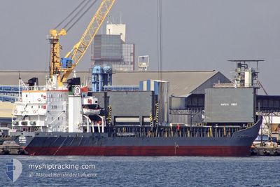
BRAVE KNIGHT
Bulk Carrier
Current Trip
ORDER
| Time Travelled | 6 h, 13 mins |
|---|---|
| Remaining Time | --- |
| Distance Travelled | 42.02 nm |
| Remaining Distance | --- |
| AVG Speed | 9.5 Knots |
| MAX Speed | 11.7 Knots |
| AVG Wind | 7.3 knots |
| MAX Wind | 10 knots |
| MIN Temp | 14.7°C / 58.46°F |
| MAX Temp | 16.9°C / 62.42°F |
| Draught | 3.8 m |
| Position Received | Now |
Current Position
| Longitude | --- |
|---|---|
| Latitude | --- |
| Status | Not under command |
| Speed | 0.3 Knots |
| Course | 267° |
| Area | Mediterranean Sea - Eastern Basin |
| Station | T-AIS |
| Position Received | Now |
Information
The current position of BRAVE KNIGHT is in Mediterranean Sea - Eastern Basin with coordinates 36.35171° / 35.39597° as reported on 2025-03-09 05:09 by AIS to our vessel tracker app. The vessel's current speed is 0.3 Knots
The vessel BRAVE KNIGHT (IMO: 7129336, MMSI: 450552000) is a Bulk Carrier that was built in 1972 ( 53 years old ). It's sailing under the flag of [LB] Lebanon.
In this page you can find informations about the vessels current position, last detected port calls, and current voyage information. If the vessels is not in coverage by AIS you will find the latest position.
The current position of BRAVE KNIGHT is detected by our AIS receivers and we are not responsible for the reliability of the data. The last position was recorded while the vessel was in Coverage by the Ais receivers of our vessel tracking app.
The current draught of BRAVE KNIGHT as reported by AIS is 3.8 meters
Weather
| Temperature | 16.7°C / 62.06°F |
|---|---|
| Wind Speed | 10 knots |
| Direction | 169° S |
| Pressure | 1013.8 hPa |
| Humidity | 75.4 % |
| Cloud Coverage | 100 % |
Featured Company
Last Port Calls
| Port | Arrival | Departure | Time In Port |
|---|---|---|---|
| 2025-03-07 10:15 | 2025-03-08 22:57 | 1 d | |
| 2025-02-28 04:15 | 2025-02-28 05:34 | 1 h | |
| 2025-02-14 14:40 | 2025-02-18 19:01 | 4 d | |
| 2025-02-04 23:25 | 2025-02-08 11:58 | 3 d | |
| 2025-01-27 05:44 | 2025-02-01 14:15 | 5 d | |
| 2025-01-19 16:52 | 2025-01-25 00:45 | 5 d | |
| 2025-01-15 04:46 | 2025-01-18 07:55 | 3 d | |
| 2025-01-12 15:45 | 2025-01-14 15:10 | 1 d |
Most Visited Ports (Last year)
| Port | Arrivals | |
|---|---|---|
| 6 | ||
| 6 | ||
| 3 | ||
| 3 | ||
| 2 | ||
| 2 |
Last Trips
| Origin | Departure | Destination | Arrival | Distance | |
|---|---|---|---|---|---|
| 2025-02-28 08:34 | 2025-03-07 13:15 | 831.53 nm | |||
| 2025-02-18 21:01 | 2025-02-28 07:15 | 585.48 nm | |||
| 2025-02-08 13:58 | 2025-02-14 16:40 | 1020.54 nm | |||
| 2025-02-01 16:15 | 2025-02-05 01:25 | 200.85 nm | |||
| 2025-01-25 02:45 | 2025-01-27 07:44 | 329.77 nm | |||
| 2025-01-18 09:55 | 2025-01-19 18:52 | 352.61 nm | |||
| 2025-01-14 17:10 | 2025-01-15 06:46 | 115.12 nm | |||
| 2024-12-29 08:34 | 2025-01-12 17:45 | 1635.53 nm |
Events
| Time | Event | Details | Position / Dest | Info |
|---|---|---|---|---|
| 2025-03-09 03:26 | STOP Moving |
36.34241 / 35.40966
ORDER
|
Speed: 0.3 kn Course: 172° |
|
| 2025-03-09 03:11 | Status Changed | Not under command Under way using engine |
36.34643 / 35.40979
ORDER
|
Speed: 2.5 kn Course: 181° |
| 2025-03-09 00:53 | Draught Changed | 3.8 6.9 |
36.58180 / 35.66882
ORDER
|
Speed: 11.1 kn Course: 230.5° |
| 2025-03-09 00:53 | Destination Changed | ORDER TR_ISK |
36.58180 / 35.66882
ORDER
|
Speed: 11.1 kn Course: 230.5° |
| 2025-03-09 00:53 | Status Changed | Under way using engine Default |
36.58180 / 35.66882
TR_ISK
|
Speed: 11 kn Course: 230° |
| 2025-03-09 00:43 | IN Coverage |
36.57709 / 35.66186
Mediterranean Sea - Eastern Basin
|
Speed: 11.2 kn Course: 229.8° |
|
| 2025-03-08 22:57 | PORT DEPARTURE |
|
36.83365 / 35.91726
TR_ISK
|
Speed: 6.5 kn Course: 109° |
| 2025-03-08 22:53 | START Moving |
36.83664 / 35.90674
[TR] CEYHAN
|
Speed: 6.5 kn Course: 109° |
|
| 2025-03-07 10:15 | STOP Moving |
36.83802 / 35.90142
[TR] CEYHAN
|
Speed: 0.2 kn Course: 152° |
|
| 2025-03-07 10:15 | PORT ARRIVAL |
|
36.83802 / 35.90142
[TR] CEYHAN
|
Speed: 1.3 kn Course: 221° |