
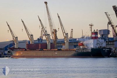
BRAVE COMMANDER
Bulk Carrier
Current Trip
| Trip Time | 1 day |
|---|---|
| Trip Distance | 268.07 nm |
| AVG Speed | 11.1 Knots |
| MAX Speed | 13.7 Knots |
| Draught | 5.8 m |
| AVG Wind | 9.4 knots |
| MAX Wind | 17.8 knots |
| MIN Temp | 20.5°C / 68.9°F |
| MAX Temp | 23.9°C / 75.02°F |
| Position Received | 2 d ago |
Current Position
| Longitude | --- |
|---|---|
| Latitude | --- |
| Status | Under way using engine |
| Speed | 2.9 Knots |
| Course | 171° |
| Area | Mediterranean Sea - Eastern Basin |
| Station | T-AIS |
| Position Received | 2 d ago |
Info
Information
The current position of BRAVE COMMANDER is in Mediterranean Sea - Eastern Basin with coordinates 31.22707° / 32.35854° as reported on 2025-12-05 23:08 by AIS to our vessel tracker app. The vessel's current speed is 2.9 Knots and is currently inside the port of SUEZ CANAL.
The vessel BRAVE COMMANDER (IMO: 9136931, MMSI: 450555000) is a Bulk Carrier that was built in 1996 ( 29 years old ). It's sailing under the flag of [LB] Lebanon.
In this page you can find informations about the vessels current position, last detected port calls, and current voyage information. If the vessels is not in coverage by AIS you will find the latest position.
The current position of BRAVE COMMANDER is detected by our AIS receivers and we are not responsible for the reliability of the data. The last position was recorded while the vessel was in Coverage by the Ais receivers of our vessel tracking app.
The current draught of BRAVE COMMANDER as reported by AIS is 5.8 meters
Weather
| Temperature | 17.4°C / 63.32°F |
|---|---|
| Wind Speed | 16 knots |
| Direction | 232° SW |
| Pressure | 1014.8 hPa |
| Humidity | 61.5 % |
| Cloud Coverage | --- |
Featured Company
Last Port Calls
| Port | Arrival | Departure | Time In Port |
|---|---|---|---|
| 2025-12-06 01:08 | |||
| 2025-11-17 06:28 | 2025-12-04 18:56 | 17 d | |
| 2025-11-04 18:59 | 2025-11-09 04:27 | 4 d | |
| 2025-11-04 18:25 | |||
| 2025-10-17 06:45 | 2025-10-21 18:24 | 4 d | |
| 2025-10-05 14:59 | 2025-10-06 14:35 | 23 h |
Most Visited Ports (Last year)
| Port | Arrivals | |
|---|---|---|
| 5 | ||
| 2 | ||
| 2 | ||
| 2 | ||
| 2 | ||
| 1 |
Last Trips
| Origin | Departure | Destination | Arrival | Distance | |
|---|---|---|---|---|---|
| 2025-12-04 18:56 | 2025-12-06 01:08 | 268.07 nm | |||
| 2025-11-09 04:27 | 2025-11-17 06:28 | 1352.18 nm | |||
| 2025-11-04 18:25 | 2025-11-04 18:59 | 13.93 nm | |||
| 2025-10-06 14:35 | 2025-10-17 06:45 | 33.28 nm | |||
| 2025-09-30 14:19 | 2025-10-05 14:59 | 751.23 nm |
Events
| Time | Event | Details | Position / Dest | Info |
|---|---|---|---|---|
| 2025-12-05 23:24 | STOP Moving |
31.22385 / 32.35965
[EG] SUEZ CANAL
|
Speed: Course: 193° |
|
| 2025-12-05 23:12 | Status Changed | Default Under way using engine |
31.22488 / 32.35935
[EG] SUEZ CANAL
|
Speed: 2.9 kn Course: 171° |
| 2025-12-05 23:08 | OUT of Coverage |
31.22707 / 32.35854
Mediterranean Sea - Eastern Basin
[EG] SUEZ CANAL
|
Speed: 2.9 kn Course: 172.4° |
|
| 2025-12-05 23:08 | PORT ARRIVAL |
|
31.22707 / 32.35854
[EG] SUEZ CANAL
|
Speed: 3.6 kn Course: 186° |
| 2025-12-05 22:51 | Status Changed | Under way using engine Default |
31.25014 / 32.36241
EG PSD
|
Speed: 7.5 kn Course: 194° |
| 2025-12-05 22:49 | Status Changed | Default Under way using engine |
31.25469 / 32.36350
EG PSD
|
Speed: 7.7 kn Course: 191.4° |
| 2025-12-05 22:42 | Status Changed | Under way using engine Default |
31.26929 / 32.36723
EG PSD
|
Speed: 8.4 kn Course: 192° |
| 2025-12-05 22:40 | Status Changed | Default Under way using engine |
31.27441 / 32.36866
EG PSD
|
Speed: 11.5 kn Course: 190.6° |
| 2025-12-05 22:27 | Status Changed | Under way using engine Default |
31.31318 / 32.37713
EG PSD
|
Speed: 7.7 kn Course: 200° |
| 2025-12-05 22:23 | IN Coverage |
31.30850 / 32.37623
Mediterranean Sea - Eastern Basin
|
Speed: 11.8 kn Course: 190.8° |