
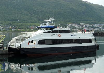
BRAGE
High speed craft
Current Trip
| Trip Time | 1 h, 56 mins |
|---|---|
| Trip Distance | 48.85 nm |
| AVG Speed | 22 Knots |
| MAX Speed | 22 Knots |
| Draught | 1.6 m |
| AVG Wind | 5.9 knots |
| MAX Wind | 7 knots |
| MIN Temp | -6.9°C / 19.58°F |
| MAX Temp | -2.4°C / 27.68°F |
| Position Received | 3 m ago |
Current Position
| Longitude | --- |
|---|---|
| Latitude | --- |
| Status | Moored |
| Speed | |
| Course | 35° |
| Area | Norwegian Sea |
| Station | T-AIS |
| Position Received | 3 m ago |
Info
Information
The current position of BRAGE is in Norwegian Sea with coordinates 69.64642° / 18.95758° as reported on 2025-12-08 11:19 by AIS to our vessel tracker app. The vessel's current speed is 0 Knots and is currently inside the port of TROMSO.
The vessel BRAGE (IMO: 9438963, MMSI: 258088000) is a High speed craft that was built in 2008 ( 17 years old ). It's sailing under the flag of [NO] Norway.
In this page you can find informations about the vessels current position, last detected port calls, and current voyage information. If the vessels is not in coverage by AIS you will find the latest position.
The current position of BRAGE is detected by our AIS receivers and we are not responsible for the reliability of the data. The last position was recorded while the vessel was in Coverage by the Ais receivers of our vessel tracking app.
The current draught of BRAGE as reported by AIS is 1.6 meters
Weather
| Temperature | -2.7°C / 27.14°F |
|---|---|
| Wind Speed | 5 knots |
| Direction | 129° SE |
| Pressure | 1005.1 hPa |
| Humidity | 77.9 % |
| Cloud Coverage | 100 % |
Featured Company
Last Port Calls
| Port | Arrival | Departure | Time In Port |
|---|---|---|---|
| 2025-12-08 09:03 | |||
| 2025-12-07 19:55 | 2025-12-08 07:07 | 11 h | |
| 2025-12-05 22:04 | 2025-12-07 14:32 | 1 d | |
| 2025-12-05 16:56 | 2025-12-05 17:13 | 17 m | |
| 2025-12-05 09:04 | 2025-12-05 15:03 | 5 h | |
| 2025-12-04 20:26 | 2025-12-05 07:07 | 10 h | |
| 2025-12-04 10:04 | 2025-12-04 15:48 | 5 h | |
| 2025-12-03 18:24 | 2025-12-03 19:25 | 1 h | |
| 2025-12-03 09:02 | 2025-12-03 16:22 | 7 h | |
| 2025-12-02 20:10 | 2025-12-03 07:07 | 10 h |
Last Trips
| Origin | Departure | Destination | Arrival | Distance | |
|---|---|---|---|---|---|
| 2025-12-08 07:07 | 2025-12-08 09:03 | 48.85 nm | |||
| 2025-12-07 14:32 | 2025-12-07 19:55 | 132.77 nm | |||
| 2025-12-05 17:13 | 2025-12-05 22:04 | 125.04 nm | |||
| 2025-12-05 15:03 | 2025-12-05 16:56 | 50.16 nm | |||
| 2025-12-05 07:07 | 2025-12-05 09:04 | 48.34 nm | |||
| 2025-12-04 15:48 | 2025-12-04 20:26 | 116.73 nm | |||
| 2025-12-03 19:25 | 2025-12-04 10:04 | 116.27 nm | |||
| 2025-12-03 16:22 | 2025-12-03 18:24 | 48.94 nm | |||
| 2025-12-03 07:07 | 2025-12-03 09:02 | 47.35 nm | |||
| 2025-12-02 15:47 | 2025-12-02 20:10 | 109.48 nm |
Events
| Time | Event | Details | Position / Dest | Info |
|---|---|---|---|---|
| 2025-12-08 08:07 | Status Changed | Moored Under way using engine |
69.64642 / 18.95754
[NO] TROMSO
|
Speed: Course: 34° |
| 2025-12-08 08:05 | STOP Moving |
69.64642 / 18.95754
[NO] TROMSO
|
Speed: 0.1 kn Course: 35° |
|
| 2025-12-08 08:03 | PORT ARRIVAL |
|
69.64500 / 18.95863
[NO] TROMSO
|
Speed: 6.4 kn Course: 345.5° |
| 2025-12-08 07:48 | START Moving | 7.79 nm, South West of TROMSO |
69.55690 / 18.79187
TROMSO
|
Speed: 31.1 kn Course: 33.4° |
| 2025-12-08 07:44 | STOP Moving | 8.66 nm, South West of TROMSO |
69.54506 / 18.76834
TROMSO
|
Speed: 0.2 kn Course: 87° |
| 2025-12-08 07:02 | START Moving | 4.2 nm, South East of BOTNHAMN |
69.44982 / 18.02276
TROMSO
|
Speed: 30.8 kn Course: 62.6° |
| 2025-12-08 06:58 | STOP Moving | 4.15 nm, South East of BOTNHAMN |
69.44561 / 17.99642
TROMSO
|
Speed: Course: 292° |
| 2025-12-08 06:07 | PORT DEPARTURE |
|
69.63946 / 18.95301
TROMSO
|
Speed: 24 kn Course: 207° |
| 2025-12-08 06:07 | START Moving |
69.64315 / 18.95985
[NO] TROMSO
|
Speed: 11.1 kn Course: 203° |
|
| 2025-12-08 05:44 | Status Changed | Under way using engine Moored |
69.64642 / 18.95757
[NO] TROMSO
|
Speed: Course: 35° |