
BR_BROTHER
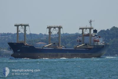
General Cargo
Current Trip
| Time Travelled | 3 days |
|---|---|
| Remaining Time | --- |
| Distance Travelled | 3.28 nm |
| Remaining Distance | --- |
| AVG Speed | 4.5 Knots |
| MAX Speed | 6.6 Knots |
| AVG Wind | 4.9 knots |
| MAX Wind | 10 knots |
| MIN Temp | 13.9°C / 57.02°F |
| MAX Temp | 17.7°C / 63.86°F |
| Draught | 0 m |
| Position Received | 5 d ago |
Current Position
| Longitude | --- |
|---|---|
| Latitude | --- |
| Status | Under way using engine |
| Speed | 9.7 Knots |
| Course | 137.8° |
| Area | Mediterranean Sea - Eastern Basin |
| Station | T-AIS |
| Position Received | 5 d ago |
Info
Information
The current position of BR_BROTHER is in Mediterranean Sea - Eastern Basin with coordinates 35.50001° / 27.98443° as reported on 2025-01-22 21:22 by AIS to our vessel tracker app. The vessel's current speed is 9.7 Knots
The vessel BR_BROTHER (IMO: 8418265, MMSI: 620010000) is a General Cargo that was built in 1985 ( 40 years old ). It's sailing under the flag of [KM] Comoros.
In this page you can find informations about the vessels current position, last detected port calls, and current voyage information. If the vessels is not in coverage by AIS you will find the latest position.
The current position of BR_BROTHER is detected by our AIS receivers and we are not responsible for the reliability of the data. The last position was recorded while the vessel was in Coverage by the Ais receivers of our vessel tracking app.
Weather
| Temperature | 18°C / 64.4°F |
|---|---|
| Wind Speed | 13 knots |
| Direction | 39° NE |
| Pressure | 1019.6 hPa |
| Humidity | 53.6 % |
| Cloud Coverage | 56 % |
Featured Company
Last Port Calls
| Port | Arrival | Departure | Time In Port |
|---|---|---|---|
| 2025-01-25 06:56 | 2025-01-25 12:28 | 5 h | |
| 2024-12-29 21:16 | 2024-12-31 14:25 | 1 d | |
| 2024-12-24 02:07 | 2024-12-24 04:14 | 2 h | |
| 2024-12-23 23:07 | 2024-12-24 01:20 | 2 h | |
| 2024-12-23 16:21 | 2024-12-23 22:00 | 5 h | |
| 2024-12-23 14:24 | 2024-12-23 15:05 | 41 m | |
| 2024-12-23 10:01 | 2024-12-23 11:12 | 1 h | |
| 2024-12-12 11:30 | 2024-12-15 11:38 | 3 d | |
| 2024-12-05 10:32 | |||
| 2024-11-28 07:38 | 2024-11-30 09:01 | 2 d |
Most Visited Ports (Last year)
| Port | Arrivals | |
|---|---|---|
| 10 | ||
| 2 | ||
| 2 | ||
| 2 | ||
| 2 | ||
| 2 |
Last Trips
| Origin | Departure | Destination | Arrival | Distance | |
|---|---|---|---|---|---|
| 2024-12-31 17:25 | 2025-01-25 08:56 | 1412.61 nm | |||
| 2024-12-24 07:14 | 2024-12-30 00:16 | 582.12 nm | |||
| 2024-12-24 04:20 | 2024-12-24 05:07 | 4.71 nm | |||
| 2024-12-24 01:00 | 2024-12-24 02:07 | 5.34 nm | |||
| 2024-12-23 18:05 | 2024-12-23 19:21 | 5.28 nm | |||
| 2024-12-23 14:12 | 2024-12-23 17:24 | 31.43 nm | |||
| 2024-12-15 14:38 | 2024-12-23 13:01 | 785.36 nm | |||
| 2024-11-30 12:01 | 2024-12-05 13:32 | 643.95 nm | |||
| 2024-11-22 14:32 | 2024-11-28 10:38 | 590.80 nm | |||
| 2024-11-20 15:04 | 2024-11-20 16:13 | 25.46 nm |
Events
| Time | Event | Details | Position / Dest | Info |
|---|---|---|---|---|
| 2025-01-25 13:08 | STOP Moving | 5.55 nm, North of DAMIETTA |
31.56012 / 31.75784
EGYPT>
|
Speed: 0.2 kn Course: 324° |
| 2025-01-25 12:28 | PORT DEPARTURE |
|
31.51327 / 31.76490
EGYPT>
|
Speed: 8.3 kn Course: 13° |
| 2025-01-25 12:09 | START Moving |
31.47163 / 31.75630
[EG] DAMIETTA
|
Speed: 4.5 kn Course: 343° |
|
| 2025-01-25 07:27 | STOP Moving |
31.46871 / 31.75757
[EG] DAMIETTA
|
Speed: Course: 152° |
|
| 2025-01-25 06:56 | PORT ARRIVAL |
|
31.48279 / 31.75722
[EG] DAMIETTA
|
Speed: 6 kn Course: 192° |
| 2025-01-25 05:52 | START Moving | 7.87 nm, North of DAMIETTA |
31.59835 / 31.77078
EGYPT>
|
Speed: 4.6 kn Course: 152° |
| 2025-01-24 04:52 | STOP Moving | 7.93 nm, North of DAMIETTA |
31.59950 / 31.76846
EGYPT>
|
Speed: 0.3 kn Course: 183° |
| 2025-01-22 21:23 | Status Changed | Default Under way using engine |
35.49794 / 27.98664
EGYPT>
|
Speed: 9.7 kn Course: 137.8° |
| 2025-01-22 21:22 | OUT of Coverage |
35.50001 / 27.98443
Mediterranean Sea - Eastern Basin
EGYPT>
|
Speed: 9.7 kn Course: 137.8° |
|
| 2025-01-22 18:53 | Change Sea Area | Greek part of the Mediterranean Sea - Eastern Basin Greek part of the Aegean Sea |
35.81513 / 27.63319
Mediterranean Sea - Eastern Basin
EGYPT>
|
Speed: 10.6 kn Course: 142.1° |