
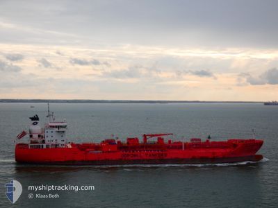
BOW TUNGSTEN
Tanker
Current Trip
US HOU>US CRP
| Time Travelled | 4 days |
|---|---|
| Remaining Time | --- |
| Distance Travelled | 1338.91 nm |
| Remaining Distance | --- |
| AVG Speed | 13.6 Knots |
| MAX Speed | 17 Knots |
| AVG Wind | 9.7 knots |
| MAX Wind | 18.9 knots |
| MIN Temp | 21.3°C / 70.34°F |
| MAX Temp | 28.6°C / 83.48°F |
| Draught | 8.6 m |
| Position Received | 1 m ago |
Current Position
| Longitude | -46.36369° |
|---|---|
| Latitude | -24.18154° |
| Status | At anchor |
| Speed | 0.1 Knots |
| Course | 212° |
| Area | South Atlantic Ocean |
| Station | T-AIS |
| Position Received | 1 m ago |
Info
Information
The current position of BOW TUNGSTEN is in South Atlantic Ocean with coordinates -24.18154° / -46.36369° as reported on 2024-05-15 02:11 by AIS to our vessel tracker app. The vessel's current speed is 0.1 Knots
The vessel BOW TUNGSTEN (IMO: 9777400, MMSI: 257290000) is a Tanker It's sailing under the flag of [NO] Norway.
In this page you can find informations about the vessels current position, last detected port calls, and current voyage information. If the vessels is not in coverage by AIS you will find the latest position.
The current position of BOW TUNGSTEN is detected by our AIS receivers and we are not responsible for the reliability of the data. The last position was recorded while the vessel was in Coverage by the Ais receivers of our vessel tracking app.
The current draught of BOW TUNGSTEN as reported by AIS is 8.6 meters
Weather
| Temperature | 21.4°C / 70.52°F |
|---|---|
| Wind Speed | 5 knots |
| Direction | 185° S |
| Pressure | 1017.3 hPa |
| Humidity | 82.5 % |
| Cloud Coverage | 100 % |
Featured Company
Last Port Calls
| Port | Arrival | Departure | Time In Port |
|---|---|---|---|
| 2024-05-09 23:13 | 2024-05-10 17:04 | 17 h | |
| 2024-04-18 19:59 | 2024-04-20 14:21 | 1 d | |
| 2024-04-16 12:49 | 2024-04-17 05:10 | 16 h | |
| 2024-04-13 15:14 | 2024-04-14 12:44 | 21 h | |
| 2024-04-05 17:41 | 2024-04-06 16:52 | 23 h | |
| 2024-04-04 13:09 | 2024-04-05 08:25 | 19 h | |
| 2024-04-01 00:23 | 2024-04-02 20:49 | 1 d | |
| 2024-03-30 03:19 | 2024-03-31 13:03 | 1 d | |
| 2024-03-22 07:38 | 2024-03-23 18:07 | 1 d | |
| 2024-03-07 10:35 | 2024-03-10 16:32 | 3 d |
Most Visited Ports (Last year)
| Port | Arrivals | |
|---|---|---|
| 11 | ||
| 3 | ||
| 3 | ||
| 3 | ||
| 3 | ||
| 2 |
Last Trips
| Origin | Departure | Destination | Arrival | Distance | |
|---|---|---|---|---|---|
| 2024-04-20 09:21 | 2024-05-09 20:13 | 4661.70 nm | |||
| 2024-04-17 00:10 | 2024-04-18 14:59 | 62.35 nm | |||
| 2024-04-14 07:44 | 2024-04-16 07:49 | 201.12 nm | |||
| 2024-04-06 11:52 | 2024-04-13 10:14 | 420.93 nm | |||
| 2024-04-05 03:25 | 2024-04-05 12:41 | 56.62 nm | |||
| 2024-04-02 15:49 | 2024-04-04 08:09 | 77.76 nm | |||
| 2024-03-31 08:03 | 2024-03-31 19:23 | 65.60 nm | |||
| 2024-03-23 14:07 | 2024-03-29 22:19 | 1986.91 nm | |||
| 2024-03-10 13:32 | 2024-03-22 03:38 | 3023.88 nm | |||
| 2024-02-08 11:21 | 2024-03-07 07:35 | 2743.52 nm |
Events
| Time | Event | Details | Position / Dest | Info |
|---|---|---|---|---|
| 2024-05-15 02:11 | Status Changed | At anchor Default |
-24.18154 / -46.36369
US HOU>US CRP
|
Speed: Course: 211° |
| 2024-05-14 18:14 | STOP Moving | 13.01 nm, South of SANTOS |
-24.18180 / -46.36358
US HOU>US CRP
|
Speed: 0.1 kn Course: 216° |
| 2024-05-14 00:08 | Status Changed | Default Under way using engine |
-23.87792 / -42.05217
US HOU>US CRP
|
Speed: 15.6 kn Course: 262.7° |
| 2024-05-14 00:04 | OUT of Coverage |
-23.87546 / -42.03311
South Atlantic Ocean
|
Speed: 15.6 kn Course: 262.7° |
|
| 2024-05-14 00:02 | Status Changed | Under way using engine Default |
-23.87435 / -42.02468
US HOU>US CRP
|
Speed: 15.5 kn Course: 261° |
| 2024-05-13 23:54 | Status Changed | Default Under way using engine |
-23.86941 / -41.98737
US HOU>US CRP
|
Speed: 15.1 kn Course: 261.3° |
| 2024-05-13 23:50 | Status Changed | Under way using engine Default |
-23.86696 / -41.96883
US HOU>US CRP
|
Speed: 14.9 kn Course: 261° |
| 2024-05-13 23:46 | Status Changed | Default Under way using engine |
-23.86432 / -41.95014
US HOU>US CRP
|
Speed: 14.9 kn Course: 262.1° |
| 2024-05-13 23:41 | Status Changed | Under way using engine Default |
-23.86102 / -41.92710
US HOU>US CRP
|
Speed: 14.9 kn Course: 268° |
| 2024-05-13 23:35 | IN Coverage |
-23.86102 / -41.92710
South Atlantic Ocean
|
Speed: 14.9 kn Course: 262.1° |