
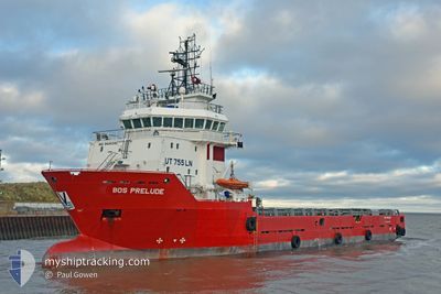
BOS PRELUDE
Offshore Supply Ship
Current Trip
| Time Travelled | 2 days |
|---|---|
| Remaining Time | --- |
| Distance Travelled | 0.25 nm |
| Remaining Distance | --- |
| AVG Speed | --- |
| MAX Speed | --- |
| AVG Wind | 23.3 knots |
| MAX Wind | 23.5 knots |
| MIN Temp | 9.7°C / 49.46°F |
| MAX Temp | 9.7°C / 49.46°F |
| Draught | 4.2 m |
| Position Received | 2 d ago |
Current Position
| Longitude | --- |
|---|---|
| Latitude | --- |
| Status | Under way using engine |
| Speed | 2.1 Knots |
| Course | 210° |
| Area | North Sea |
| Station | T-AIS |
| Position Received | 2 d ago |
Info
Information
The current position of BOS PRELUDE is in North Sea with coordinates 52.69365° / 2.49812° as reported on 2025-12-14 08:50 by AIS to our vessel tracker app. The vessel's current speed is 2.1 Knots
The vessel BOS PRELUDE (IMO: 9444340, MMSI: 253000039) is a Offshore Supply Ship that was built in 2010 ( 15 years old ). It's sailing under the flag of [LU] Luxembourg.
In this page you can find informations about the vessels current position, last detected port calls, and current voyage information. If the vessels is not in coverage by AIS you will find the latest position.
The current position of BOS PRELUDE is detected by our AIS receivers and we are not responsible for the reliability of the data. The last position was recorded while the vessel was in Coverage by the Ais receivers of our vessel tracking app.
The current draught of BOS PRELUDE as reported by AIS is 4.2 meters
Weather
| Temperature | 9.7°C / 49.46°F |
|---|---|
| Wind Speed | 24 knots |
| Direction | 216° SW |
| Pressure | 1020 hPa |
| Humidity | 84.7 % |
| Cloud Coverage | 59 % |
Featured Company
Last Port Calls
| Port | Arrival | Departure | Time In Port |
|---|---|---|---|
| 2025-11-29 15:49 | 2025-12-14 08:43 | 14 d | |
| 2025-11-25 07:01 | 2025-11-26 07:03 | 1 d | |
| 2025-11-21 23:46 | 2025-11-23 19:49 | 1 d | |
| 2025-11-16 20:40 | 2025-11-20 17:40 | 3 d | |
| 2025-11-08 22:31 | 2025-11-15 17:41 | 6 d | |
| 2025-11-03 02:56 | 2025-11-07 18:44 | 4 d | |
| 2025-10-24 00:53 | 2025-10-30 18:23 | 6 d | |
| 2025-10-19 01:26 | 2025-10-22 22:51 | 3 d | |
| 2025-10-15 04:18 | 2025-10-17 17:43 | 2 d | |
| 2025-10-09 04:16 | 2025-10-13 21:29 | 4 d |
Most Visited Ports (Last year)
| Port | Arrivals | |
|---|---|---|
| 66 | ||
| 17 | ||
| 3 | ||
| 1 | ||
| 1 |
Last Trips
| Origin | Departure | Destination | Arrival | Distance | |
|---|---|---|---|---|---|
| 2025-11-26 07:03 | 2025-11-29 15:49 | 24.25 nm | |||
| 2025-11-23 19:49 | 2025-11-25 07:01 | 232.32 nm | |||
| 2025-11-20 17:40 | 2025-11-21 23:46 | 160.34 nm | |||
| 2025-11-15 17:41 | 2025-11-16 20:40 | 160.28 nm | |||
| 2025-11-07 18:44 | 2025-11-08 22:31 | 163.77 nm | |||
| 2025-10-30 18:23 | 2025-11-03 02:56 | 216.41 nm | |||
| 2025-10-22 22:51 | 2025-10-24 00:53 | 82.45 nm | |||
| 2025-10-17 17:43 | 2025-10-19 01:26 | 157.16 nm | |||
| 2025-10-13 21:29 | 2025-10-15 04:18 | 169.89 nm | |||
| 2025-10-07 18:34 | 2025-10-09 04:16 | 156.26 nm |
Events
| Time | Event | Details | Position / Dest | Info |
|---|---|---|---|---|
| 2025-12-14 08:50 | OUT of Coverage |
52.69365 / 2.49812
North Sea
|
Speed: 2.1 kn Course: 227.8° |
|
| 2025-12-14 08:44 | IN Coverage |
52.69532 / 2.50062
North Sea
|
Speed: 2.4 kn Course: 222.2° |
|
| 2025-12-14 08:43 | PORT DEPARTURE |
|
52.69666 / 2.50280
GBGTY
|
Speed: Course: 160° |
| 2025-12-11 23:31 | OUT of Coverage |
52.58056 / 1.73243
North Sea
[GB] GREAT YARMOUTH
|
Speed: Course: 113.1° |
|
| 2025-12-11 23:31 | IN Coverage |
52.58056 / 1.73243
North Sea
[GB] GREAT YARMOUTH
|
Speed: Course: 113.1° |
|
| 2025-12-11 07:49 | OUT of Coverage |
52.58056 / 1.73244
North Sea
[GB] GREAT YARMOUTH
|
Speed: Course: 113.1° |
|
| 2025-12-11 07:21 | IN Coverage |
52.58056 / 1.73240
North Sea
[GB] GREAT YARMOUTH
|
Speed: Course: 113.1° |
|
| 2025-12-11 03:30 | OUT of Coverage |
52.58055 / 1.73243
North Sea
[GB] GREAT YARMOUTH
|
Speed: Course: 113.1° |
|
| 2025-12-11 02:06 | IN Coverage |
52.58055 / 1.73241
North Sea
[GB] GREAT YARMOUTH
|
Speed: Course: 113.1° |
|
| 2025-12-11 00:00 | OUT of Coverage |
52.58054 / 1.73242
North Sea
[GB] GREAT YARMOUTH
|
Speed: Course: 113.1° |